Let's be clear about something before you read another word. The K2 Base Camp Trek is not the Everest Base Camp Trek. It is longer, harder, more remote, and gets a fraction of the visitors. There are no teahouses. No WiFi at camp. The nearest hospital is a helicopter flight away on a good weather day. If that sounds discouraging, this guide probably isn't for you. If it sounds like the right kind of difficult, keep reading.
The trek follows the Baltoro Glacier from the village of Askole to K2 Base Camp at 5,150 metres. Round trip from Askole is 14 to 16 days. Total from Skardu, with travel and preparation, you are looking at 18 to 20 days minimum. Most people who rush it regret it. Most people who take their time do not.
Quick Facts
| Duration | 18-20 days from Skardu (14-16 days trekking) |
| Max Altitude | 5,150m (K2 Base Camp) |
| Difficulty | Hard - no technical climbing, but demanding moraine and altitude |
| Best Season | July (best), late August-early September (second best) |
| Starting Point | Skardu, via Askole |
| Permits | Alpine Club of Pakistan + Central Karakoram National Park |
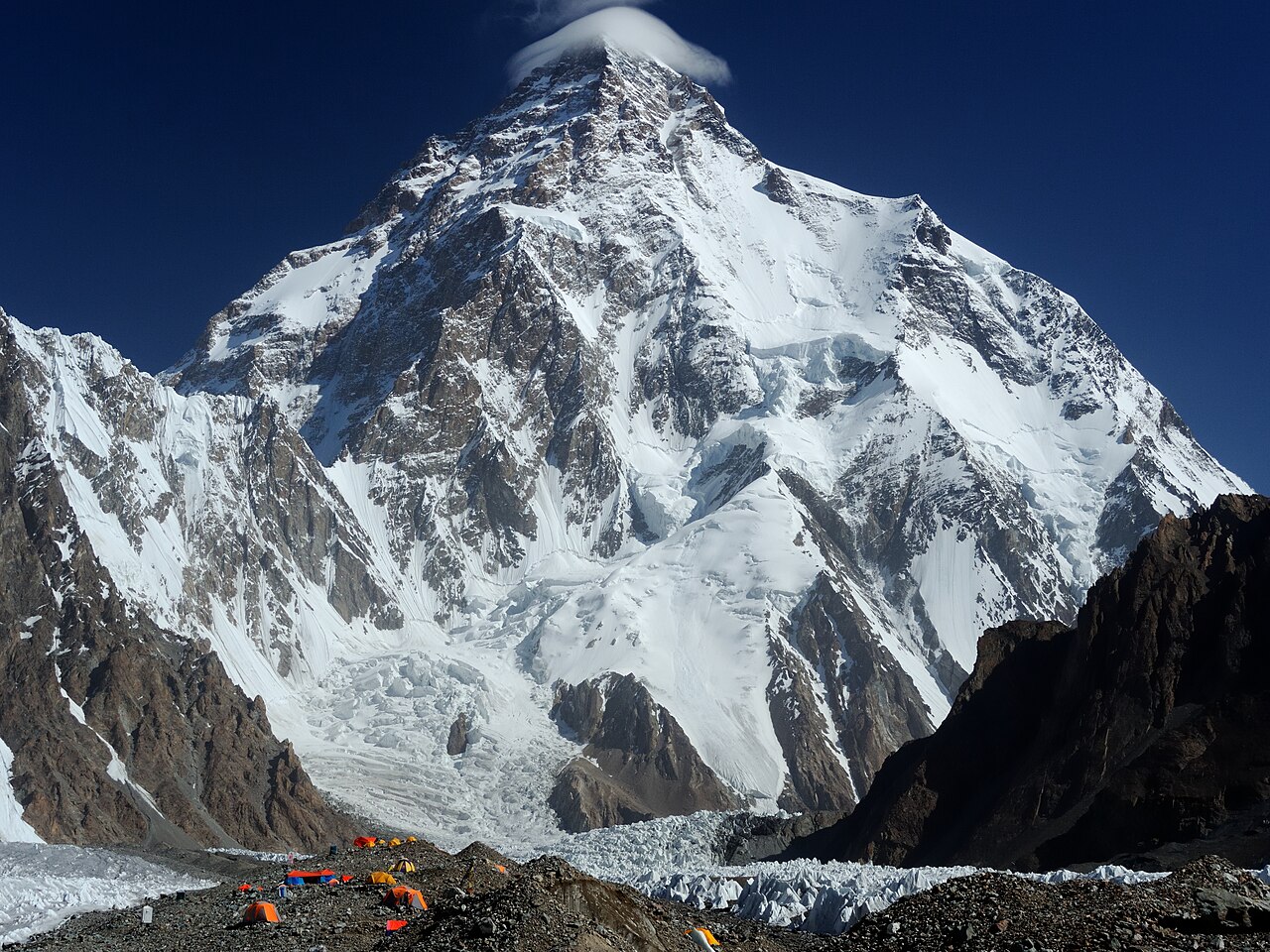
Table of Contents
- What You Are Actually Getting Into
- The Route Day by Day
- K2 Base Camp: What It Looks Like
- When to Go
- How Hard Is It
- Permits
- Getting to Skardu
- What to Bring
- What It Costs
- Questions People Actually Ask
What You Are Actually Getting Into
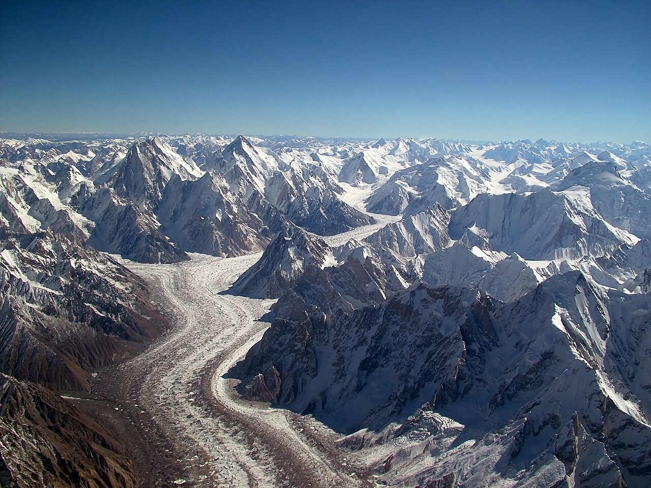
The Baltoro Glacier is 63 kilometres long. You walk the lower half of it. The surface is not ice. It is moraine: angular boulders and rock debris sitting on top of the ice, with melt pools, unstable slabs, and the occasional hole that goes further down than you want to find out. Walking on it for eight hours a day is genuinely tiring in a way that a normal mountain trail is not. Your ankles, knees, and the small stabilizer muscles in your hips will know about it by day three.
The altitude is real. Askole sits at 3,015 metres. K2 Base Camp is at 5,150. You gain that over a week of walking, which is a reasonable acclimatization rate, but it is not a guaranteed protection against altitude sickness. Some very fit people struggle above 4,500 metres. Some less fit people do not. The one thing that helps is going slowly and drinking 4 litres of water a day. Both of those things sound simple and neither is as easy as it sounds when you are tired.
There is no phone signal beyond the first day out of Askole. A Garmin inReach or SPOT satellite communicator is the only way to contact the outside world from the glacier. Tell your family your schedule before you leave Skardu and do not expect to update them until you return.
The Route Day by Day
What follows is a 16-day itinerary from Skardu. There are shorter versions. They cut rest days and push longer daily distances. We do not recommend them for most trekkers. The route is forgiving if you treat it with patience. It is less forgiving if you treat it like a race.
Days 1-2: Skardu
Fly in from Islamabad or take the KKH overland via Gilgit. The flight is 50 minutes and spectacular. The road is 20 hours and also spectacular but you will spend most of it sleeping. Fly if you can get a seat. In Skardu: sort permits, meet the team, buy snacks for the glacier (Skardu bazaar has nuts, dried apricots, biscuits, energy bars). The dried apricots from Baltistan are among the best in the world and cost almost nothing. Buy more than you think you need.
Day 3: Skardu to Askole (3,015 m)
Six to eight hours by jeep along the Braldu River. The road from Dasso onward is rough. Bring something to cushion the seat. Askole is the last village. Population somewhere around 300 people. You camp at the edge of it and in the morning it is just glacier.
Day 4: Askole to Jhola (3,100 m, 24 km)
The first day is the longest in distance: 24 kilometres on a relatively flat track along the Braldu River. You cross a rope bridge early. The terrain is sandy, dusty, and hot in the middle of the day. Start early and rest through the midday heat. Jhola is a campsite on a flat stretch of riverbank. Nothing remarkable about it except that it is the end of day one and you are still walking fine.
Day 5: Jhola to Paiju (3,400 m, 13 km)
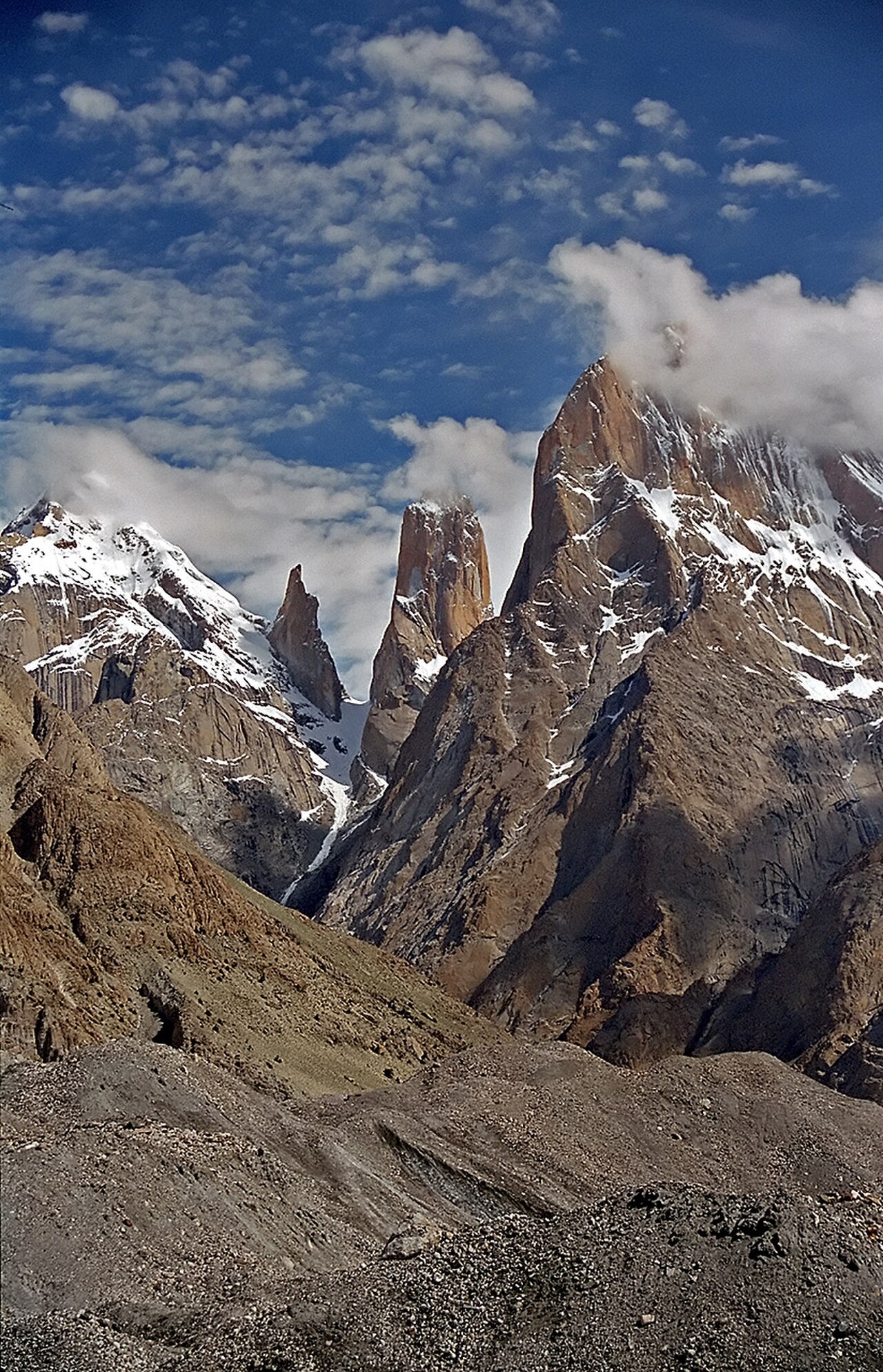
Shorter day. Good. You need it. Paiju is the last green camp before the glacier: willow trees, a stream, apricot bushes in season. The Trango Towers are visible from camp. Take a photograph. The rock is orange-pink at the right time of day and nothing in the Alps looks like it. A rest day at Paiju is standard. Most itineraries build it in. Take it.
Day 6: Rest Day at Paiju
Rest days are for acclimatizing, sorting gear, letting porters redistribute loads, and eating well before the glacier section. Some trekkers use it to walk up the hillside above camp for a view. That is optional. The mandatory part is resting.
Day 7: Paiju to Khoburtse (3,700 m, 13 km)
First day on the Baltoro Glacier. This is where the trek changes character. Moraine walking is slow. What looks like 13 kilometres on a map takes as long as 20 kilometres on a normal trail. The surface is constantly uneven. You step, check footing, step again. Trekking poles are not optional from this point. Use them. Khoburtse camp is on the lateral moraine with views north toward the Trango Towers and Cathedral group. Cold at night here even in July.
Day 8: Khoburtse to Urdukas (4,050 m, 12 km)
Urdukas is the best campsite on the approach. It sits on a grassy shelf above the glacier. The view south takes in the Cathedral Spires, Lobsang Spire, Payu Peak. The view north shows the upper Baltoro opening up toward Concordia. This is also the last grass you will see until you walk back. From here it is all rock and snow and ice. The camp has a natural water source. Fill bottles here and drink well.
Day 9: Urdukas to Goro II (4,285 m, 14 km)
A long, demanding glacier day. Goro I is an intermediate stopping point some groups use. Goro II is the standard camp at 4,285 metres. By this point the altitude is noticeable at pace. If you are breathing harder than expected, slow down. Headache is common here. Drink water and rest when you reach camp. Do not push through altitude symptoms. There is nowhere to go.
Day 10: Goro II to Concordia (4,690 m, 12 km)
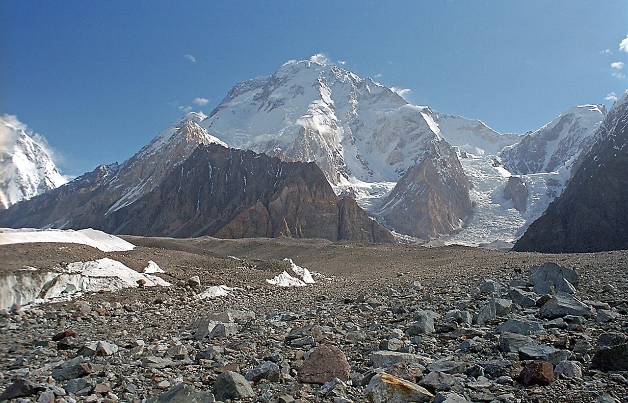
K2 appears in the distance around midday, identifiable by its distinctive black pyramid profile. It looks deceptively close for most of the walk. Then you round a bend in the glacier and Concordia opens: Broad Peak directly east, K2 north, Gasherbrum IV's knife-edge ridge to the left. Most people go quiet when they see it. That is the correct response.
Day 11: Concordia Rest Day
One night at Concordia is not enough. Two nights gives you two morning windows for clear skies. The light at Concordia at 6 a.m. in clear weather is something specific: the south face of Broad Peak catches first light while K2 is still dark, and for a few minutes the two peaks are lit at different colour temperatures simultaneously. Plan two nights. Build it in from the start.
Day 12: Concordia to K2 Base Camp and Back (5,150 m)
Twenty kilometres round trip on the Godwin-Austen Glacier. You leave Concordia heading north and K2 fills more and more of the sky ahead. Base camp itself is not beautiful. It is a flat, rocky area at the base of the Abruzzi Spur where expeditions pitch their tents. During expedition season (May through August) there are often groups here preparing for the climb. The scale becomes real at base camp in a way it does not at Concordia. The south face rises almost 3,600 metres directly above you. Walk to it and back in one day. Sleep at Concordia.
Days 13-16: Return to Askole
The return follows the same route. Going down is faster and the descent through lower altitude makes the physical effort easier. Most groups cover the return in three days with longer distances per day. On the last day you reach Askole, load into jeeps, and drive back to Skardu. The hot shower at the Skardu hotel will be the best shower of your life.
K2 Base Camp: What It Looks Like
K2 is 8,611 metres. From base camp you are looking at the bottom 3,600 metres of the mountain. The south face is a wall of ice and rock that dominates everything in your visual field. The Abruzzi Spur, the main climbing route, begins just left of the flat base area and goes straight up the southeast ridge. In climbing season you can sometimes see fixed ropes with binoculars on the lower sections.
The Godwin-Austen Glacier at base camp level is wide and flat, covered in the same angular moraine rubble as the lower Baltoro. At 5,150 metres, the air is noticeably thinner. Simple tasks take longer. Moving too fast triggers immediate shortness of breath. This is normal at this elevation. It is also a reminder of what the climbers above are dealing with at 8,000 metres.
Broad Peak (8,051 m) is immediately to the east, close enough that you can pick out the individual features of its summit ridge. The mountain looks different from here than it does from Concordia: less like a wide wall and more like a real three-dimensional massif. Gasherbrum I and II are further down the Abruzzi Glacier, visible in the distance to the southeast.
When to Go
July. That is the answer. July gives you the best average weather, the least residual snow on the lower glacier, and the most predictable conditions at Concordia and K2 Base Camp.
August works but is statistically cloudier in the first half. If you can only go in August, go in the second half. Late August into early September is often excellent: stable, cold at night, very clear skies. The risk is that the season is closing and porter availability drops.
Late June is possible. The lower glacier has more snow coverage, which makes moraine walking slightly easier in some sections and harder in others (wet snow on slabs is unpleasant). The views at Concordia are on average better in late June than in August because there are fewer clouds in the Karakoram before the monsoon moisture arrives.
Do not go before June 20. Do not plan to be on the glacier after September 15. Both of those limits have exceptions and both exceptions involve things going wrong.
How Hard Is It
Harder than most people expect. Not harder than fit, prepared people can handle.
The glacier moraine is the specific challenge that surprises first-time visitors. Fifteen kilometres on moraine feels like twenty on a normal trail. The footing demands constant attention. There is no section where you can switch off and move on autopilot. After several consecutive days of this, fatigue accumulates in a way that pure distance does not capture.
Altitude compounds the physical effort above 4,000 metres. You will be walking slower than you normally do. That is intentional and correct. Fighting it is the mistake most people make.
There is nothing technical. No ropes, no crampons (normally), no climbing. What there is: distance, altitude, and moraine for two weeks. If you can hike 18 kilometres a day on a normal mountain trail, you can do this. If you cannot, train before you go.
Permits
Two permits are required. Both are arranged through your Pakistani trekking agency. You cannot get them independently.
The trekking permit from the Alpine Club of Pakistan costs around USD 50 per person. You need a passport copy, photo, application form, and proof of travel insurance that includes helicopter evacuation. The insurance part is enforced. Do not think you can skip it.
The Central Karakoram National Park entry fee is around USD 25. It is collected at checkpoints on the route. Your agency includes it in most packaged itineraries.
Pakistani rules require a licensed guide and porter team for all foreign trekkers on the Baltoro. Self-guiding is not permitted. This is enforced at the Askole checkpoint.
Getting to Skardu
PIA operates turboprop flights (ATR 72) from Islamabad to Skardu (IATA: KDU). Flight time is 50 minutes. Seats fill fast in July. Book early, ideally 4 to 6 weeks before travel.
Mountain weather delays are common. A 20% delay rate is normal. A 40% delay rate happens some years. Always build a buffer day into both ends of your trip. Do not schedule an international flight out of Islamabad the day after your planned Skardu arrival. You will miss it.
The overland option: Islamabad to Gilgit by road (12 hours on the KKH), then Gilgit to Skardu by road (6 hours). Total 18-20 hours. Cheaper, no delay risk from weather, scenery is exceptional. Genuinely worth doing once in your life. Not worth doing both directions on a tight schedule.
What to Bring
This is not an exhaustive packing list. It is the things people most commonly get wrong.
Sleeping bag: Rated to minus 15 Celsius. Not minus 5. Minus 15. Concordia and K2 Base Camp regularly drop below minus 10 at night in July with clear skies. Clear skies are when the temperatures are coldest.
Trekking poles: Two of them. Collapsible. Non-optional on the Baltoro. If you have not used trekking poles before, practise before the trip. Using them incorrectly provides no benefit and tires your arms.
Boots: Stiff, high-ankle, broken in well before the trip. Boots with any kind of heel instability will produce blisters by day three on the moraine. Break them in on rocky trails, not on roads.
Sunglasses: Category 4 glacier glasses, not regular sunglasses. Glacier UV reflection at 4,000 metres is severe. Standard category 2-3 sunglasses are not adequate. Snow blindness on the upper glacier is painful and requires descending.
Sun protection: SPF 50+ on face, lips, and neck. The glacier amplifies UV. People who apply sunscreen once in the morning and do not reapply get burned badly.
What not to bring: Anything heavy you do not specifically need. Your daypack should be 20 to 25 litres maximum. Porter load limits are strict. The lighter your personal carry, the more energy you have for walking.
What It Costs
A packaged K2 Base Camp Trek with guide, porters, camping equipment, meals, permits, and Skardu-Askole jeep transfer runs between USD 2,000 and USD 3,200 per person. The wide range reflects group size: solo trekkers pay more because fixed costs (guide, camp cook, equipment) are split fewer ways. A group of 4 to 6 people gets closer to the lower end of that range.
International flights and the Islamabad-Skardu domestic flight are additional. Budget USD 800 to USD 1,200 for flights from Europe. From North America, USD 1,200 to USD 1,800 depending on routing.
Tips for guide and porter teams are expected and important. Guide tips of USD 80 to USD 120 per week are appropriate. Porter tips of USD 3 to USD 5 per porter per day. Budget these costs separately before you go.
Questions People Actually Ask
Is K2 Base Camp harder than Everest Base Camp?
Yes, significantly. Everest Base Camp follows maintained trails with tea houses every few hours. K2 Base Camp involves 14 days on a remote glacier with full camping, no resupply, and maximum altitude roughly 500 metres higher than EBC. The two treks are not in the same category of difficulty.
Can I do K2 Base Camp without a guide?
No. Pakistani regulations require a licensed guide for all foreign trekkers on the Baltoro route. You will be turned back at the Askole checkpoint without the correct documentation. Beyond the rules, a guide on this trek is genuinely useful rather than ceremonial: route-finding on glacier moraine, camp management, weather assessment, and emergency response are all real functions your guide provides.
What is the failure rate? How many people turn back?
Hard to put an exact number on it. Altitude sickness is the most common reason people turn back. Injury, mainly ankle and knee problems from the moraine, is the second most common. Among well-prepared, fit trekkers on a properly scheduled itinerary, a large majority complete the route. Among trekkers who underestimate the difficulty or rush the acclimatization, the failure rate is meaningfully higher.
Do I need crampons?
Not normally. On the standard July and August itinerary, the glacier is mostly moraine-covered and crampons are not required for the trek to K2 Base Camp. In late June with significant snow coverage on the upper glacier, lightweight crampons or microspikes may be useful. Your guide will advise based on current conditions.
Is it safe?
The trekking route itself has no serious objective hazards for prepared trekkers on the standard itinerary. The glacier is not crevassed at trekking route level. There is no rock fall risk on the main path. The risks on this trek are altitude sickness and injury, both of which are manageable with proper preparation and a competent guide team. It is not a dangerous route. It is a demanding one.
What do I do if I get altitude sickness?
Descend. That is the only definitive treatment. If you have a mild headache and mild nausea, stop, rest, drink water, take ibuprofen, and do not ascend further that day. If symptoms include confusion, loss of balance, severe headache that does not respond to medication, or difficulty breathing at rest, descend immediately regardless of the time of day or weather. Helicopter evacuation is available from the Baltoro but depends on weather and cannot be guaranteed to arrive quickly. Descending on foot is faster and more reliable.
How cold does it get at K2 Base Camp?
At night in July, with clear skies, temperatures at 5,150 metres regularly reach minus 10 to minus 12 Celsius. Wind drops the effective temperature further. During the day in good weather, direct sun at altitude makes daytime temperatures in the 5 to 15 degree Celsius range. The temperature swing between a clear Karakoram day and the same night is extreme. Layer aggressively.
