Spantik Peak Expedition
Spantik (Golden Peak), Nagar, Gilgit-Baltistan, Pakistan
0/5
0% of guests recommend
Duration
30 Days
Group Size
8 persons
Overview
About the Spantik Peak Expedition
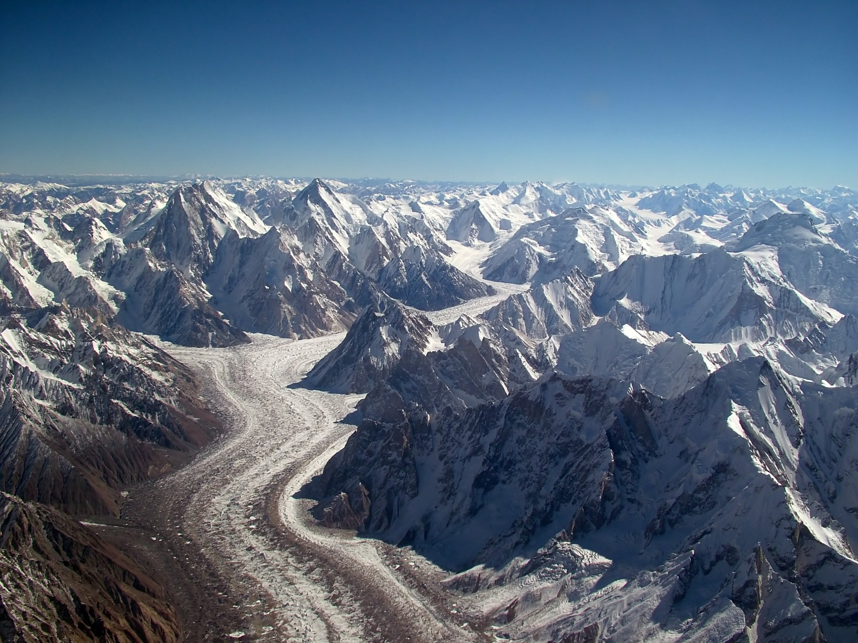
Spantik, also known as Golden Peak, stands at 7,027 metres in the Nagar district of Gilgit-Baltistan, Pakistan. It is one of the most popular 7,000-metre peaks in the Karakoram range, offering a non-technical normal route via the southeast ridge that is achievable for alpinists with solid high-altitude trekking experience and basic technical mountaineering skills. The mountain gained its English name Golden Peak from the warm golden colour the snow and ice take at sunset when viewed from the Nagar Valley below. A successful ascent of Spantik is a natural first 7,000-metre objective for climbers progressing from 6,000-metre peaks toward the 8,000-metre range.
The approach to Spantik Base Camp from Nagar Valley takes 4 to 5 days through the Chogolungma Glacier system. The expedition establishes a camp at base camp around 4,800 metres and then typically two high camps: Camp I at approximately 5,900 metres and Camp II at approximately 6,500 metres. The summit push from Camp II gains 527 metres to the summit on a snow and ice ridge with moderate technical demands. Total expedition duration is approximately 21 to 25 days.
Route Overview
The approach from Nagar Valley base to Spantik Base Camp follows the Chogolungma Glacier for 4 to 5 days. The glacier is long and the moraine walking is similar in character to the Baltoro Glacier approach, demanding but manageable for fit walkers. Base camp at 4,800 metres is established on a moraine platform with clear views of the Spantik summit and the surrounding Nagar peaks. Camp I at 5,900 metres is reached via the southeast glacier and lower ridge. Camp II at 6,500 metres is the high camp positioned on the upper ridge section. The summit push from Camp II follows the snow and ice ridge with some mixed terrain on the upper section to the flat summit plateau at 7,027 metres.
Technical Character of the Route
The Spantik southeast ridge is the standard route and is rated as Alpine PD (peu difficile) to AD (assez difficile) depending on conditions. This rating places it within reach of competent alpinists with crampon and ice axe skills but without requiring the advanced technical competence needed for more serious 7,000-metre routes. Fixed ropes are placed on the steeper sections of the upper ridge. The main physical challenges are the sustained altitude above 6,000 metres during the high camp rotations and the cumulative effort of a 3 to 4 week expedition. There are no serious objective hazards comparable to the serac risks on the 8,000-metre peaks.
Best Season
The Spantik expedition season runs June through early September. July and August offer the most stable weather and the most established approach conditions. The Chogolungma Glacier approach is safer and faster in settled summer weather. Autumn expeditions in September and early October are possible and often experience excellent visibility and cold stable weather, but the summit push probability decreases as early autumn weather systems bring stronger summit-level winds.
Experience Requirements
Climbers should have previous experience on peaks between 5,500 and 6,500 metres before attempting Spantik. Island Peak (6,189 m) or Mera Peak (6,476 m) in Nepal, or a 6,000-metre Karakoram peak, are appropriate prior objectives. Technical skills required include confident crampon walking on steep snow (35 to 45 degrees), ice axe use and self-arrest, and ascending fixed ropes with a jumar ascender. The expedition also requires the physical and psychological capacity for 3 to 4 weeks of expedition life at altitude, which is a qualitatively different challenge from a 5-day peak climb.
The Nagar Valley and Hunza Region
The Spantik expedition starts from the Nagar Valley, the historically separate twin kingdom of Hunza on the south side of the Hunza River. Nagar and Hunza share the same physical landscape of the upper Gilgit-Baltistan but have distinct cultural and political histories. The villages of Nagar are predominantly Shia Ismaili and Twelver communities mixed, with a rich heritage of apricot cultivation, traditional stone architecture, and Silk Road trade history. The Karakoram Highway that connects Nagar to Gilgit and the wider Pakistan road network runs through some of the finest mountain scenery in the country.
Why Choose Spantik
Spantik at 7,027 metres is the right mountain for alpinists who are ready to cross into 7,000-metre territory without the full expedition complexity of an 8,000-metre peak. The route is technically moderate, the approach is manageable, and the summit success rate in our expeditions is higher than the 8,000-metre objectives because the weather windows are broader and the altitude extreme is lower. The summit view from 7,027 metres encompasses the entire central Karakoram including Rakaposhi, Diran, the Hispar Glacier peaks, and on clear days K2 and the Baltoro peaks to the southeast. All permits, approach logistics, base camp setup, cook service, and high camp equipment are included.
Customized/Private Groups PricingDiscount will be automatically applied during the booking process if the number of guests meets the criteria specified in table below.(currently discounts are applicable to private tours only)
| Solo Price | 2 to 4 Person | 5 to 8 Person | 9 to 20 Person |
|---|---|---|---|
| $10,000 | $6,700 | $5,300 | $5,100 |
Itinerary
Day 1: Arrival in Islamabad
Altitude: 508 m | Accommodation: Hotel
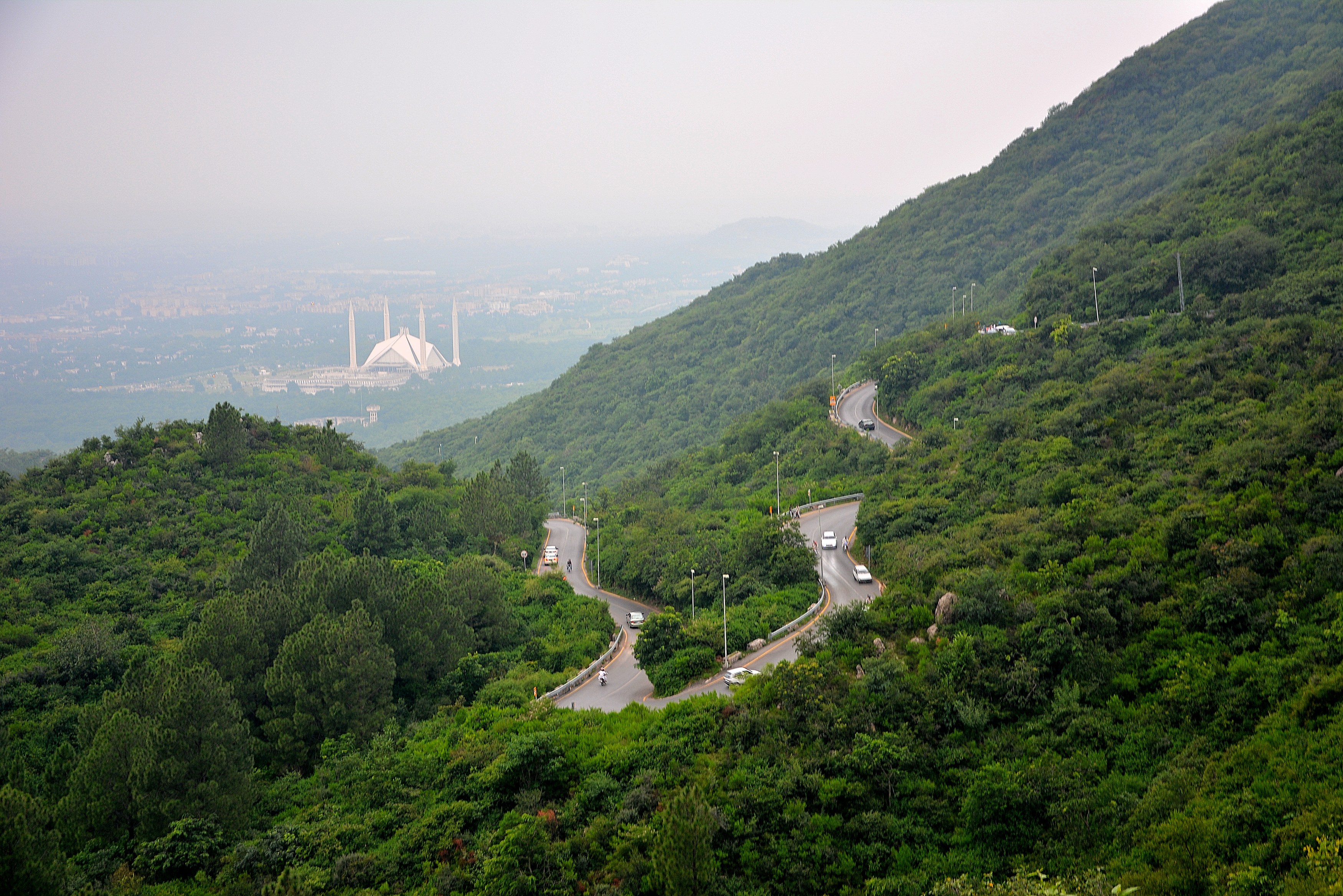
You arrive in Islamabad and meet the expedition team. Briefing dinner tonight covers the 30-day schedule in detail. The guide reviews the South Spur route on Spantik and explains the rotation plan. Check all personal gear tonight. Permits are collected from the Pakistan Alpine Club office tomorrow morning.
Day 2: Drive Islamabad to Gilgit via KKH
Altitude: 1,500 m | Accommodation: Hotel
Morning drive north from Islamabad on the Karakoram Highway. The KKH follows the Indus River for hundreds of kilometres. The drive to Gilgit takes about 14 hours on the highway. This is a long day but the scenery along the Indus Gorge is spectacular. You see Nanga Parbat from the highway road. Overnight in Gilgit at 1,500 metres.
Day 3: Drive Gilgit to Nagar
Altitude: 2,400 m | Accommodation: Hotel
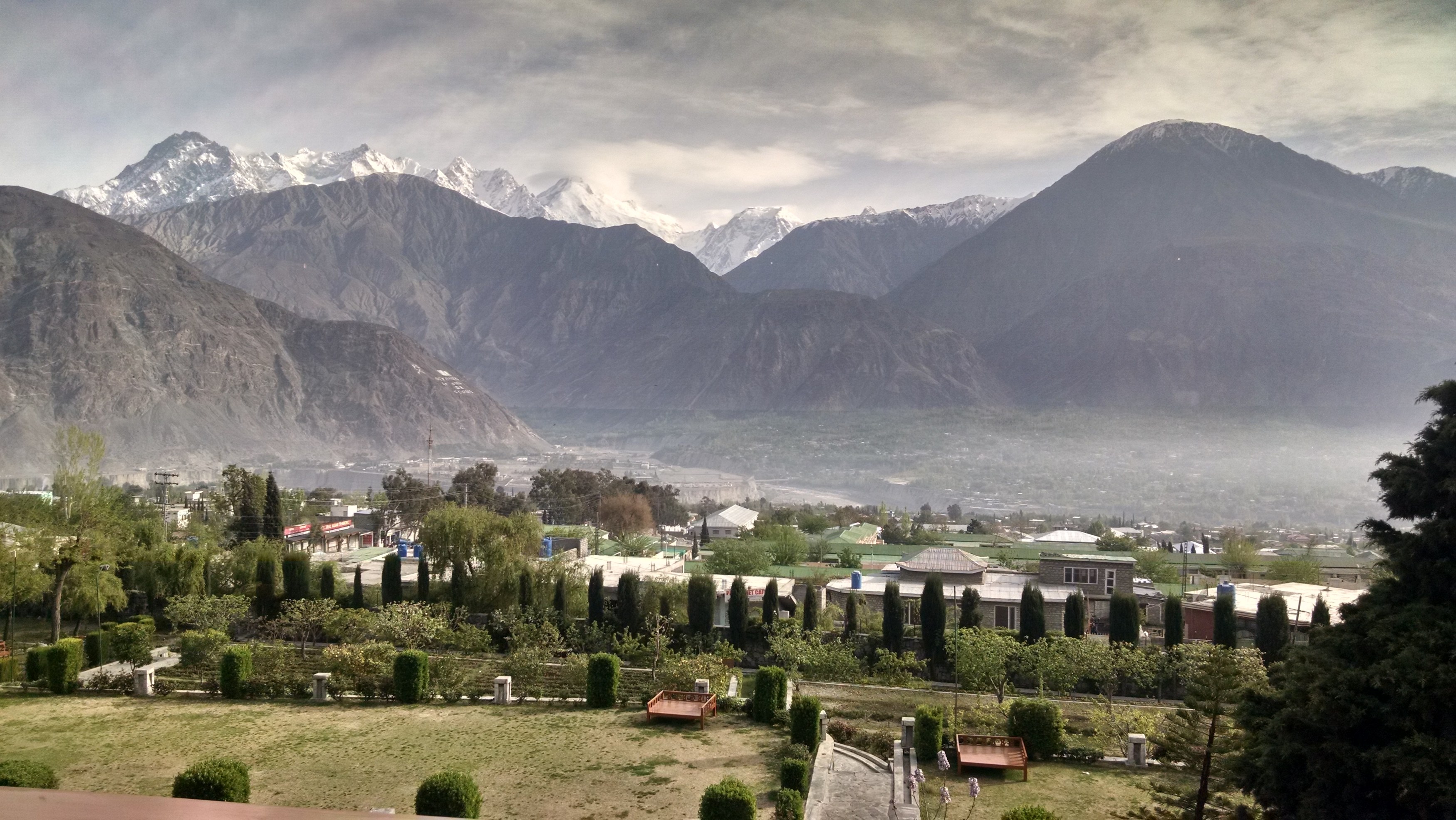
Short drive from Gilgit east to Nagar Valley. Nagar is a historic kingdom across the river from Hunza. The drive takes two hours. You see Rakaposhi at 7,788 metres towering above the Nagar valley as you approach. Check into a local guesthouse in Nagar town. This afternoon the expedition manager arranges porter recruitment and supply organisation.
Day 4: Drive to Arandu, Trek to Camp 1
Altitude: 3,500 m | Accommodation: Campsite
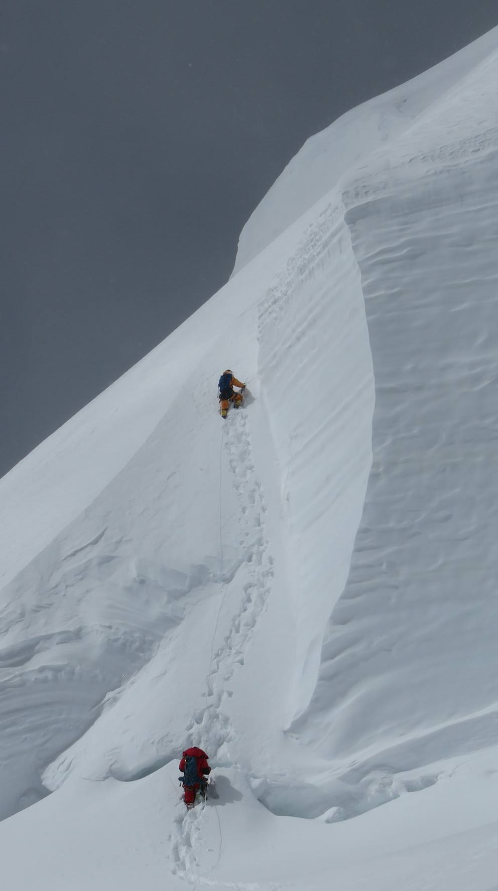
Drive from Nagar toward the Arandu area, the starting point for the Spantik approach trek. The jeep road ends at the roadhead and you begin walking from there. Today's walk covers four to five hours through the lower valley terrain to Camp 1 of the approach at around 3,600 metres. Set up camp by late afternoon.
Day 5: Trek to Advance Base Camp
Altitude: 4,200 m | Accommodation: Campsite
The second approach day takes you higher toward Advance Base Camp. You walk through increasingly rocky and glaciated terrain for about five to six hours. The path climbs steadily on moraine and snow patches. Spantik's south face becomes visible as you gain altitude. You camp tonight at roughly 4,200 metres. The mountain is now visible in detail above you.
Day 6: Base Camp - Setup and Rest
Altitude: 4,200 m | Accommodation: Base Camp
You reach base camp today at approximately 4,400 metres. The walk takes three to four hours from last night's camp. Base camp is set up on a flat moraine area at the foot of the South Spur. The guide and cook team set up the kitchen tent and dining area. You organise personal equipment and sort your high-altitude kit. Rest for the remainder of the day.
Day 7: Rest at Base Camp
Altitude: 4,200 m | Accommodation: Base Camp
Rest day at base camp. Today is a full rest day for acclimatization at 4,400 metres. Walk slowly around the camp area, eat well, and drink plenty of water. The guide reviews the first rotation plan and discusses conditions on the lower part of the route. The cook prepares good food throughout the day.
Day 8: First Rotation - Base Camp to Camp 1 (5,200 m)
Altitude: 5,200 m | Accommodation: Camp 1
First rotation day one. You climb from base camp to Camp 1 at 5,200 metres. The South Spur involves steep snow climbing with fixed ropes on the key sections. Walking time from base to Camp 1 is five to six hours. You sleep at Camp 1 tonight. The night at 5,200 metres starts your real acclimatization work on the mountain.
Day 9: Camp 1 to Camp 2 (5,900 m)
Altitude: 5,900 m | Accommodation: Camp 2
First rotation day two. From Camp 1 you climb to Camp 2 at 5,900 metres. The terrain steepens above Camp 1. Fixed ropes help on the most demanding sections. The climb takes four to five hours. At Camp 2 you are on a high snow slope with wide views over Nagar Valley and toward the Hispar region. Sleep here tonight to push your acclimatization higher.
Day 10: Descent to Base Camp
Altitude: 4,200 m | Accommodation: Base Camp
You descend from Camp 2 all the way back to base camp. The descent takes three to four hours. Coming down from 5,900 metres to 4,400 metres in one day is a significant altitude drop. Your body will recover well during the base camp rest days ahead. First rotation is complete.
Day 11: Rest at Base Camp
Altitude: 4,200 m | Accommodation: Base Camp
Rest day at base camp after rotation one. Sleep, eat, and let your body rebuild red blood cell counts from the altitude exposure. Do nothing strenuous. The cook provides good food. Tomorrow is another rest day before starting rotation two.
Day 12: Rest at Base Camp
Altitude: 4,200 m | Accommodation: Base Camp
Second rest day at base camp. You should feel the acclimatization effects from rotation one. Breathing at 4,400 metres feels easier than it did a week ago. Prepare mentally and check equipment for rotation two which goes higher than the first.
Day 13: Second Rotation - Base Camp to Camp 1
Altitude: 5,200 m | Accommodation: Camp 1
Second rotation begins. You climb from base camp to Camp 1 at 5,200 metres again. The familiar route feels more manageable this time. Sleep at Camp 1. The guide checks your condition and pace and confirms readiness for the push toward Camp 3.
Day 14: Camp 1 to Camp 2
Altitude: 5,900 m | Accommodation: Camp 2
Second rotation day two. You climb from Camp 1 to Camp 2 at 5,900 metres. The same terrain as before but this time you move with more confidence. Spend the night at Camp 2. You will push to Camp 3 tomorrow for the first time.
Day 15: Camp 2 to Camp 3 (6,400 m)
Altitude: 6,400 m | Accommodation: Camp 3
The key day of rotation two. You climb from Camp 2 to Camp 3 at 6,400 metres. The terrain above Camp 2 is more demanding with steeper snow and potential ice sections depending on conditions. Camp 3 is exposed and cold. Tonight at 6,400 metres is the highest you have been. Your acclimatization is now solid for the summit push.
Day 16: Descent Camp 3 to Base Camp
Altitude: 4,200 m | Accommodation: Base Camp
You descend from Camp 3 all the way back to base camp. The long descent from 6,400 to 4,400 metres takes five to seven hours. You pass through Camp 2 and Camp 1 on the way down. Both rotations are now complete. Your body is well acclimatized and you are ready for the summit push when the weather window opens.
Day 17: Rest at Base Camp
Altitude: 4,200 m | Accommodation: Base Camp
Rest day at base camp after rotation two. This is the most important rest of the expedition. Sleep as much as possible. Eat large meals. The guide watches weather forecasts closely and discusses prospects with other expedition teams nearby. You wait for the right weather window.
Day 18: Rest and Weather Monitoring
Altitude: 4,200 m | Accommodation: Base Camp
Second rest and weather monitoring day. The guide receives updated forecasts and evaluates wind and precipitation patterns above 6,000 metres. You continue resting and eating well. The summit push begins when the guide determines the window is suitable, typically a 48 to 72 hour period of calm conditions.
Day 19: Summit Push - Base Camp to Camp 1
Altitude: 5,200 m | Accommodation: Camp 1
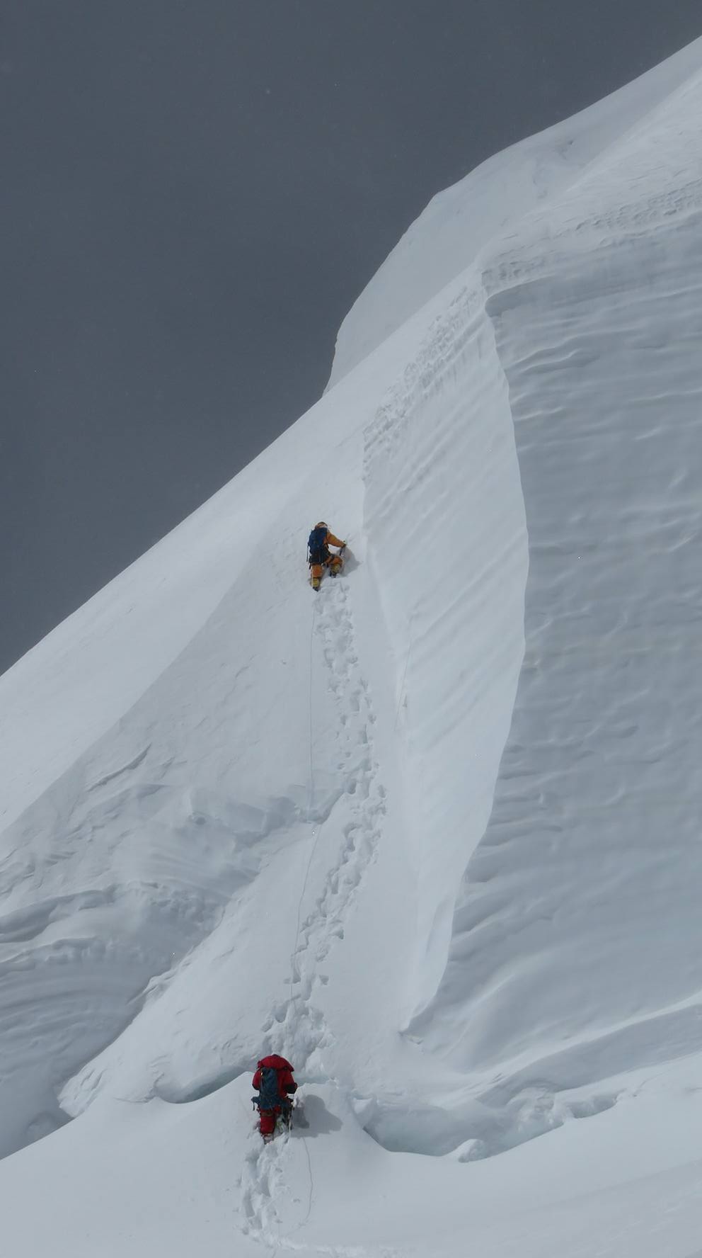
Summit push day one. You climb from base camp to Camp 1 at 5,200 metres. The ascent is smooth because you have done this route four times already. Sleep early tonight at Camp 1. Tomorrow you move to Camp 2.
Day 20: Camp 1 to Camp 2
Altitude: 5,900 m | Accommodation: Camp 2
Summit push day two. You climb from Camp 1 to Camp 2 at 5,900 metres. Pace yourself carefully today. You need energy reserves for the Camp 3 climb and summit day that follow. Good dinner and maximum rest at Camp 2 tonight.
Day 21: Camp 2 to Camp 3
Altitude: 6,400 m | Accommodation: Camp 3
Summit push day three. You climb from Camp 2 to Camp 3 at 6,400 metres. Arrive at Camp 3 in good condition and as early as possible. The earlier you arrive the more rest time you have before the summit departure in the early hours. Eat, drink, and sleep as much as altitude allows.
Day 22: Summit Day - Camp 3 to Spantik Summit (7,027 m)
Altitude: 7,027 m summit | Accommodation: Camp 3
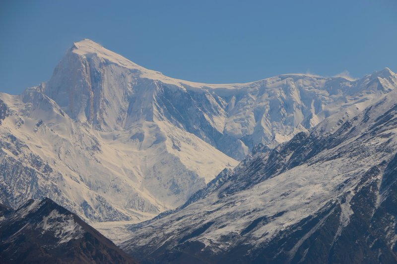
Summit day. Departure from Camp 3 at 1 to 2 AM. The route from Camp 3 to Spantik's summit at 7,027 metres follows the upper South Spur. The final section involves a narrow ridge and some corniced snow. The summit is a small point with dramatic views over Nagar, Hunza, and into the Karakoram. Descend immediately back to Camp 3 and then toward base camp.
Day 23: Descent to Base Camp
Altitude: 4,200 m | Accommodation: Base Camp
Descent from Camp 3 to base camp after the summit attempt. Your body is depleted after summit day. Move carefully on the descent. The guides assist on all technical sections. Arriving at base camp brings relief and satisfaction. Rest immediately on arrival.
Day 24: Rest and Celebration at Base Camp
Altitude: 4,200 m | Accommodation: Base Camp
Rest and celebration day at base camp. Whether the summit was reached or not, this is the final day on the mountain. Begin packing personal equipment for the walk out. The cook prepares a celebration dinner. The expedition team reflects on the experience together.
Day 25: Trek Base Camp to Arandu
Altitude: 2,800 m | Accommodation: Campsite
Trek from base camp back to Arandu roadhead. The descent takes three days in reverse of the approach. Today is the first day of the walk out, covering about five hours on moraine and valley trail. Camp tonight at roughly the same elevation as the first approach camp.
Day 26: Drive Arandu to Nagar to Gilgit
Altitude: 1,500 m | Accommodation: Hotel
Second walk-out day. You descend further toward the jeep road. The terrain becomes more gradual and lower altitude makes breathing easy. You feel noticeably lighter and stronger at lower altitude after the weeks above 4,000 metres. Camp near the roadhead tonight.
Day 27: Gilgit - Rest
Altitude: 1,500 m | Accommodation: Hotel
You reach the jeep road and drive from Arandu back through Nagar to Gilgit. The drive takes three to four hours. Gilgit has proper hotels, restaurants, and hot showers. Check in and rest. Tomorrow you begin the drive or fly back to Islamabad.
Day 28: Drive Gilgit to Islamabad via KKH
Altitude: 508 m | Accommodation: Hotel
Rest day in Gilgit. The town sits at a comfortable 1,500 metres after weeks at altitude. The bazaar has good food and local crafts. Visit the Kargah Buddha carved into a cliff face just outside town. Your guide confirms transport arrangements for tomorrow's Islamabad journey.
Day 29: Islamabad - Final Day
Altitude: 508 m | Accommodation: Hotel
Drive or fly from Gilgit back to Islamabad. The Karakoram Highway drive takes 14 hours. A morning PIA flight takes 45 minutes if available. Either way you arrive back in Islamabad by evening. Check into your hotel for the final night. The 30-day Spantik Expedition is complete.
Day 30: Departure
Accommodation: Hotel if needed
Departure day from Islamabad. Your guide takes you to Benazir Bhutto International Airport. If you have time before departure, the Daman-e-Koh viewpoint above Islamabad gives a final view of the Margalla Hills. Fly home with a 7,027-metre summit in your record.
Highlights
- Summit Spantik at 7,027 metres on the South Spur route in Nagar Valley.
- Drive the Karakoram Highway through the Hunza Valley with views of Rakaposhi and Ultar.
- Complete two rotation cycles on the mountain to build solid acclimatization before summiting.
- Camp at 6,400 metres on Camp 3 before the final summit push above the corniced ridge.
- Experience base camp life at 4,400 metres with Nagar Valley peaks all around.
- No supplemental oxygen required on this expedition.
Included/Excluded
All accommodation (hotels in Islamabad, Gilgit, Nagar, camping at base camp and high camps)
All meals throughout the expedition
Ground transport Islamabad to Gilgit and return
Jeep transfers Nagar to Arandu trailhead
Pakistani government Spantik climbing permit
Certified high-altitude expedition guide
Fixed ropes and anchors on the South Spur
Approach trek porters and their insurance and wages
Base camp equipment: mess tent, kitchen, sleeping tents
Emergency medical kit and oxygen at base camp
Airport and hotel transfers in Islamabad
International flights to and from Islamabad
Pakistan visa fee
Personal high-altitude climbing equipment
Personal sleeping bag rated to -30C
Supplemental oxygen (available at extra cost)
Travel and rescue insurance (mandatory)
Tips for guide, cook, and porters
Expenses due to weather delays or early evacuation
Satellite phone rental
Alcoholic beverages
Things To know
Personal Climbing Equipment Required
- 7,000-metre rated double boots (La Sportiva G2 SM, Scarpa Mont Blanc Pro, or equivalent)
- Technical crampons compatible with your boots
- Ice axe with positive grip head
- Climbing harness, jumar, and descender
- Helmet
- Expedition down suit rated to -30C
- High-altitude sleeping bag rated to -25C
- Expedition down mitts with inner liner gloves
- Polarised glacier goggles
Rescue Insurance
- Rescue insurance is mandatory for all participants
- Policy must cover helicopter evacuation up to 6,000 metres and overland evacuation above
- Minimum medical evacuation coverage of USD 100,000 required
- Provide policy copy to World of Mountain at least 4 weeks before departure
Physical Training Recommendations
- Begin structured training at least 4 months before departure
- Prioritise cardiovascular endurance: running, cycling, stair climbing with heavy pack
- Complete at least one multi-day trek above 4,000 metres before the expedition
- Strength training for legs, core, and arms supports technical sections
- Altitude pre-acclimatisation with altitude tents is beneficial but not essential
Communication on the Mountain
- Satellite communicator at base camp for emergency contact throughout
- Mobile coverage ends below Nagar town
- Daily weather forecasts received via satellite
- Inform family of expected return date and emergency contact procedures before departure
FAQs
What experience is required for Spantik?
You need documented climbing experience on peaks above 6,000 metres with technical ice and snow skills. You must be comfortable using crampons, ice axe, and ropes on steep terrain. Submit a climbing resume when you apply and we evaluate suitability based on your actual experience.
Is Spantik a good first seven-thousander?
Many climbers use Spantik as their first seven-thousander. The South Spur route is technically moderate compared to harder Karakoram peaks. The altitude is genuinely serious but the route does not require extreme technical ability. Good high-altitude fitness and solid crampon skills are the main requirements.
What is the technical difficulty of the South Spur route?
The South Spur is rated as a moderate snow and ice route. The steepest sections above Camp 2 reach about 55 to 60 degrees on snow and ice. Fixed ropes protect the key sections. Technical rock climbing is minimal. The corniced summit ridge requires careful movement.
How long does the summit day take?
Summit day from Camp 3 takes 8 to 12 hours for the round trip depending on conditions. Departure is typically at 1 to 2 AM. You arrive at the summit by mid-morning in good conditions and descend back to Camp 3 by early afternoon. Fast descent to base camp usually happens the same day.
What permits are required?
You need a Pakistan climbing royalty permit for Spantik and a liaison officer assigned by the government. Both are included in our expedition price. No additional permits are required for the approach valley.
What is included in the base camp setup?
We set up a fully equipped base camp with a dining tent, cook tent, toilet facilities, medical kit, and satellite communication. The cook prepares three hot meals daily. High-altitude tents at Camps 1, 2, and 3 are supplied. You provide your own personal sleeping bag and down gear.
Tour Location
Spantik (Golden Peak), Nagar, Gilgit-Baltistan, Pakistan
Reviews
0/5
Not Rated
Based on
0 review
Excellent
0
Very Good
0
Average
0
Poor
0
Terrible
0
No Review
18%
from
$5,500
$4,500
from
$5,500
$4,500