Gondogoro La Trek
Hushe Valley to Baltoro Glacier, Karakoram, Pakistan
0/5
0% of guests recommend
Duration
21 Days
Group Size
20 persons
Overview
About the Gondogoro La Trek
The Gondogoro La Trek is the complete Baltoro traverse, a 21-day route that enters the Karakoram from Askole via the Baltoro Glacier and exits via the Gondogoro La Pass at 5,585 metres into the Hushe Valley on the south side of the range. It combines everything the standard Concordia Trek offers, including the full Baltoro approach, Concordia at 4,691 metres, and a side trip to K2 Base Camp at 5,150 metres, and then extends the experience with the technical glacial pass crossing and descent into a completely different mountain valley. This is widely considered the finest mountain traverse available to non-mountaineers in Pakistan and one of the great trekking circuits in the world.
The Gondogoro La Pass at 5,585 metres is one of the highest regularly crossed trekking passes in the world. It requires crampons, an ice axe, and a harness for the fixed ropes on the steep upper section. The crossing is not technical climbing but it is genuinely technical trekking that demands respect and preparation. The reward is the view from the col, simultaneous sightlines to K2, Broad Peak, the Gasherbrums behind you and the Laila Peak group ahead, followed by a descent into the green Hushe Valley that feels like crossing from the high ice world into another country.
Route Overview
From Islamabad the route flies to Skardu, drives the Braldu Valley to Askole, and then follows the Baltoro Glacier northeast for seven days through Jhola, Paiju, Urdukas, and Biange to Concordia at 4,691 metres. After a rest and acclimatization day at Concordia, a side trip visits K2 Base Camp at 5,150 metres. Then the route leaves the Baltoro system and heads southeast to Gondogoro La Base Camp at 5,000 metres for the night. A 4 AM start on day 14 begins the pass crossing with crampons and fixed ropes, reaching the col at 5,585 metres before descending the south face to Ali Camp. From Ali Camp the route descends the Hushe Valley through Saicho to Hushe village, then exits by road through Khaplu to Skardu and the flight home.
The Gondogoro La Crossing in Detail
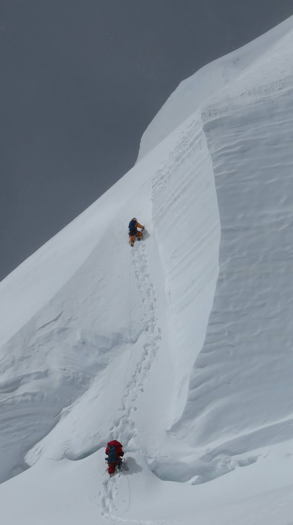
The crossing day is the technical and emotional peak of the 21-day trek. The 3 AM start is mandatory because the snow on the 40 to 45 degree slope is frozen firm in the pre-dawn hours and softens dangerously by mid-morning. The ascent to the col takes 3 to 4 hours. The key section is a 40 to 60 metre steep slope protected by fixed ropes where you clip your carabiner and ascend hand-over-hand combined with front-pointing on your crampons. At the col at 5,585 metres you look back at K2 and Broad Peak in the northwest and forward at Laila Peak and the green Hushe Valley below. The descent to Ali Camp is steep on the south side and requires the ice axe in the self-arrest ready position at all times. By 9 or 10 AM you are at Ali Camp. By afternoon you are in Saicho, and by the following day you are in Hushe village walking through apricot orchards.
Best Time to Cross
Mid-July through early August is the most reliable window for the Gondogoro La crossing. The pass has a historical success rate of approximately 80 to 85 percent in July and August departures based on our seasons from 2019 to 2025. June crossings are possible but the snow conditions on the approach slope are more variable. September crossings exist but early autumn snowfall increases the avalanche risk on the descent side. If the pass cannot be crossed within the scheduled buffer days, the route defaults to the standard K2 Base Camp Trek return to Askole. The glacier approach and Concordia viewpoint are full experiences in their own right regardless of whether the pass crossing succeeds.
Difficulty and Technical Requirements
The Gondogoro La Trek is more demanding than the standard K2 Base Camp Trek in two ways: it is 7 days longer, and the pass crossing adds a technical element absent from any other standard Baltoro trekking route. For the approach section, the difficulty rating and requirements are identical to the Concordia Trek: strenuous trekking on rough moraine at altitude, no technical equipment required. For the pass crossing itself, basic proficiency with crampons and an ice axe is required. You do not need formal mountaineering training but you should have walked on crampons before arriving at Gondogoro La Base Camp. Your guide provides a full technical briefing and practice session in Skardu and again at base camp before the crossing day.
The Hushe Valley Descent
The descent from the Gondogoro La into the Hushe Valley is one of the most dramatic landscape transitions in any trekking itinerary. Within a single day you drop from 5,585 metres of glaciated alpine wilderness to terraced wheat fields, apricot trees, and stone-walled Balti villages at 3,000 metres. The Hushe Valley is less visited than the Baltoro approach and has a quieter, more rural character. Hushe village is a genuine Balti farming community, not an expedition transit town. The valley's final destination, Khaplu, is a historic Balti town with a beautifully restored 17th-century fort palace that provides a fitting cultural conclusion to a physically intense 21 days.
Why Choose the Gondogoro La Trek
The Gondogoro La Trek gives you everything the Concordia Trek offers, including Concordia, K2 Base Camp, the Trango Towers, and the full Baltoro approach, plus the unique experience of the pass crossing and the Hushe Valley exit. It is the only standard trekking route in Pakistan that crosses the main Karakoram divide on foot, linking two entirely separate drainage systems in a single continuous journey. All permits for the Baltoro approach, the Gondogoro La crossing, and the Hushe Valley descent are included. Technical equipment for the pass crossing is provided as group gear. Guide, cook, and porter team are fully staffed throughout.
Customized/Private Groups PricingDiscount will be automatically applied during the booking process if the number of guests meets the criteria specified in table below.(currently discounts are applicable to private tours only)
| Solo Price | 2 to 4 Person | 5 to 8 Person | 9 to 20 Person |
|---|---|---|---|
| $4,000 | $2,700 | $2,100 | $2,000 |
Itinerary
Day 1: Arrive Islamabad
Altitude: 507m | Briefing, gear check, team dinner
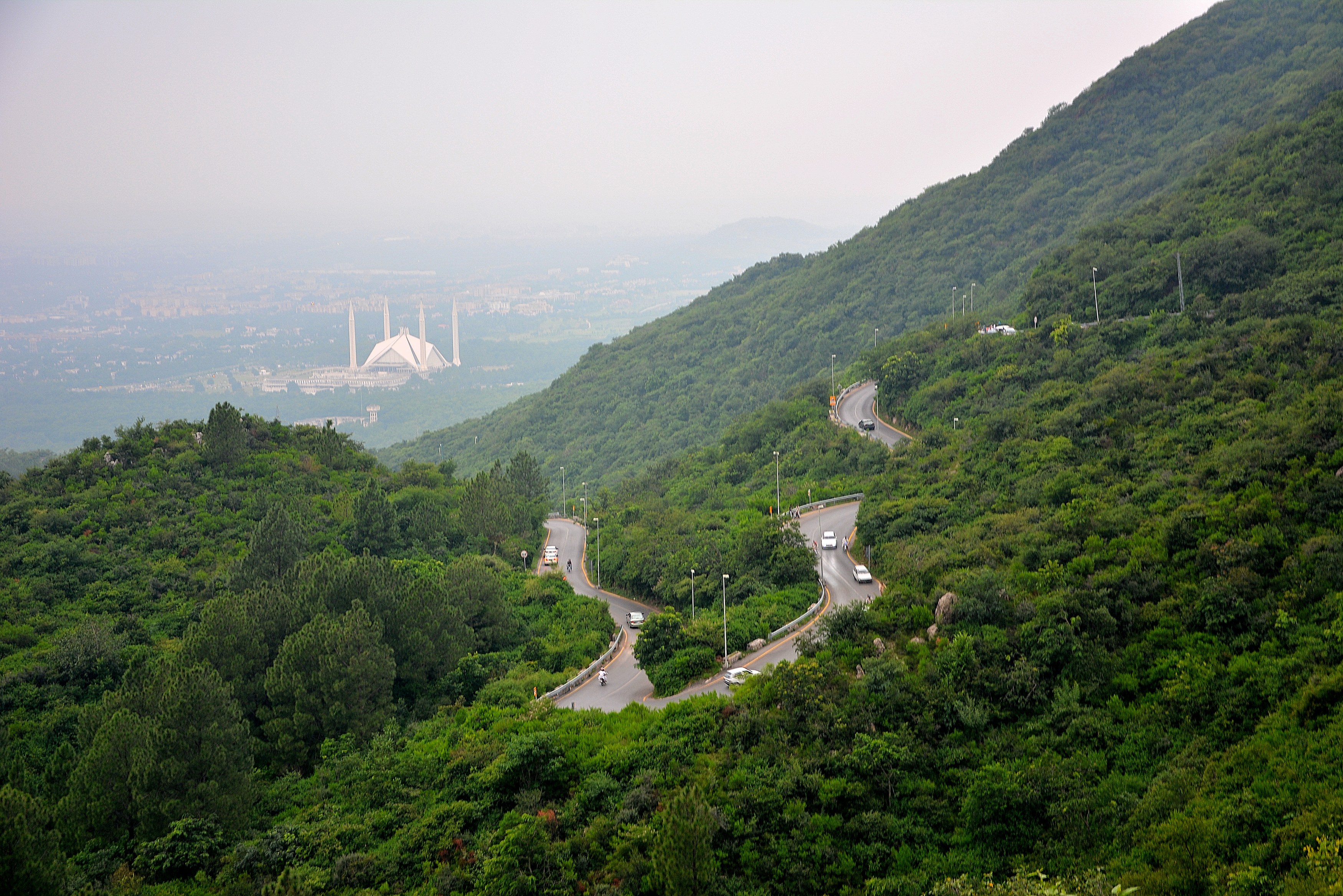
Arrive at Islamabad Benazir Bhutto International Airport and meet your World of Mountain guide in the arrivals hall. Islamabad sits at 507 metres and the heat can be surprising if you are arriving from a cooler climate, especially in June and July. The drive from the airport to your hotel in the Blue Area or F-7 sector takes 30 to 45 minutes depending on traffic.
The afternoon is your time to prepare. Your guide will sit with you for the full pre-departure briefing, covering the 21-day route in detail: the Baltoro Glacier approach to Concordia, the K2 Base Camp day hike, the preparation for the Gondogoro La pass crossing, and the Hushe Valley descent. Gear is checked: crampons, ice axe, high-altitude sleeping bag, and boot specifications are reviewed at this stage, not at 5,000 metres. If any item needs replacing or renting, Islamabad is the last urban city before Skardu.
Dinner as a group in the evening. The route ahead covers over 200 kilometres on foot through some of the highest and most remote terrain on the planet. Tonight is the last night at low altitude for three weeks.
Day 2: Fly Islamabad to Skardu
Altitude: 2,228m | Flight 55 minutes | Acclimatization begins
Hotel departure at 4 AM for the drive to the airport. The Skardu flight operates in the early morning because the afternoon winds through the Indus Gorge make the approach to Skardu Airport dangerous for fixed-wing aircraft. The Islamabad to Skardu route is one of the most spectacular commercial flights in the world: from takeoff the aircraft climbs northeast through the foothills and then the full Himalayan front range comes into view. On a clear morning the peaks of Nanga Parbat appear to the west before the aircraft turns toward the Indus and begins the descent into Skardu Valley.
The flight is 55 minutes. Weather cancellations are common, especially in early June when cloud systems hang over the Karakoram through the morning. If the flight is cancelled a same-day rebook is attempted. If a second cancellation occurs the land route to Skardu via the Karakoram Highway becomes the fallback, a 20 to 24 hour drive on a road that is itself one of the great engineering feats of the 20th century.
Landing at Skardu Airport at 2,228 metres, the altitude difference from Islamabad (507 m) is immediate. The afternoon in Skardu is free. Walking on flat ground is the right activity for the first hours at altitude. Dinner at the hotel. Sleep well: your body is beginning its acclimatization work whether or not you feel it.
Day 3: Skardu Acclimatization
Altitude: 2,228m | Satpara Lake, Skardu Fort | Rest day
Full rest and acclimatization day in Skardu. Two nights at 2,228 metres before the drive to Askole is the minimum medical preparation for a route that will climb to 5,585 metres over the following weeks. Skipping this day is not an option. Your guide will remind you that the altitude at Skardu feels trivial now precisely because the serious altitude is still far away, and that investing this day properly is what allows you to function on the Gondogoro La crossing 11 days from now.
Optional morning visit to Satpara Lake, a reservoir 8 kilometres south of Skardu town at 2,636 metres. The lake is crystal clear with views of the surrounding ridges and a short walk around the shore is good low-intensity acclimatization exercise. The Skardu Fort, a 16th-century Balti fortress on a sandstone outcrop above the Indus River, is worth the 30-minute climb from town for its views over the Skardu Valley and the converging Indus and Shigar rivers.
Equipment and food resupply in the Skardu bazaar if needed. The bazaar is the last point where camp food, fuel canisters, and basic gear items are commercially available. Your cook will complete food provisions for the entire expedition here. Sort your personal kit into trek bags (carried by porters) and a summit daypack. Weight management is serious on a 21-day route.
Day 4: Skardu to Askole
Altitude: 3,015m | Jeep drive 8-9 hours via Shigar Valley
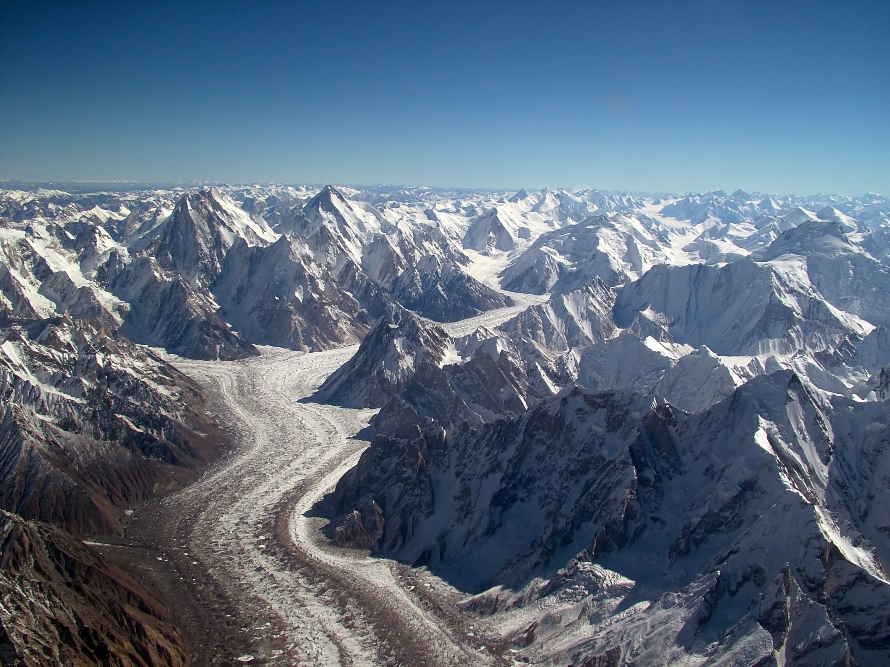
Breakfast at 6 AM, jeeps loaded by 7 AM. The drive from Skardu to Askole covers approximately 100 kilometres and takes 8 to 10 hours on a road that becomes progressively rougher as it approaches the mountains. The route runs northeast through the Shigar Valley, a fertile agricultural corridor with poplar-lined canal roads and apricot orchards before the landscape abruptens into the bare Braldu Gorge.
The Braldu River road from Daso onward is one of the most demanding vehicle tracks in Pakistan. The road is cut into cliffs above a river that runs turquoise and fast with glacial melt. In several sections the track is barely wider than the jeep and the drop to the river is vertical. Local drivers know every corner. The village of Chongo at mid-journey is a good break stop with chai and basic food available.
Askole at 3,015 metres is the last permanently inhabited village on the Baltoro route. Its population of approximately 200 Balti families lives in stone houses irrigated by channels from the Braldu River. The village has hosted mountaineering and trekking expeditions for over a century and its role as the gateway to the Karakoram is both its economic foundation and its cultural identity. Tonight in a basic village guesthouse or tents at the camp ground. The trekking begins tomorrow.
Day 5: Askole to Jhola
Altitude: 3,050m | 14km, 5-7 hours | Trek day 1
First trekking day. Departure from Askole at 6 AM. The trail leaves the village through the last of the irrigated fields and immediately enters open mountain terrain. The first major landmark is the crossing of the Dumordo River on a wooden bridge, 2 to 3 hours from Askole. The Dumordo Valley branches north toward the Chokto and Aling Chokto glaciers. Your route continues east-northeast along the Braldo River valley toward the Baltoro Glacier.
The trail from Askole to Jhola is dusty and exposed with no significant shade. Start early and take the heat seriously. 14 kilometres on this terrain takes 5 to 7 hours with the porter caravan. Jhola camp at 3,050 metres sits above the river on a sandy flat near a small gorge. The name Jhola means "swinging bridge" in Balti, referring to the suspension bridge that marks the camp approach. The camp has a cooking shelter used by expedition teams and enough flat ground for multiple tent groups.
The porter team sets up camp before your arrival on most days. The cook crew prepares a hot meal by the time trekkers arrive. This camp routine, early departure, long walk, camp arrival and meal, becomes the rhythm of the next 10 trekking days. Settle into it on day one. Your legs will carry you much further than you expect once the rhythm is established.
Day 6: Jhola to Paiju
Altitude: 3,400m | 11km, 5-6 hours | Last trees before the glacier
Jhola to Paiju Camp: 11 kilometres, 5 to 6 hours. Leave at 6:30 AM. The trail continues along the true left bank of the Braldu River, crossing occasional side streams from the lateral moraines of small glaciers descending from the north. The canyon walls become taller and the sky narrower as the valley deepens. Approximately 2 hours from Jhola a section of trail crosses boulder fields where the canyon walls have shed rockfall onto the path.
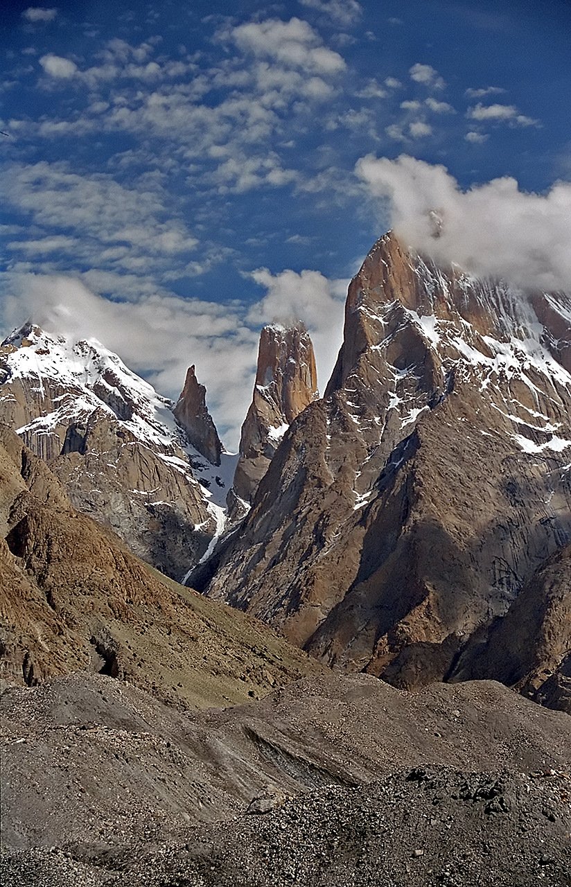
Paiju is announced from a distance by its trees, a grove of poplars and willows that marks a water source in the otherwise treeless moraine world of the upper Braldu. At 3,400 metres, Paiju Camp is the last green vegetation zone before the Baltoro Glacier. The camp itself sits in an open meadow next to the trees with good tent space and a reliable water source from a side stream. Across the valley the Trango Towers become visible for the first time today, their near-vertical granite walls rising over 1,000 metres from the glacier below.
Paiju is a transition camp. Tomorrow the Baltoro Glacier begins and the character of the trek changes fundamentally. Moraine walking on a live glacier is different from the valley floor trails of the past two days. Ensure crampons and ice axes are accessible in the top of your pack from tomorrow morning. Rest well tonight and eat fully.
Day 7: Rest Day at Paiju
Altitude: 3,400m | Acclimatization day | Short walk to glacier snout
Rest day at Paiju. Sleep until 7 AM. This is not a day off from the expedition, it is a medically productive day that your body uses to increase red blood cell production and vascular efficiency at 3,400 metres before the sustained altitude gain on the Baltoro begins. Trekkers who skip rest days at Paiju and Concordia consistently perform worse on the Gondogoro La crossing than those who take them.
The optional morning activity is a 2-hour walk to the snout of the Baltoro Glacier where the ice meets the valley floor. The snout is dramatic at close range: the terminal face of the glacier calves off in chunks of dirty ice that have been in the glacier system for decades. The moraine debris at the snout gives an indication of the scale of rock the glacier carries. From this point you can see 3 to 4 kilometres up the glacier tongue toward the first major icefall section. This is your first view of the terrain you will walk for the next 4 days.
Afternoon in camp. Read, sort gear, or do nothing. Your guide gives a route briefing for the glacier approach section, covering the navigation of the lateral moraine on the north bank, the camp locations at Urdukas and Biange, and the Concordia arrival protocol. The porter team rests as well. Tomorrow is an 8-hour day on moraine.
Day 8: Paiju to Urdukas
Altitude: 4,050m | 14km, 6-7 hours | Baltoro Glacier begins
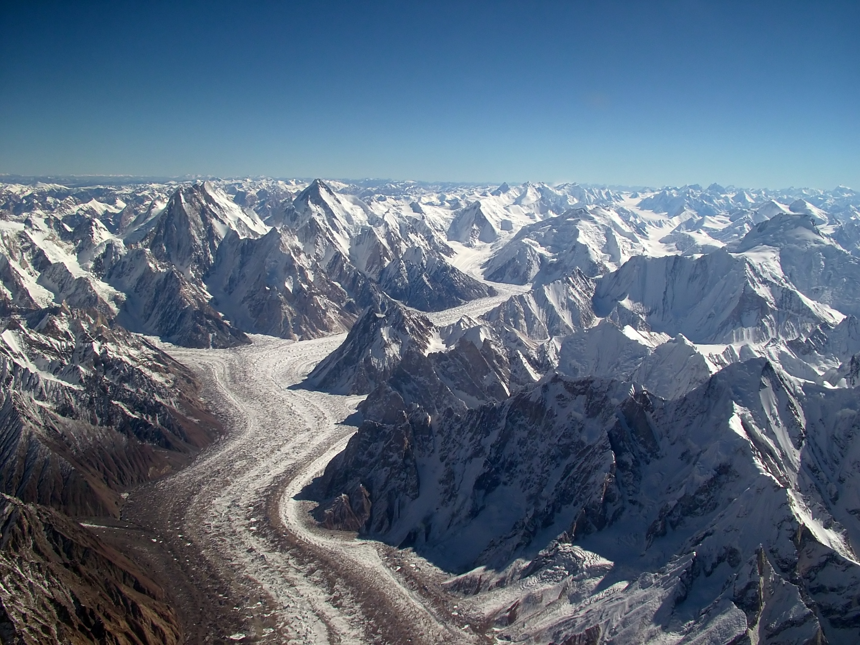
Paiju to Urdukas: 14 kilometres, 6 to 7 hours, gaining 650 metres to 4,050 metres. Leave at 6 AM. The trail from Paiju immediately crosses the toe of the Baltoro Glacier and climbs onto the lateral moraine on the north bank of the glacier. Moraine walking is different from trail walking: the footing is loose rock of all sizes with no flat ground for extended stretches. Your ankles work constantly. Poles are valuable from this day onward.
The Trango Towers dominate the northern skyline for the first half of today's walk. The Great Trango Tower at 6,286 metres and Nameless Tower (Trango Tower) at 6,239 metres rise in near-vertical granite walls that represent some of the most extreme technical rock climbing terrain in the world. The east face of the Great Trango Tower is one of the largest sheer cliff faces on Earth. Walking below these walls for 3 to 4 hours as they shift in perspective and light is one of the formative experiences of the Baltoro route.
Urdukas camp at 4,050 metres is a grassy ledge on the moraine above the glacier with outstanding views in all directions. The camp is one of the most scenic on the Baltoro and is used by virtually every expedition and trekking group on the route. The Trango group is visible to the northwest, Uli Biaho to the northeast, and on clear afternoons the hint of the Gasherbrum giants begins to appear far up the glacier. Altitude gain today is significant. Drink 3 to 4 litres of water.
Day 9: Urdukas to Gore I (Biange)
Altitude: 4,300m | 10km, 5-6 hours | Karakoram giants come into view
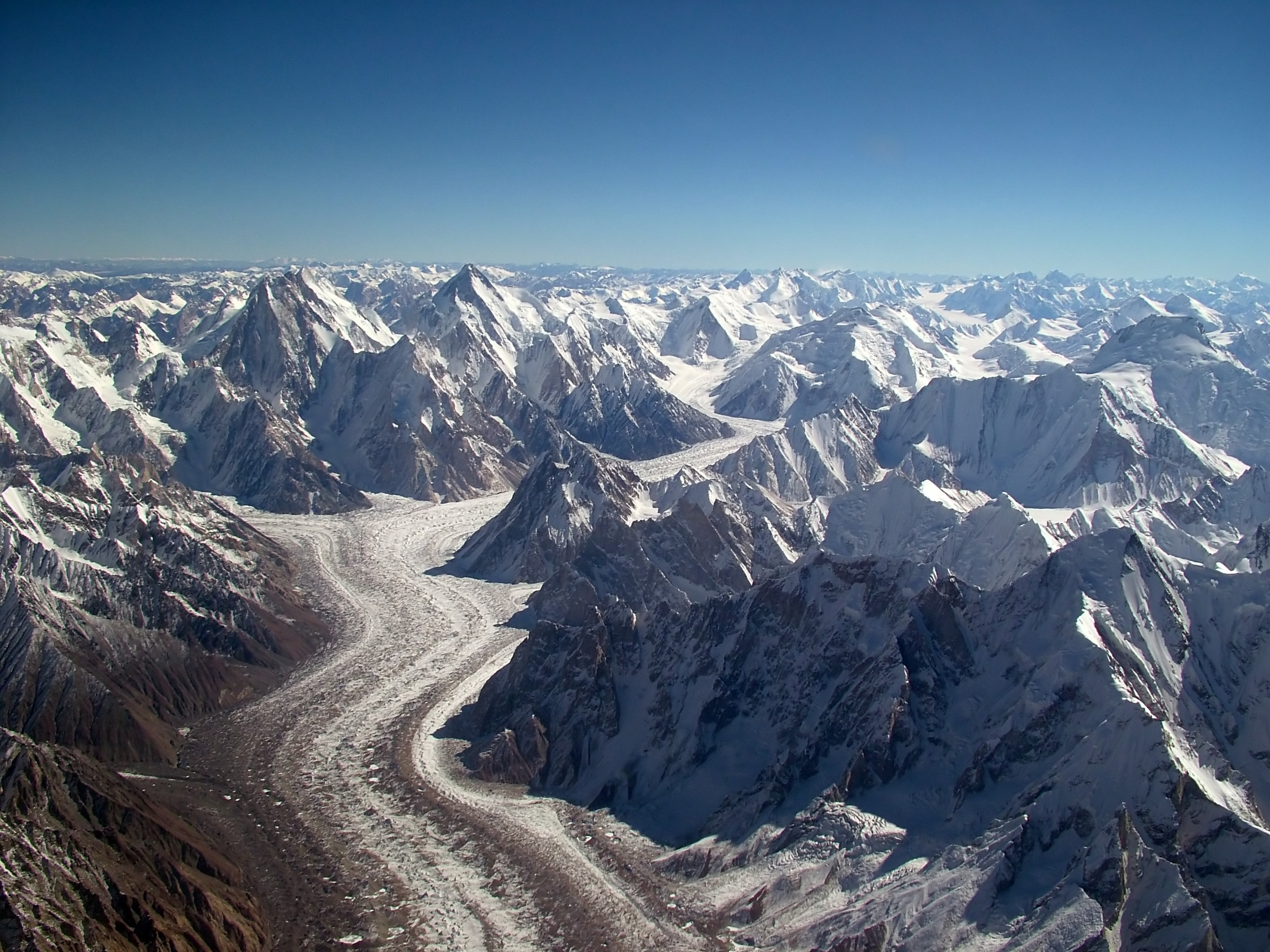
Urdukas to Gore I Camp: approximately 10 kilometres, 5 to 6 hours. The trail leaves Urdukas and drops back onto the moraine of the Baltoro Glacier proper. From this point the glacier is wide enough that the opposite southern bank is clearly visible across the ice. The middle of the Baltoro is a chaos of pressure ridges, crevasses, and melt ponds that makes direct glacier travel impractical. The route follows the northern lateral moraine, a raised ridge of debris that provides clear if rough walking.
The character of the landscape deepens significantly today. The valley opens and the sky grows as the Karakoram giants begin to reveal themselves: Gasherbrum IV at 7,925 metres first becomes visible at the head of the glacier, its northeast face a spectacular wall of rock and ice. Mitre Peak at 6,010 metres rises in a perfect geometric form above the southern bank. Masherbrum at 7,821 metres appears to the southeast, its four-sided pyramid silhouette one of the most recognised mountain profiles in Pakistan.
Gore I camp, also called Biange, sits at approximately 4,300 metres on a moraine flat. It is a large camp area used by multiple expeditions simultaneously during peak season. The surrounding peaks are close enough that their scale is now fully comprehensible. The air at 4,300 metres is noticeably thin. Breathing during the morning walk is effortful and the body needs recovery time at camp each afternoon. The cook prepares a full hot meal by arrival time.
Day 10: Gore I to Concordia
Altitude: 4,691m | 8km, 4-5 hours | K2 appears at the glacier junction

Gore I to Concordia: 8 kilometres, 4 to 5 hours, climbing from 4,300 to 4,691 metres. This is the day that justifies every kilometre of moraine walking since Askole. Concordia is where the Baltoro Glacier meets the Godwin-Austen Glacier, the Vigne Glacier, and the Baltoro tributary from the south, a meeting of four glacier systems at 4,691 metres that creates a vast open plateau of ice surrounded by a semicircle of 8,000-metre peaks.
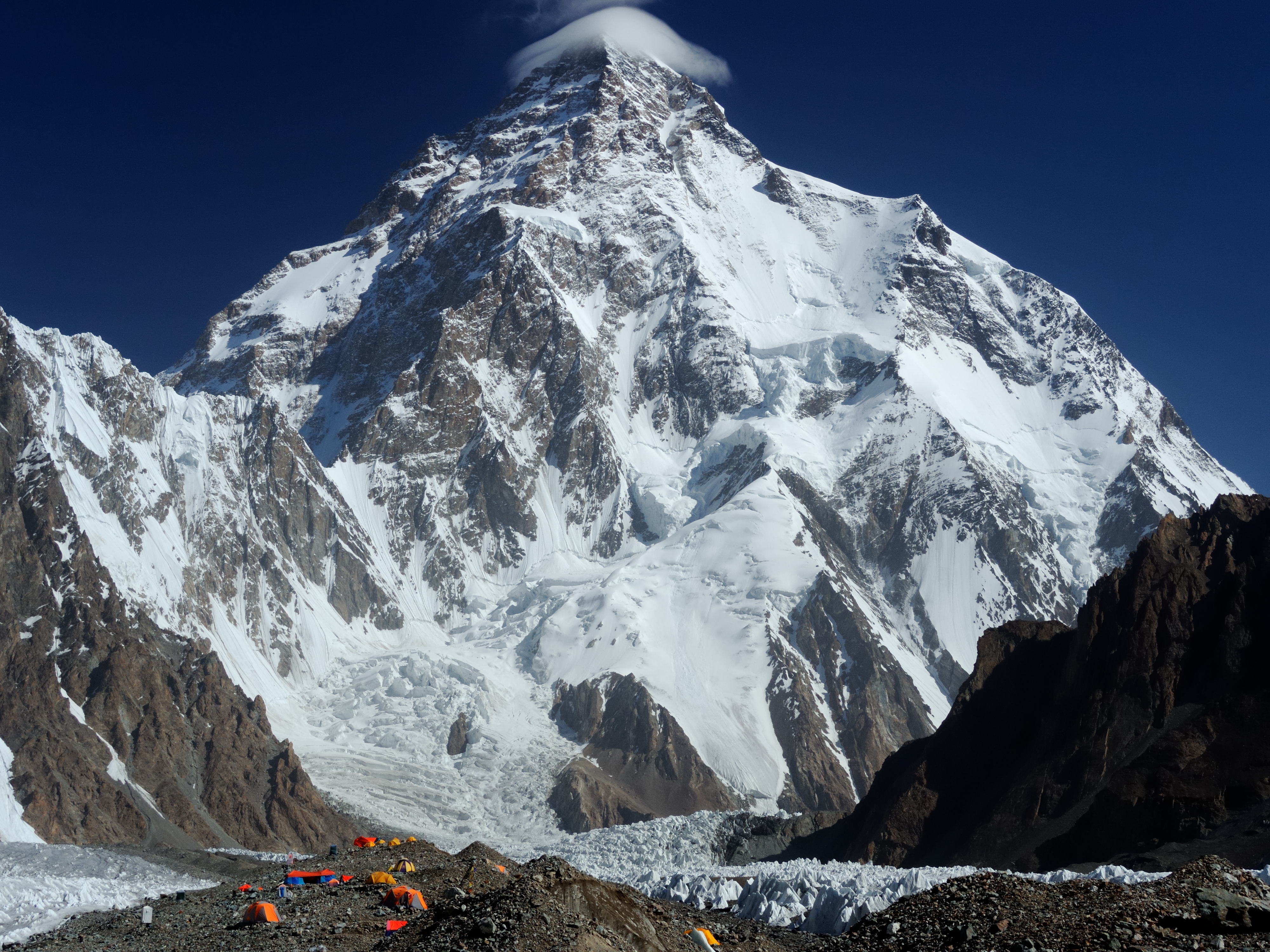
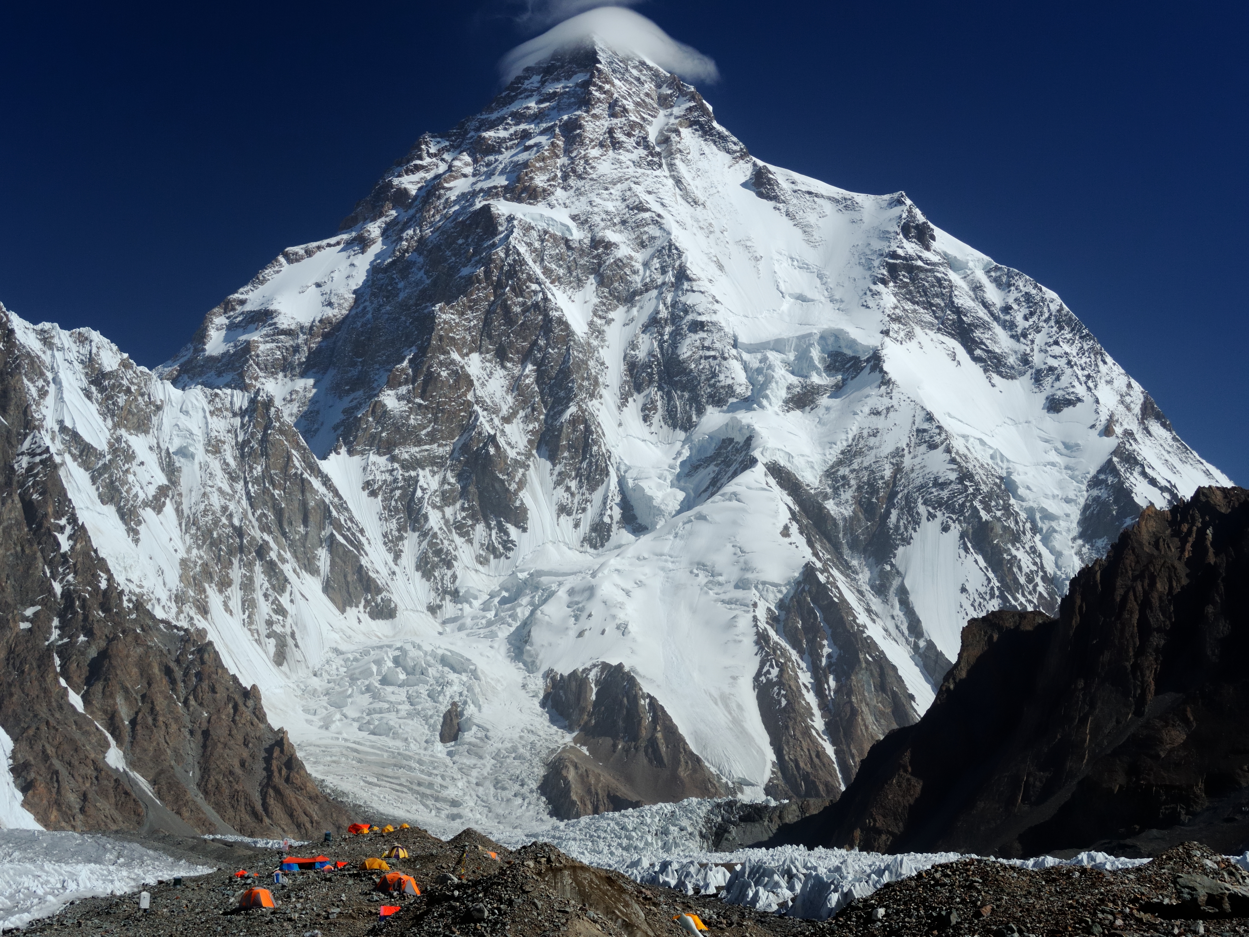
K2 comes into view approximately 45 minutes before Concordia as the glacier bends northeast. The first view of K2 from the Baltoro is one of the most discussed visual experiences in mountaineering. The mountain is visually different from expectations formed by photographs: it is rounder and more symmetrical than the jagged profile of Everest, its flanks sweep upward in clean lines, and at 8,611 metres it terminates in a pyramidal summit above the surrounding glaciers. The scale requires a moment of processing before the eye can properly calibrate. Broad Peak at 8,051 metres stands beside K2 to the northeast. Gasherbrum I and II fill the southern panorama. Eight of the world's 14 eight-thousanders are visible from Concordia on a clear day.
Camp at Concordia at 4,691 metres. Your porter team arrives and sets up tents. The altitude here is serious: headaches are common on the first afternoon, appetite decreases, and sleeping is often broken. Drink before you are thirsty. Eat even if you are not hungry. Tomorrow is a rest day and your body uses sleep and food to adjust.
Day 11: Concordia Acclimatization
Altitude: 4,691m | Rest day | Short walk on Godwin-Austen Glacier
Full rest and acclimatization day at Concordia. This day is non-negotiable before the K2 Base Camp hike and the Gondogoro La crossing. The altitude here is 4,691 metres and the climbers who have moved through Concordia for over 130 years of Karakoram history have consistently noted that the human body needs 24 hours minimum at this altitude before it is capable of useful work. The science supports this: haemoglobin production and oxygen-carrying capacity measurably improve after a single night at 4,691 metres compared to a rapid passage.
Optional short walk on the Godwin-Austen Glacier toward K2 for 1 to 2 hours and return. This provides controlled altitude exposure at 4,700 to 4,900 metres without the full commitment of the base camp walk. The Godwin-Austen Glacier between Concordia and K2 Base Camp is a highway of expedition groups during peak season. You will pass loaded porter teams, climbing expeditions returning from the mountain, and other trek groups heading to base camp. The sense of a living mountain community active on the glacier is distinctive and different from the empty moraine of the lower Baltoro.
Your guide gives the technical briefing for the Gondogoro La crossing: the 2:30 AM wakeup, the crampon procedure, the fixed rope section, the summit col at 5,585 metres, and the descent to Ali Camp. Listen carefully tonight. The crossing happens in three days and the preparation begins now.
Day 12: Concordia to K2 Base Camp and Return
Altitude: 5,150m | 8km each way, 6-7 hours round trip | K2 at close range
K2 Base Camp day. Daypacks only, main camp stays at Concordia. Departure at 6:30 AM. The route runs northeast from Concordia up the Godwin-Austen Glacier for 8 kilometres to the base camp area at 5,150 metres. The walking surface alternates between rough moraine and smooth glacier ice. Where the glacier is bare the footing is easy. Where moraine covers the ice the footing is demanding and ankle fatigue is real. Poles are essential today.
K2 Base Camp is not a single fixed point but a broad moraine area on the west and northwest side of the Godwin-Austen Glacier at approximately 5,100 to 5,200 metres. The standard trekking viewpoint is the moraine hill northwest of the base camp area that gives a clear view of the Abruzzi Spur, the normal climbing route on K2's southeast ridge. From this viewpoint you can trace the route from the Abruzzi Glacier to the shoulder at 8,000 metres with binoculars. The Bottleneck couloir at 8,300 metres that has claimed more lives on K2 than any other single feature is visible as a narrow snow chute below the serac wall on the upper south face.
Standing at K2 Base Camp at 5,150 metres and looking directly up the Abruzzi Spur at the summit 3,461 metres above is a qualitatively different experience from any photograph of K2. The mountain is close enough that the upper snowfields show fine detail and the comparison between your altitude and the summit altitude is not abstract. This is the high point of the outbound journey. Descent back to Concordia for the evening, arriving by 2 to 3 PM. Hot meal and early sleep: tomorrow the route turns toward the Gondogoro La.
Day 13: Concordia to Gondogoro La Base Camp
Altitude: 5,000m | 8km, 4-5 hours | Vigne Glacier approach
Concordia to Gondogoro La Base Camp: approximately 8 kilometres heading south on the Vigne Glacier, 4 to 5 hours, arriving at the base camp at approximately 5,000 metres. This is the day the route separates from the main Baltoro flow and takes its own line toward the pass. Most groups on the Baltoro go no further than Concordia or K2 Base Camp. The Gondogoro La route is less trafficked and the Vigne Glacier has a distinctly quieter character than the main glacier highway.
The Vigne Glacier runs south from Concordia toward the Gondogoro La at the head of the basin. The walk is a steady glacier ascent with improving views back to K2 and Broad Peak to the north as altitude is gained. The Chogolisa massif at 7,665 metres dominates the east side of the glacier, its broad snow plateau and the ridge where Hermann Buhl fell to his death in 1957 clearly visible from the upper Vigne. Mitre Peak at 6,010 metres rises steeply from the glacier's western edge.
Base camp at 5,000 metres is established on the moraine below the pass. The camp is exposed and cold, significantly colder than Concordia despite being only 309 metres higher because the surrounding terrain provides less shelter. The pass is visible from camp, a saddle in the ridge ahead. Your guide confirms the 2:30 AM wakeup time and checks crampon bindings and ice axe leashes. Dinner at 5 PM, in sleeping bags by 7 PM. The crossing begins in 8 hours.
Day 14: Cross Gondogoro La (5,585m) to Ali Camp
Altitude: 4,800m | Alpine start 2:30 AM | 6-7 hours crossing
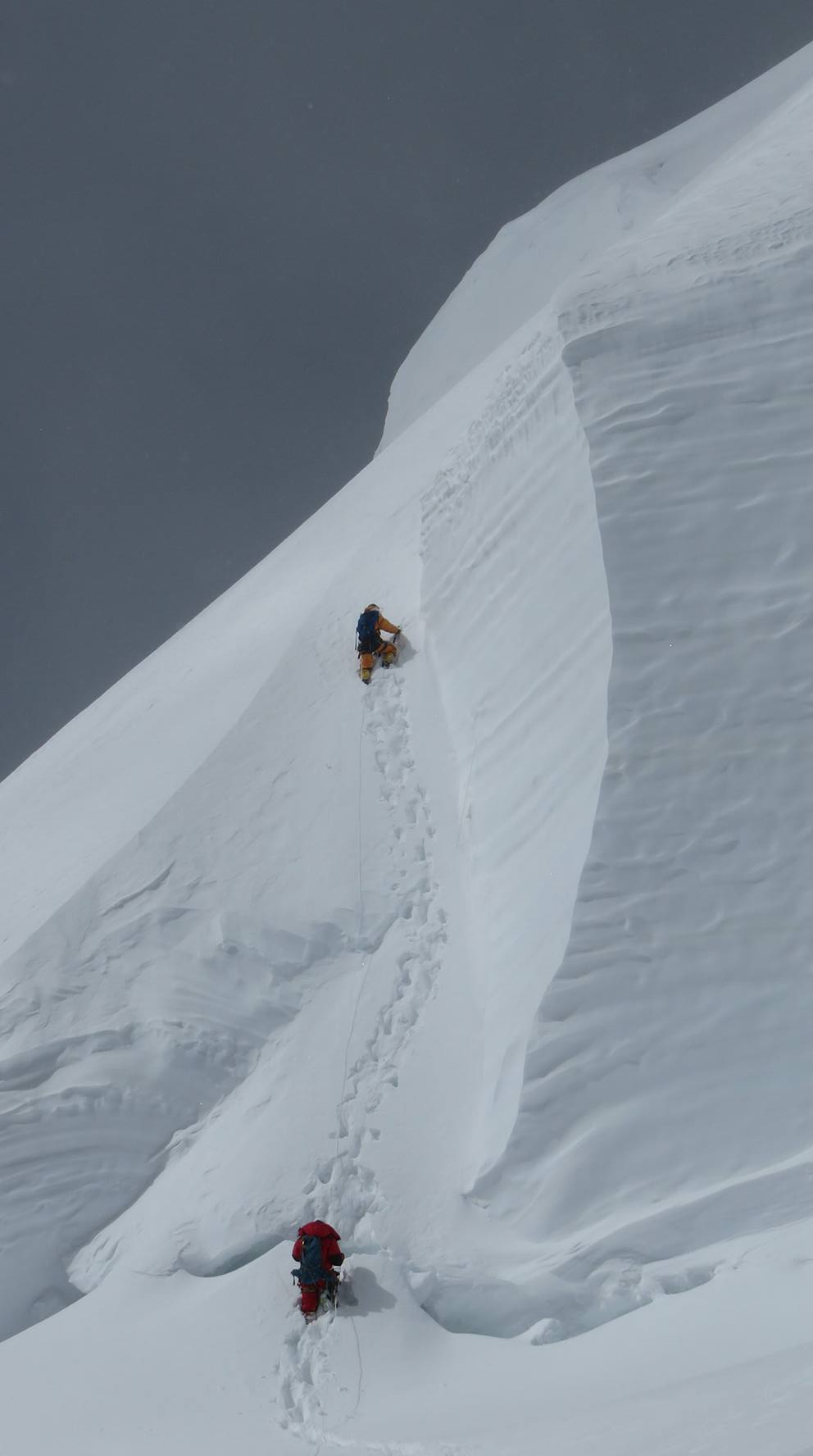
The Gondogoro La crossing: the defining day of the entire trek. Wakeup at 2:30 AM. Breakfast at 3 AM: hot porridge, tea, biscuits. Crampons on at camp, ice axes in hand, headlamps on. The team moves out at 3:30 AM on the snow approach to the pass. The temperature is minus 10 to minus 15 Celsius. Moving in the dark through the pre-dawn cold with headlamps lighting a bubble of snow ahead is a concentrated and serious experience.
The approach to the pass from the Vigne side takes 3 to 4 hours on hard snow. The gradient increases progressively as the trail approaches the steeper upper section of the pass. Fixed ropes have been placed by earlier expeditions on the two steep sections below the col: the first at approximately 45 degrees and the second at 50 degrees where the snow transitions to ice in some years. Jumar ascenders or friction hitches on the fixed ropes allow controlled ascent. Your guide leads each section and checks every client's attachment before they begin the roped section.
The Gondogoro La col at 5,585 metres is reached approximately 3 hours after leaving camp. The view from the col is one of the most dramatic in Pakistan: K2, Broad Peak, Gasherbrum I, Gasherbrum II, and Chogolisa are all visible to the north across the Concordia basin in the early morning light. The Hushe Valley drops steeply to the south below. Take the view and then move immediately: the col is exposed and cold and the descent must be completed before afternoon sun softens the snow and increases the avalanche and rockfall risk on the south face.
The Hushe side descent is steep initially, requiring careful crampon work and short-roping on the upper section, then moderates onto open snowfields leading to Ali Camp at approximately 4,800 metres. The total crossing time from camp to Ali Camp is 6 to 7 hours. Ali Camp is a simple campsite on moraine below the pass snowfields. The sense of completion at reaching Ali Camp is real: the hardest technical day of the trek is behind you and from here the route is entirely downhill to Hushe.
Day 15: Ali Camp to Saicho
Altitude: 3,500m | 12km, 5-6 hours | Descending into the Hushe Valley
Ali Camp to Saicho: approximately 12 kilometres, 5 to 6 hours, descending from 4,800 metres to roughly 3,500 metres. The descent from the Gondogoro La onto the Hushe side follows the moraine of the Gondogoro Glacier initially, then transitions to the valley trail as the glacier gives way to the lower Hushe drainage. The descent is steep enough in the upper section that the legs feel the grade after the previous day's crossing effort. Take it at a comfortable pace.
The Hushe Valley reveals itself gradually as height is lost. The valley is narrower and more enclosed than the broad Baltoro corridor, with steeper valley walls and a more intimate character. The K6 massif at 7,282 metres dominates the northern horizon, visible from the descent trail in its full south-face aspect. Masherbrum at 7,821 metres appears to the west as a perfect pyramid once the ridge blocking its line of sight is passed. The combination of altitude and perspective makes the peaks appear to float above the valley sides rather than rise from them.
Saicho is a summer herder camp used by Hushe Valley families who bring their goats and cattle to the high pastures in July and August. The camp area at approximately 3,500 metres has flat tent ground near a stream. After the technical demands of the crossing day and the altitude work of the past week, Saicho feels warm and approachable. The cook prepares a celebratory dinner. The Gondogoro La is behind you.
Day 16: Saicho to Hushe Village
Altitude: 3,085m | 18km, 6-7 hours | Final trekking day
Saicho to Hushe Village: approximately 18 kilometres, 6 to 7 hours, the longest walking day of the return journey. The trail follows the Hushe Valley downstream through progressively changing terrain. The upper section is moraine and rock. The middle section passes through a series of seasonal herder camps with stone-walled enclosures. The lower section as the valley widens enters scrub vegetation and the first signs of cultivated land: irrigation channels bringing water from the river to small terraced fields of potatoes and barley.
Hushe village at 3,085 metres is reached in the early to mid-afternoon. The village is the largest community in the Hushe Valley and the primary base for expeditions and treks in the K6, Masherbrum, Gondogoro La, and Charakusa Glacier areas. It has a small bazaar, several guesthouses, and an active community of mountaineering porters and guides whose names appear on expedition reports from across the Karakoram. The village sits at the junction of three glacial valleys and the view from the guesthouse roof encompasses Masherbrum, K6 North, and the Gondogoro La ridge you crossed this morning.
The last trekking day carries a particular emotional quality that veteran trekkers describe consistently: the reluctance to finish combined with the physical relief of knowing you have crossed the pass. Dinner in Hushe is the first meal back in a village setting after 12 consecutive nights in the mountain. Local food, fresh bread, and the sound of the river below the village mark the return to a human environment.
Day 17: Rest Day in Hushe
Altitude: 3,085m | Recovery day | Optional short walks
Rest day in Hushe village. After 13 consecutive trekking and travel days including the Gondogoro La crossing, the body needs an undemanded day before the jeep drive to Khaplu. The guesthouses in Hushe are simple but clean and the ability to wash clothes, bathe properly, and sleep in a bed without worrying about the next day's altitude gain is itself a significant recovery mechanism.
The morning is good for a short walk through the Hushe village fields and orchards without a pack. The terraced fields above the village are irrigated from channels that run from the Hushe River and produce small crops of potatoes, buckwheat, and vegetables in the brief growing season. Apricot trees, the signature fruit of Baltistan, line many of the field walls. The interaction with village families in their daily work environment, women in the fields and men preparing for the next expedition season, gives the rest day cultural substance.
Optional afternoon walk toward the lower Masherbrum Glacier approach for trekkers who want to see the approach to the peak that dominated the western horizon during the descent. The Hushe guide community is available for conversation and local knowledge about the surrounding peaks. Many of the Hushe guides are accomplished climbers who have been to the summits of K6, Masherbrum, and adjacent peaks and their first-hand accounts of the routes are worth hearing. Pack for the jeep drive tomorrow.
Day 18: Hushe to Khaplu
Altitude: 2,530m | Jeep drive 3-4 hours via Shyok Valley
Hushe to Khaplu: 3 to 4 hours by jeep, approximately 70 kilometres. Departure at 8 AM after a full breakfast. The drive descends the Hushe Valley road to the Shyok River junction and then follows the Shyok River upstream to Khaplu. The Shyok Valley is one of the most beautiful in Baltistan: wide terraced valley floors with cultivated fields, poplar trees in ruler-straight lines marking the irrigation channels, and mud-brick villages with carved wooden balconies that show the traditional Balti architecture before it was replaced by concrete.
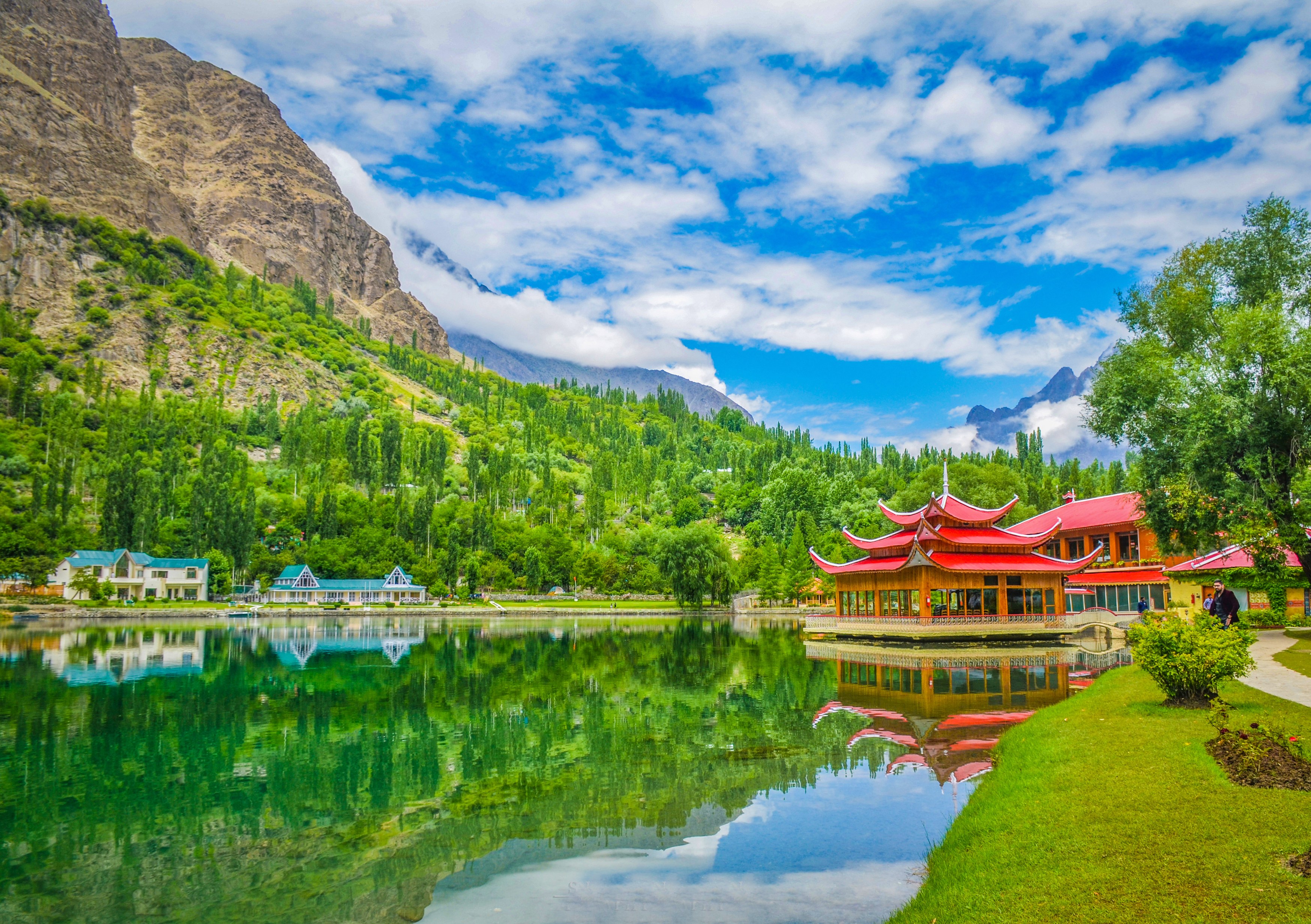
Khaplu at 2,530 metres is the main town of the Ghanche District, the easternmost district of Gilgit-Baltistan bordering the Indian-controlled Siachen Glacier area. The town has a significant heritage building in the Khaplu Palace, a 19th-century summer residence of the Raja of Khaplu that has been restored by the Aga Khan Cultural Service of Pakistan and now operates as a heritage hotel. Staying at the Khaplu Palace is one of the finest accommodation experiences in Baltistan: the restored wooden verandas, the carved panels, and the view over the Shyok Valley from the hotel gardens are extraordinary.
Khaplu bazaar in the afternoon has good dried fruit and nut shops where apricots, walnuts, and almonds from the local orchards are sold at the source. The town also has the closest banking facilities to the Hushe Valley route. Dinner at the hotel and early sleep ahead of the Skardu drive tomorrow.
Day 19: Khaplu to Skardu
Altitude: 2,228m | Drive 3-4 hours | Farewell dinner
Khaplu to Skardu: 3 to 4 hours by jeep, approximately 100 kilometres. Departure at 8 AM. The road from Khaplu to Skardu follows the Shyok River downstream to its confluence with the Indus and then takes the Indus Valley road west to Skardu. The Indus between the Shyok confluence and Skardu runs through a wide sandy valley with dunes on the southern bank, an unexpected desert landscape in the middle of the Karakoram. The dunes are formed by the prevailing westerly winds that carry sand from the river bed and deposit it against the valley walls.
Arrival in Skardu by noon. Hotel check-in and showers. The contrast between the hotels of Skardu and the camps of the Baltoro route is significant enough that the first shower takes longer than it should. Afternoon free for personal needs: buying gifts from the Skardu bazaar (local handicrafts, embroidered cloth, and Balti jewellery are all worth browsing), checking in with home, and processing the experience of the past 18 days.
Farewell dinner in Skardu with the guide and cook team. The Gondogoro La Trek is one of the harder standard trek routes in Pakistan and completing it is worth acknowledging properly. The guide and cook team who have been with you since Askole deserve the recognition: their knowledge, logistics management, and camp cooking are what made the experience possible. Your contribution to porter livelihoods through the trek fee has directly supported the Balti mountain community economy.
Day 20: Fly Skardu to Islamabad
Altitude: 507m | Return flight 55 minutes
Hotel departure at 4 AM for the early morning flight to Islamabad. Same weather conditions as the outbound journey apply: morning flights only, weather cancellations possible. If the flight is cancelled the same-day rebook and KKH land route protocols are in effect. On a clear morning the flight provides a final view of the Karakoram from the air: the Skardu Valley, the Shigar River corridor, and then the receding line of peaks as the aircraft turns southwest toward Islamabad.
Landing in Islamabad, the transition from the Karakoram back to the lowland city is abrupt. The heat, the traffic, the density of sound and people after three weeks in mountain terrain is a decompression experience that most trekkers describe as disorienting for the first few hours. This is normal and expected. The body adjusts to low altitude almost immediately while the sensory system takes longer to recalibrate.
Transfer to your hotel in Islamabad. Your guide is available through the evening for any post-trek logistics or questions. The flight connection to your international destination is tomorrow morning.
Day 21: Depart Islamabad
Trek ends | Transfer to Islamabad airport
Departure from Islamabad. Transfer to Benazir Bhutto International Airport for your international flight. Check-out time at the hotel is typically 12 noon. Depending on your flight time the morning may allow a final breakfast at a good restaurant in the city or a quick visit to the Faisal Mosque, the largest mosque in South Asia and one of the architectural landmarks of Islamabad.
The Gondogoro La Trek covers 21 days and two of the most demanding high-altitude environments accessible to non-technical trekkers in Pakistan. The Baltoro Glacier approach gives you the Concordia panorama and the K2 Base Camp at 5,150 metres. The Gondogoro La crossing at 5,585 metres is the technical highpoint of the Karakoram trekking circuit, achievable with proper preparation but demanding in both physical fitness and mental commitment. The Hushe Valley descent gives you a different cultural and geographic angle on the same mountains you approached from the Askole side.
Carry the experience carefully. The number of people who have stood at K2 Base Camp and then crossed the Gondogoro La in the same journey is small relative to the world's trekking population. The route demands a standard of fitness, preparation, and respect for the mountain environment that few places on Earth can match.
Highlights
- Cross the Gondogoro La Pass at 5,585 metres with crampons and fixed ropes, one of the highest trekking passes in the world, with a view from the top that simultaneously shows K2, Broad Peak, Gasherbrum I, Gasherbrum II, and the Hushe Valley below.
- Visit Concordia at 4,691 metres, the glacier junction where four separate 8,000-metre peaks are visible simultaneously, the most dramatic viewpoint accessible to non-technical trekkers anywhere on Earth.
- Side-trip to K2 Base Camp at 5,150 metres and stand at the foot of the world's second highest and most dangerous mountain directly below the Abruzzi Spur.
- Complete a one-way traverse of the Karakoram, entering from Askole via the Baltoro and exiting to Hushe via the Gondogoro La, a crossing that links two entirely separate valleys with no overlap.
- Descend from 5,585 metres of glaciated high wilderness to the apricot orchards and terraced fields of Hushe village within a single trekking day, one of the most dramatic altitude transitions in world trekking.
- See the Trango Towers, Masherbrum, Paiju Peak, and K6 on the Baltoro approach, then the Laila Peak group on the Hushe Valley descent, two completely different mountain perspectives in one trek.
- Stay in Khaplu, a historic Balti town with a beautifully restored 17th-century fort, on the final night before returning to Skardu.
Included/Excluded
Return flights Islamabad to Skardu (both directions)
All jeep transport: Skardu to Hushe and Askole to Skardu
All accommodation: hotels in Islamabad and Skardu, camping throughout the trek
All meals from Day 1 dinner through Day 15 breakfast
Certified high-mountain guide with Gondogoro La crossing experience
Assistant guide and full Balti porter team
Crampons, ice axes, and safety ropes for the Gondogoro La crossing (group equipment)
All trekking permits, national park fees, and porter insurance
Camp kitchen equipment, cooking fuel, and group tents
First aid kit, emergency oxygen, and satellite phone
International flights to and from Pakistan
Pakistan visa fees and travel insurance
Personal crampons and ice axe if preferred over group equipment
Personal trekking gear: sleeping bag, trekking poles, boots, clothing
Tips for guides and porters
Personal snacks and drinks beyond included meals
Medical or evacuation expenses
Optional K2 Base Camp extension costs (available on request)
Things To know
Trekking Preparation
The Gondogoro La Trek is one of the most physically demanding treks in Pakistan and requires genuine preparation. Arriving fit and strong directly translates into a safer, more enjoyable experience on the glacier and at the pass.
- Begin a structured training programme at least eight to ten weeks before departure. Focus on long uphill hikes with a loaded pack, stair climbing, and sustained cardiovascular exercise.
- Prior multi-day trekking experience above 4,000 metres is strongly recommended. If you have not trekked above this altitude before, consider completing the Concordia Trek first.
- Practise walking in crampons on snow or ice before the expedition if possible. Your guide will provide technique training at Gondogoro Camp, but prior familiarity reduces anxiety on the pass crossing day.
- Strength training targeting legs, core, and back supports load carrying over sustained trekking days of six to eight hours on challenging terrain.
- Consult your doctor about high-altitude medication (Diamox / acetazolamide) at least four weeks before departure to allow time for any allergy assessment.
Altitude Awareness
The Gondogoro La Trek reaches 5,585 metres, a serious altitude that demands respect and a well-paced acclimatization schedule. The itinerary is deliberately designed to ascend gradually, but individual responses to altitude vary and cannot be fully predicted in advance.
- Acute Mountain Sickness (AMS) symptoms headache, nausea, fatigue, poor sleep are common above 4,000 metres. Mild symptoms are normal; worsening or persistent symptoms require action.
- Never ascend to sleep at a higher altitude if you have a headache that does not resolve with rest and hydration. Inform your guide and allow an extra rest day.
- Drink three to four litres of water daily from Paiju onward. Glacial terrain is deceptively dry and dehydration develops rapidly at altitude without conscious effort to drink.
- High Altitude Cerebral Edema (HACE) and High Altitude Pulmonary Edema (HAPE) are medical emergencies. If any team member shows confusion, ataxia (staggering gait), or severe breathlessness at rest, the guide initiates immediate descent.
- Your guide carries a pulse oximeter for daily SpO2 and heart rate monitoring throughout the high-altitude section of the trek.
Packing for a High Pass
The Gondogoro La crossing at 5,585 metres begins at 2am in sub-zero temperatures on a 45-degree snow slope. Your personal equipment directly determines your comfort and safety on the most critical day of the trek.
- Gaiters are essential for the snow approach to the pass without them, snow enters your boots on the steep ascent and causes dangerously cold and wet feet.
- A balaclava and thick waterproof outer gloves are required for the pre-dawn crossing regardless of summer daytime temperatures. Wind chill on the exposed pass summit can exceed minus 20 degrees Celsius.
- Glacier sunglasses with side shields are critical. UV intensity at 5,585 metres is extreme, and snow blindness from inadequate eye protection is a genuine risk on the crossing and descent.
- A headlamp with fully fresh batteries (not partially depleted ones) is mandatory for the 2am start. Carry a spare set of batteries in an inner pocket to prevent cold-induced power failure.
- A lightweight but warm down jacket worn over your trekking layers provides vital insulation during rest stops on the pass approach without adding excessive bulk to your pack.
Weather and Pass Conditions
The Gondogoro La is a glaciated high pass with weather conditions that differ dramatically from the valley below. Your guide monitors conditions throughout the expedition and makes all crossing decisions based on real-time information, not calendar dates.
- The crossing window is late June through early September. Before June, the approach slopes carry heavy snow and avalanche risk. After mid-September, early winter storm systems close the pass unpredictably.
- Afternoon storms are common on the upper Baltoro system. The 2am crossing schedule is specifically designed to reach the pass summit and complete the descent before afternoon weather develops.
- In the event of unsafe snow conditions, high wind, or poor visibility on crossing morning, the guide delays the attempt by 24 hours. Reserve days in the itinerary accommodate this.
- Rockfall risk increases on the descent from the Gondogoro La as afternoon temperatures soften the snow. Moving efficiently and staying close to the guide's chosen line reduces exposure.
Photography and Documentation
The Gondogoro La Trek passes through some of the most photographically spectacular terrain anywhere in the world. The summit of the pass at dawn, with six 8,000-metre peaks visible simultaneously, is a once-in-a-lifetime photographic opportunity that rewards preparation.
- The Gondogoro La summit panorama K2, Broad Peak, Gasherbrum I, II, III, and IV all visible at once is best photographed in the first light of dawn on the crossing morning. Ensure your camera battery is fully charged the night before.
- Operate your camera with thick outer gloves on crossing day. Bare hands lose dexterity within minutes at sub-zero temperatures at altitude, making camera operation difficult and dangerous.
- Concordia golden hour typically falls between 6 and 8am and between 5 and 7pm. These two windows produce the most dramatic light on K2's south face.
- A dry bag or waterproof camera case is recommended for glacier sections where meltwater channels and wet moraine create persistent spray and moisture risk for electronics.
- Drone use in the Baltoro corridor requires special permit from Pakistan's Civil Aviation Authority and is not permitted without prior authorisation.
Responsible Mountaineering and Porter Welfare
The Gondogoro La Trek traverses one of Pakistan's most protected wilderness corridors. All trekkers are required to follow the Baltoro Clean Up Campaign protocols and Pakistan Alpine Club porter welfare regulations throughout.
- All non-biodegradable waste including food packaging, batteries, and personal care products must be carried out of the trekking corridor and deposited at the Askole ranger checkpoint waste facility.
- Human waste management protocols are mandatory on the upper Baltoro. Your guide designates toilet sites at all camps using established practices that minimise glacier contamination.
- All porters on World of Mountain expeditions receive legal wage rates, appropriate footwear and clothing for the terrain and season, sufficient food, and full insurance coverage as required by Pakistan's Porter Welfare Law.
- Porter loads are limited to the legal maximum of 25 kilograms. Do not request porters to carry additional personal items beyond the agreed equipment list.
- Leave no fixed equipment on the mountain, including old ropes, tent pegs, or anchors. The Baltoro Glacier cleanup programme requires all expedition waste to leave the mountain.
FAQs
Do I need technical climbing experience for the Gondogoro La?
Yes, basic technical skills are required for the Gondogoro La crossing. You need to be comfortable walking on crampons on steep snow (35 to 45 degree slopes), capable of using an ice axe in the self-arrest ready position, and able to ascend a fixed rope using a carabiner clip on a steep slope. None of these skills require formal mountaineering courses to acquire, but you should practice before departure. At minimum, find a snowy slope in your home country and practice crampon walking and self-arrest technique before arriving in Pakistan. Your guide will do a technical briefing in Skardu and again at Gondogoro La Base Camp.
The rest of the trek, everything before and after the pass crossing, is standard trekking with no technical requirements. If you can do the K2 Base Camp Trek, you can do everything about the Gondogoro La Trek except the pass itself. The pass is genuinely different and you should not underestimate it. People have been seriously hurt on the descent side of the Gondogoro La in poor conditions. We assess conditions on the pass the evening before the crossing and will postpone if conditions are not safe. We do not force crossings in icy or unstable conditions regardless of schedule pressure.
What happens if the Gondogoro La cannot be crossed due to conditions?
If the pass is not crossable due to conditions, we retreat to Concordia and return to Askole via the standard Baltoro route. This effectively converts the Gondogoro La Trek into the K2 Base Camp Trek in terms of route. We have 1 to 2 buffer days built into the schedule and will attempt the crossing again if conditions improve within that window. In recent seasons (2022 to 2025) the pass was successfully crossed by our groups in approximately 80 to 85 percent of July and August departures. June departures have a somewhat lower success rate due to more variable snow conditions.
A failed crossing is disappointing but not a failure of the trek itself. You will still have walked the full Baltoro, visited Concordia, and seen K2 Base Camp. The Baltoro approach alone is one of the great trekking routes on Earth. Booking the Gondogoro La Trek means accepting the possibility of not crossing the pass, particularly for early season departures. If a guaranteed crossing is important to you, book a mid-July or early August departure which has the best statistical success rate based on historical conditions.
Are crampons and ice axes provided?
We provide group crampons (strap-on style that fit over most hiking boots) and group ice axes for rent as part of the expedition equipment. If you have your own crampons and ice axe that fit your boots, bring them. Personally fitted crampons are significantly more secure than group rental equipment and worth the cost and weight of bringing them from home if you own them. The harness (saddle harness, not a full body harness) and locking carabiner used for the fixed ropes are also provided as group equipment but you can bring your own if you prefer.
What is the maximum altitude on this trek?
The Gondogoro La Pass col sits at 5,585 metres. K2 Base Camp, visited the day before the crossing, sits at 5,150 metres. These are the highest points of the 21-day trek. Concordia at 4,691 metres is the third highest point and where you spend 2 nights during the route.
How different is the Gondogoro La Trek from the K2 Base Camp Trek?
The Gondogoro La Trek is the superior choice for trekkers who want a traverse rather than an out-and-back. The core Baltoro-Concordia-K2 Base Camp experience is identical for both treks. The difference is purely in how you exit. The K2 Base Camp Trek returns to Askole the way it came. The Gondogoro La Trek crosses the pass and exits to Hushe, giving you a completely different landscape on the exit and the technical challenge of the pass itself. The Gondogoro La Trek is 7 days longer than the K2 Base Camp Trek.
In terms of physical and mental difficulty, the Gondogoro La Trek is harder. The pass crossing adds a technically demanding element that the standard trek lacks. The total distance is greater and the total number of high-altitude nights is higher. However, the additional effort is rewarded with the experience of the crossing itself and the descent into the Hushe Valley, which most trekkers describe as one of the most dramatic landscape transitions they have ever experienced in a single trekking day.
Is there an option to extend to K2 Base Camp?
The Concordia side trip to K2 Base Camp is standard on our Gondogoro La Trek itinerary and included in the price. It happens on Day 12, the day after the Concordia rest day. You walk from Concordia up the Godwin-Austen Glacier to K2 Base Camp at 5,150 metres and return to Concordia the same day carrying only a daypack. It is not an optional extra on our trek. it is part of the standard itinerary.
What are the accommodation conditions on the trail?
Hotels in Islamabad and Skardu with private rooms and bathrooms. From Askole to just before Hushe village, four-season dome tents supplied by us on moraine or glacier terrain. One night at a basic guesthouse in Hushe village. One night at a hotel or heritage guesthouse in Khaplu. Final nights back in Skardu and Islamabad hotels. All accommodation from Islamabad to Islamabad is arranged and included in the tour price. No individual booking is required by you.
Toilet facilities on the glacier section are pit toilets at established camps and cat-hole burial between camps. Carry a small trowel, toilet paper, and a ziplock bag in your daypack at all times. The Pakistan Alpine Club waste management regulations apply throughout and we comply fully.
How do we travel from Skardu to Hushe village?
You drive from Hushe village to Khaplu by jeep (4 to 5 hours), then Khaplu to Skardu by road (3 to 4 hours). Total road time from Hushe to Skardu is about 7 to 9 hours spread across days 18 and 19 of the itinerary. The roads are unpaved in sections through the Hushe Valley but improve significantly approaching Khaplu and the Karakoram Highway.
Is the Gondogoro La Trek suitable for solo travellers?
Yes, solo travellers are welcome on all our group departures. You join a group of up to 12 trekkers. Solo bookings are confirmed once the group departure is viable, typically when at least 3 to 4 trekkers are confirmed. Private solo departures are also available with a higher per-person cost due to fixed group costs being divided among fewer participants. Contact us for a private tour quotation.
What permits are required for this trek?
Three permits are required: a Baltoro Glacier Trekking Permit from the Pakistan Alpine Club, a No Objection Certificate from Gilgit-Baltistan Tourism, and a Gondogoro La crossing authorisation. All three are included in the tour price. Provide passport copies and two photographs when booking. Applications are submitted 45 to 60 days before departure.
What is the Hushe Valley like compared to Askole?
The upper Hushe Valley below the Gondogoro La is pristine and largely ungrazed high-altitude terrain until you reach the summer grazing camps. The lower Hushe Valley is noticeably greener and warmer than the Baltoro side. Hushe village itself is a typical Balti settlement with terraced agriculture, apricot orchards, and stone-walled houses. The population is Shia Muslim Balti and generally warm toward respectful visiting trekkers. The Hushe Valley sees far less trekking traffic than the Baltoro approach side and has a correspondingly less commercial character.
Khaplu, the town you exit through, is historically significant as the capital of the old Khaplu princely state. The 17th-century palace is one of the finest restored heritage buildings in northern Pakistan. The town bazaar is well-stocked by Baltistan standards and the food is good. The atmosphere in Khaplu on the Gondogoro La exit night feels civilised and welcoming after 13 days of glacier walking.
What is the success rate for crossing the Gondogoro La?
Based on our departures in July from 2019 to 2025, the crossing success rate is approximately 82 percent. The primary reason for failed crossings is hard blue ice conditions on the steep section above the fixed rope zone, which develops when there is a prolonged warm period followed by freezing temperatures that convert the snow surface to bulletproof ice. On ice this hard, fixed rope ascent becomes extremely difficult and the descent side is dangerous even with crampons. The second reason for failed crossings is high wind at the col, which occurs during active weather systems passing through the range.
The best way to maximise your crossing success is to book a mid-July departure (15 to 25 July historically has the best conditions), be fully acclimatized before attempting the crossing, have your technical gear fitted correctly before day 14, and listen to your guide's assessment of conditions the evening before the crossing. If your guide says conditions are not safe, they are right and the crossing should be postponed or abandoned.
Tour Location
Hushe Valley to Baltoro Glacier, Karakoram, Pakistan
Reviews
0/5
Not Rated
Based on
0 review
Excellent
0
Very Good
0
Average
0
Poor
0
Terrible
0
No Review
13%
from
$2,200
$1,900
from
$2,200
$1,900