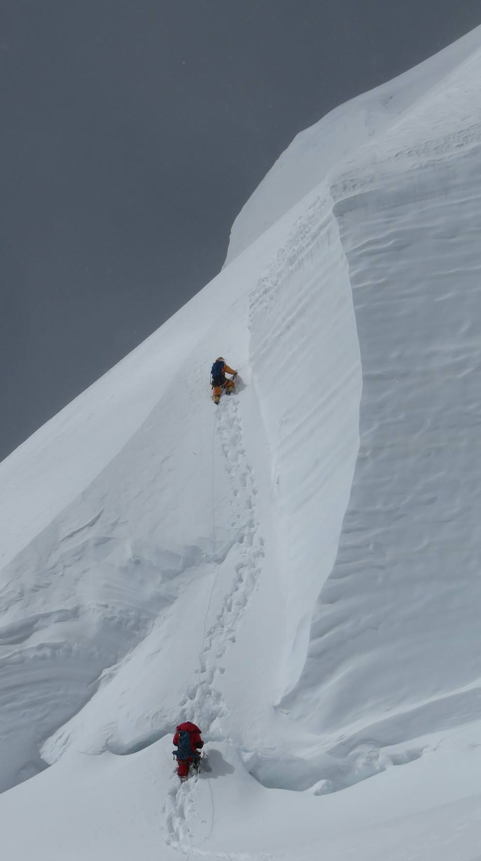
Gasherbrum II Expedition
Gasherbrum, Karakoram, Pakistan
0/5
0% of guests recommend
Duration
55 Days
Group Size
12 persons
Overview
About the Gasherbrum II Expedition
Gasherbrum II at 8,035 metres is the 13th highest mountain on Earth and one of the two Gasherbrum peaks visible from Concordia on the upper Baltoro Glacier in Pakistan. The mountain was first summited by an Austrian team in 1956 via the southwest face route that remains the standard approach for all expeditions today. Gasherbrum II is frequently cited as the most technically approachable of all 8,000-metre peaks on its normal route, making it a natural objective for alpinists ready to move from 7,000-metre experience to the full Death Zone altitude of 8,035 metres.
The 55-day expedition follows the Baltoro Glacier from Askole to Concordia and then branches southeast up the South Gasherbrum Glacier to Gasherbrum Base Camp at 5,150 metres. Two systematic acclimatization rotations establish Camps I, II, and III before the summit push targets the southwest face and the broad summit at 8,035 metres. The season runs June through August with the summit window targeting late July to early August.
Route Overview
The 7-day Baltoro Glacier approach from Askole to Concordia is shared with K2, Broad Peak, and Gasherbrum I expeditions. At Concordia the Gasherbrum route branches southeast onto the Abruzzi Glacier and then the South Gasherbrum Glacier to reach base camp. Gasherbrum Base Camp at 5,150 metres has both G1 and G2 visible above camp. The climbing route ascends the southwest face from base camp to Camp I at 6,100 metres, Camp II at approximately 7,000 metres, and Camp III at approximately 7,400 metres. The summit push from Camp III follows the southeast ridge to the summit plateau.
Acclimatization Rotations
The expedition completes two full acclimatization rotations before the summit push. The first rotation establishes Camp I and reaches Camp II before returning to base camp. The second rotation reaches Camp III at 7,400 metres for one to two nights before the descent to base camp and the final rest period. Blood oxygen saturation is measured at every camp. Go and no-go decisions for each rotation stage are made by the guide based on individual health status and weather conditions. The rest periods between rotations at base camp are as important as the rotations themselves: the physiological adaptations to altitude take effect during rest, not during climbing.
Best Season and Summit Window
The climbing season on Gasherbrum II runs June through August. The optimal summit window occurs in late July and the first two weeks of August when high-pressure systems over the Karakoram produce the stable multi-day weather periods required for a safe summit attempt. Commercial meteorological services provide daily summit-level forecast data. The expedition targets the first reliable multi-day window after completing the acclimatization rotations. Reserve summit days are built into the schedule for a second attempt if the first push is weather-limited.
Difficulty and Experience Required
The Gasherbrum II southwest face is the most technically moderate route on any 8,000-metre peak. The terrain between base camp and Camp II is primarily steep snow slopes without the severe rock technical sections found on more demanding routes. Fixed ropes are in place on the steeper sections. Above Camp II the southeast ridge involves more mixed terrain but remains within the range of a capable alpinist with solid crampon and ice axe technique. The summit day from Camp III gains approximately 635 metres and takes 8 to 12 hours round trip in normal conditions.
Previous experience on at least one 7,000-metre peak is required. A climber with strong performance at 7,000 metres in the Karakoram or Himalayas is well positioned for G2. Death Zone altitude at 8,035 metres is the same physiological reality on G2 as on any other 8,000-metre peak regardless of route character. The summit success rate on guided G2 expeditions varies by season but averages 20 to 35 percent across all years of operation.
The Baltoro Approach and Base Camp Life
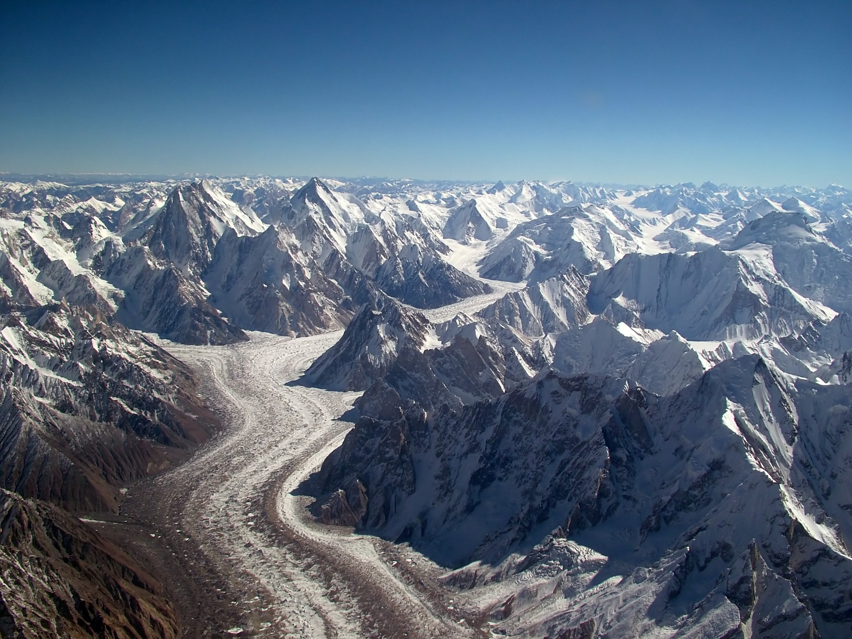
The Baltoro Glacier approach from Askole to Concordia takes 7 days of moraine walking and delivers one of the finest sustained mountain experiences in the world. The Trango Towers, Masherbrum, Paiju Peak, and K6 are all passed on the approach. Concordia with four 8,000-metre peaks visible simultaneously is the approach highpoint. The South Gasherbrum Glacier to base camp adds two further days of glacier travel through less-visited terrain. Base camp at 5,150 metres with both G1 and G2 above is one of the most dramatic camp positions in the Karakoram. The international expedition community during the summer season makes base camp a collegial environment, with teams from multiple countries sharing weather information and route condition data.
Why Choose This Expedition
Our Gasherbrum II expedition includes all government permits (G2 climbing royalty, liaison officer salary, Pakistan Alpine Club registration), the full Baltoro approach with licensed porter team, 40 days of base camp cook service, high camp equipment at all three camps, fixed rope establishment on the route, and one dedicated high-altitude support climber per client from Camp II through the summit day. Supplementary oxygen is available from Camp II for all clients. Small groups ensure a high guide-to-client ratio and a personal experience on an expedition of this scale and duration.
Customized/Private Groups PricingDiscount will be automatically applied during the booking process if the number of guests meets the criteria specified in table below.(currently discounts are applicable to private tours only)
| Solo Price | 2 to 4 Person | 5 to 8 Person | 9 to 20 Person |
|---|---|---|---|
| $18,000 | $12,000 | $9,600 | $9,200 |
Itinerary
Day 12: Arrival in Islamabad and Preparations
Altitude: 507m | Equipment check, briefing, permits
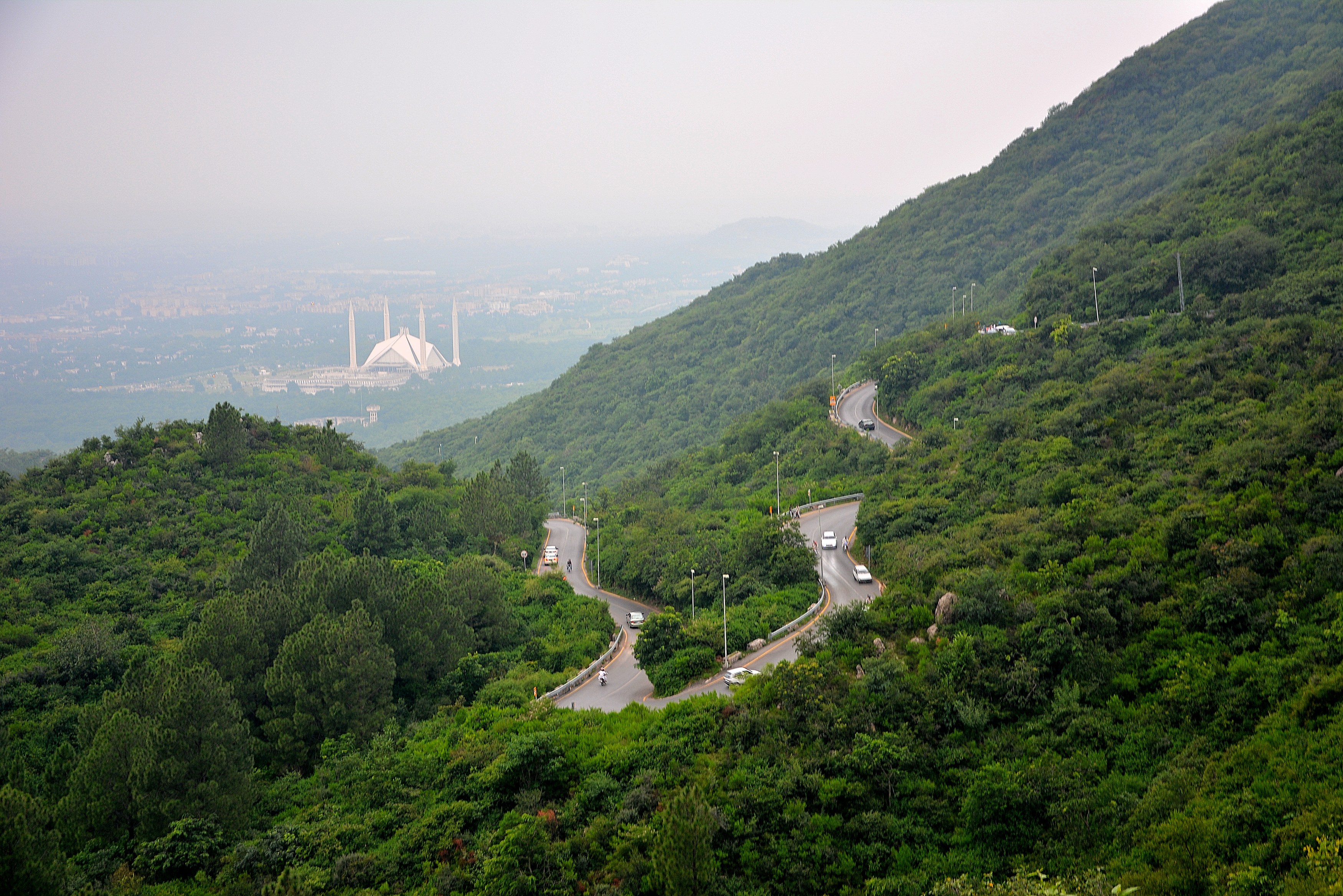
Days 1 to 2 in Islamabad: expedition preparation, team briefing, Pakistan Alpine Club permit verification, and liaison officer introduction. The liaison officer is a mandatory government appointment for all Gasherbrum expeditions. The expedition equipment is sorted into 25-kilogram porter loads. Final supply purchases are made at Islamabad's expedition outfitters. The medical kit is inventoried by the guide. Personal gear is reviewed against the required equipment list. Sleep by 9 PM on day 2 for the 4 AM departure on day 3.
Day 3: Fly to Skardu
Altitude: 2,228m | Flight and arrival
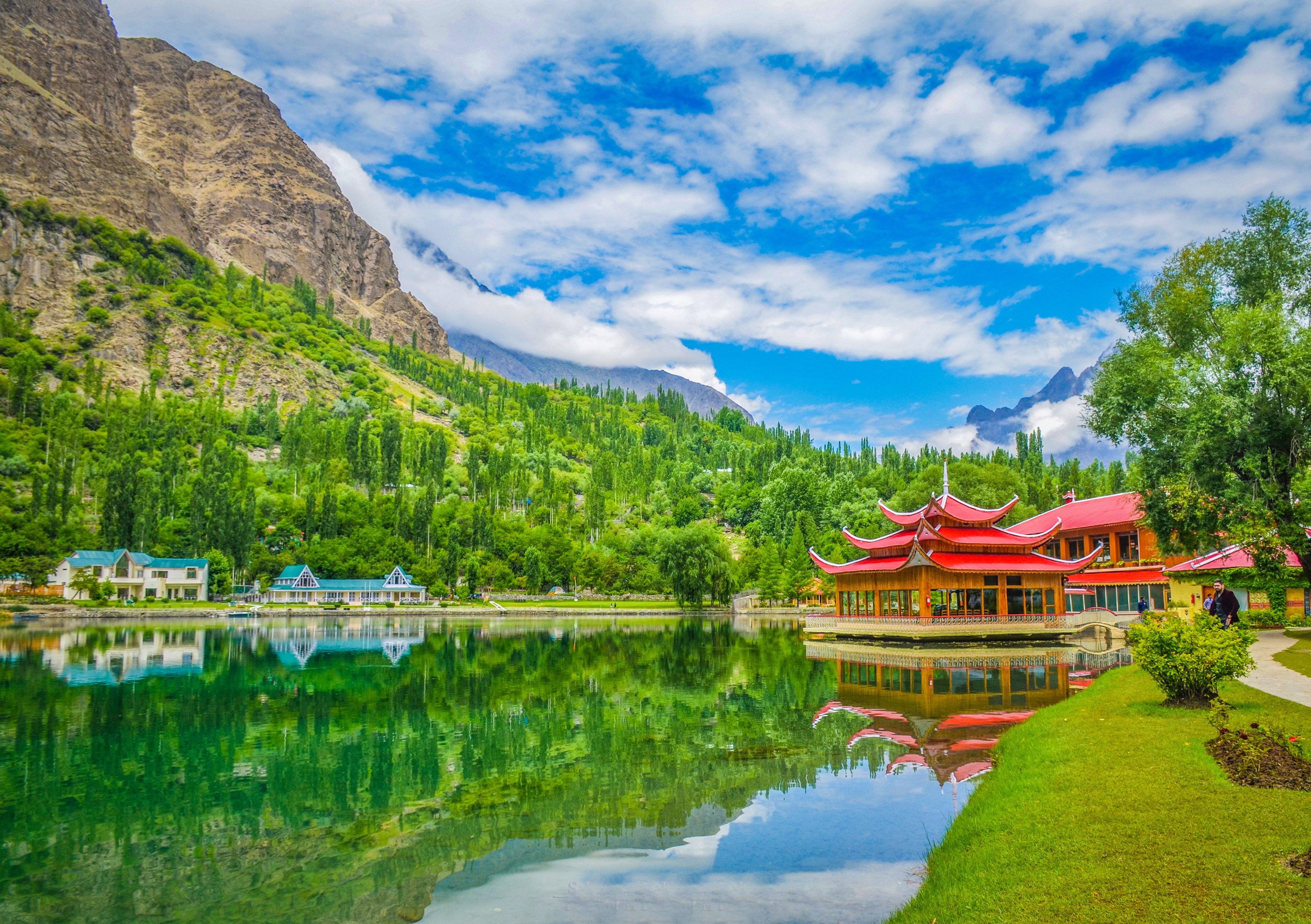
Day 3: fly Islamabad to Skardu on the early morning Pakistan International Airlines ATR-72 flight. 4 AM hotel departure. The one-hour flight provides an extraordinary aerial view of the western Karakoram in clear conditions. Nanga Parbat at 8,126 metres appears on the left side of the aircraft approximately 40 minutes into the flight. Skardu airport at 2,228 metres. Transfer to hotel. Begin two days of acclimatization and logistics at Skardu before the Askole drive.
Day 4: Skardu, Rest and Acclimatization
Altitude: 2,228m | Rest day
Day 4: full rest day in Skardu at 2,228 metres. Permit finalisation at the Pakistan Alpine Club liaison office. Porter team briefing and load distribution. Personal technical gear verification: crampon fit, ice axe, harness, jumar. Skardu market shopping for personal food supplements and any missing equipment items. Short acclimatization walk to Kharpocho Fort (150 metre gain, 30 minutes one way). Two nights at Skardu contribute meaningful acclimatization before the Askole drive to 3,050 metres.
Day 5: Drive Skardu to Askole
Altitude: 3,015m | Jeep drive 56 hours
Day 5: drive Skardu to Askole, 4 to 5 hours by jeep convoy through the Braldu Valley gorge road. Departure at 7 AM. The dramatic road carved into cliff faces above the Braldu River is an introduction to the scale of the Karakoram landscape. Tea stop at Dassu village. Arrive Askole at 3,050 metres in early afternoon. Full porter team assembles and receives load assignments. Cook team sets up kitchen. Tonight the expedition sleeps under Askole's dark sky before the trek into the glacier begins tomorrow morning.
Day 6: Askole to Jhola
Altitude: 3,170m | Trek 6 hours
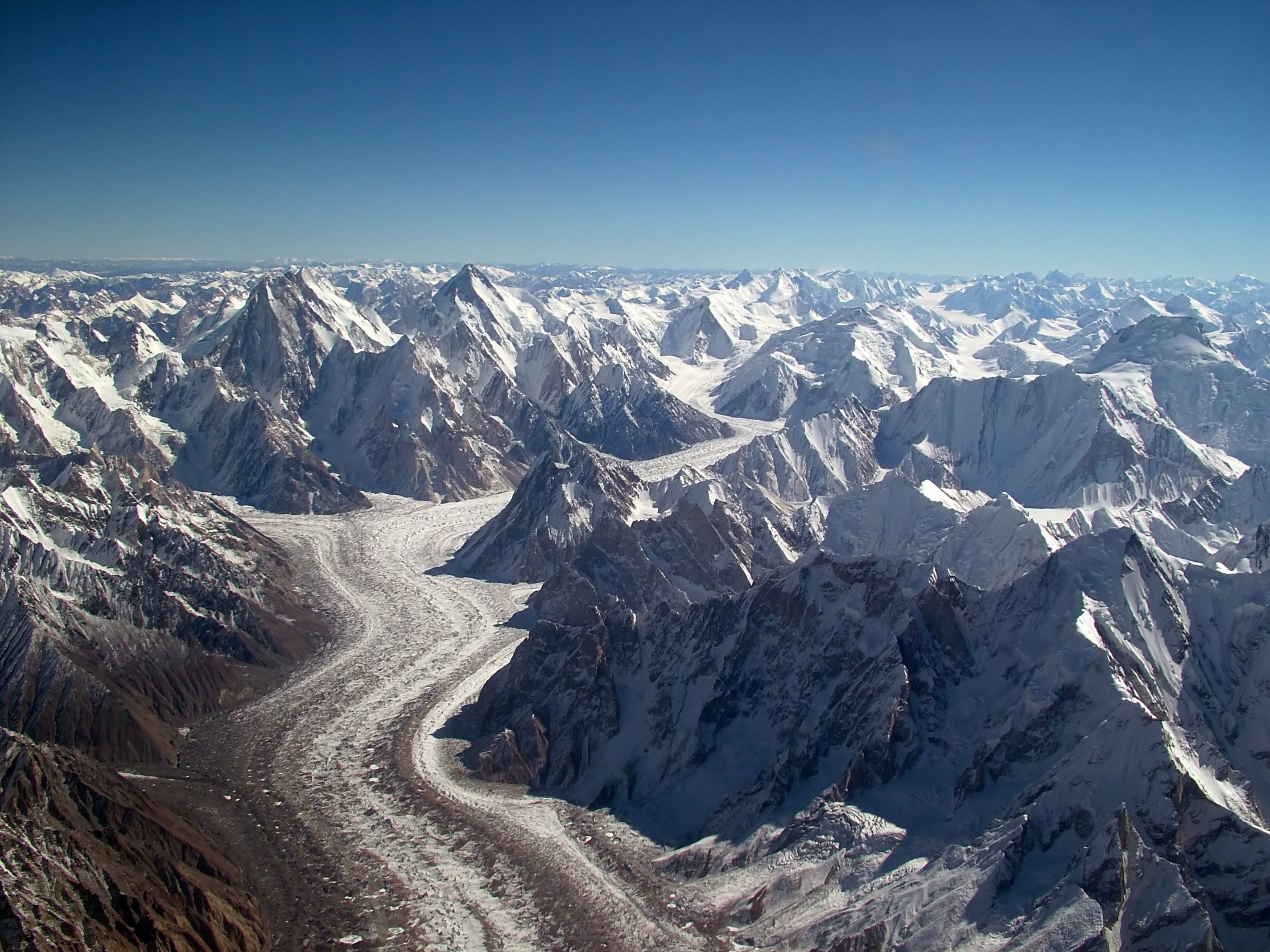
Day 6 to Jhola (3,170 m), Day 7 to Paiju (3,400 m), rest day at Paiju, Day 9 to Khoburtse (3,850 m via Trango Towers), Day 10 to Urdukas (4,050 m), Day 11 to Goro II (4,270 m): this 6-day Baltoro approach follows the same route as the K2 and Broad Peak expeditions. Daily distances range from 11 to 14 kilometres on moraine terrain with 5 to 7 hours of walking. The altitude progression from 3,050 metres at Askole to 4,270 metres at Goro II is the foundation of the expedition's acclimatization sequence. The Trango Towers section between Khoburtse and Urdukas is the visual highlight of the approach, with Nameless Tower's 1,200-metre east face directly beside the trail.
Walk at a steady pace throughout the approach. There is no benefit to arriving at Goro II a day early and significant benefit to arriving with good energy reserves. Drink 3 to 4 litres of water daily from Paiju onward. At Paiju rest day, your guide conducts the first altitude health assessment of the expedition. Report any persistent symptoms rather than managing them privately. The rest day at Paiju is the right time to adjust pace or address concerns, not at Goro II with the high camps ahead.
Day 7: Jhola to Paiju
Altitude: 3,410m | Trek 67 hours
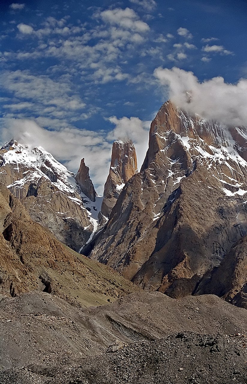
Day 12: Goro II at 4,270 metres to Concordia at 4,691 metres, 9 kilometres, 4 to 5 hours. The arrival at Concordia with K2, Broad Peak, Gasherbrum I, and Gasherbrum II visible simultaneously is the visual peak of the approach. From Concordia the Gasherbrum expedition diverges from the K2 and Broad Peak route. Instead of heading north on the Godwin-Austen Glacier toward K2 Base Camp, the Gasherbrum route turns southeast up the Abruzzi Glacier and then the South Gasherbrum Glacier toward Gasherbrum Base Camp.
Day 13: Concordia to Gasherbrum Base Camp at 5,150 metres, approximately 12 to 15 kilometres, 5 to 6 hours southeast across the glacier system. The South Gasherbrum Glacier is narrower and less travelled than the Baltoro. The route requires glacier travel across the ice surface rather than simply walking the lateral moraine. Your guide leads the route on the glacier. The base camp area is a flat moraine site on the South Gasherbrum Glacier with both G1 at 8,080 metres and G2 at 8,035 metres visible above camp. The mountain directly above the northwest aspect of the camp is G2, your objective. The southwest face route begins directly above the camp.
Day 8: Paiju Rest Day
Altitude: 3,410m | Acclimatization rest
Days 14 to 16: base camp acclimatization and expedition setup. Three days at base camp before the first rotation. The cook tent, mess tent, and sleeping tents are fully established. Medical assessments cover blood oxygen saturation, resting heart rate, and a structured neurological check for each climber. Days 14 and 15 are complete rest at 5,150 metres. Day 16 is the technical preparation day: jumar practice on fixed ropes in the camp area, crampon walking on the lower glacier, ice axe technique review, and a reconnaissance walk to the base of the southwest face to identify the route start and current snow conditions.
Day 9: Paiju to Khoburtse via Baltoro Glacier
Altitude: 3,835m | Trek 7 hours on glacier
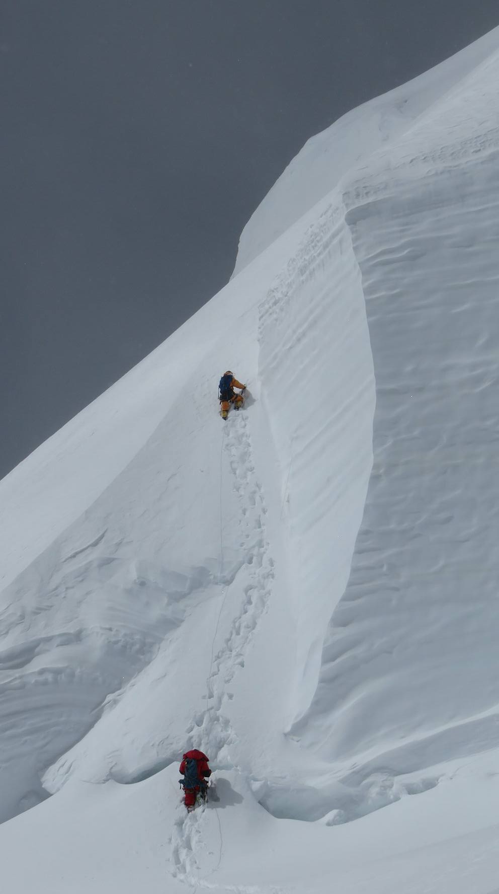
Days 17 to 20: first rotation to Camp I at 6,100 metres. Leave base camp at 5 AM and ascend the southwest face of G2. The lower southwest face is a broad snow slope at 30 to 40 degrees angled above the base camp area. Camp I at 6,100 metres sits on a snow platform approximately 4 to 6 hours above base camp. The ascent is technically moderate on the lower section with steeper snow on the approach to Camp I. Fixed ropes are in place on the steepest sections. Spend 1 to 2 nights at Camp I acclimatizing before descending to base camp for the first rest period. This rotation is primarily physiological: the exposure to 6,100 metres programmes your body for the next rotation higher.
Day 10: Khoburtse to Urdukas
Altitude: 4,050m | Trek 45 hours
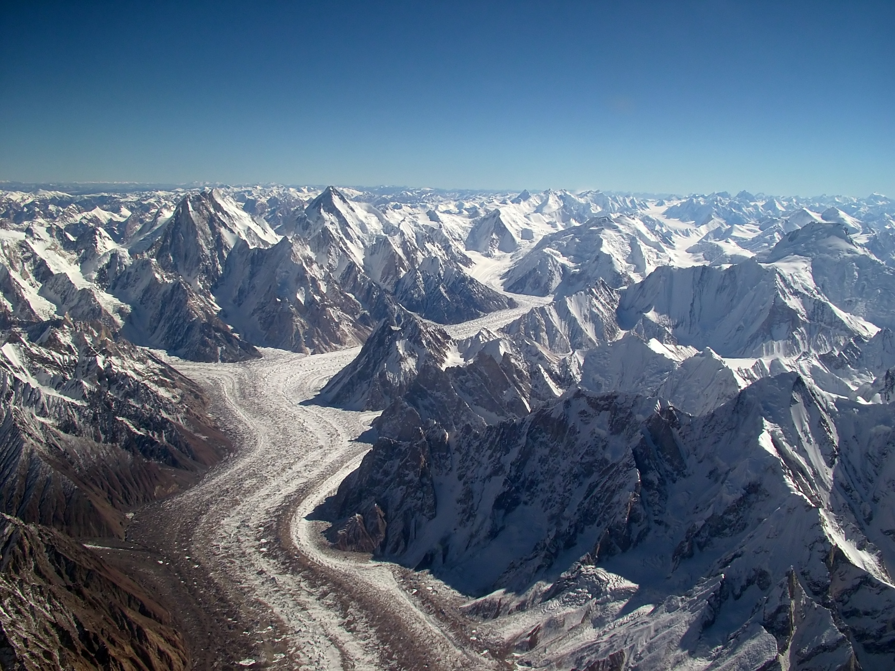
Days 21 to 25: base camp rest period of 4 to 5 days after the first rotation. Return to 5,150 metres from 6,100 metres and allow the body to consolidate the acclimatization gains. Eat as much as possible. Caloric deficit builds quickly above 6,000 metres and rest days are when it is recovered. The guide reviews each climber's rotation performance. Any issues with technique, pace, or altitude response are addressed now before the second rotation. Weather monitoring begins systematically during this rest period with daily forecast reviews for the summit window planning.
Day 11: Urdukas to Goro II
Altitude: 4,285m | Trek 67 hours
Days 26 to 32: second rotation reaching Camp II and Camp III. Leave base camp, ascend through Camp I and continue to Camp II at approximately 7,000 metres. Camp II on G2's southeast ridge is a series of platforms carved into the ridge snow. The route between Camp I and Camp II crosses steeper terrain on the upper southwest face before the ridge begins. Camp II marks the entry into the Death Zone. Time at Camp II is physiologically expensive: deterioration begins even with rest. Spend 1 night at Camp II then push to Camp III if conditions allow. Camp III sits at approximately 7,400 metres on the upper southeast ridge below the final summit pyramid. 1 night at Camp III completes the second rotation. Descend directly to base camp in 2 days.
Day 12: Goro II to Concordia
Altitude: 4,600m | Trek 5 hours

Days 33 to 38: base camp rest and weather monitoring. Six days of full rest between the second rotation return and the summit push window. This is the longest rest period of the expedition and the most physiologically important. Your body has been to Camp III at 7,400 metres and is now fully acclimatized for the summit attempt. Maximum rest, maximum caloric intake, and active weather monitoring define this phase. The summit push begins within 24 hours of a favourable weather window opening. All gear for the summit push was cached on the rotations and is in position at Camps I through III.
Day 13: Concordia to Gasherbrum Base Camp
Altitude: 5,100m | Trek 45 hours on South Gasherbrum Glacier
Days 39 to 44: summit push. Day 1: base camp to Camp I. Day 2: Camp I to Camp II at 7,000 metres. Day 3: Camp II to Camp III at 7,400 metres. Day 4 (summit day): Camp III to G2 summit at 8,035 metres and descent to Camp II or Camp III. The summit day from Camp III gains 635 metres on the final southeast ridge to the summit. Departure at midnight to 2 AM. The upper ridge is exposed and wind is the primary hazard on summit day rather than technical difficulty. The summit of Gasherbrum II is a narrow snow/rock top at 8,035 metres. From the summit K2 is visible to the northwest and Gasherbrum I to the northeast. Descent to Camp I and base camp completes the summit push over 2 days.
Days 1416: Base Camp Acclimatization
Altitude: 5,100m | Rest, training, and acclimatization
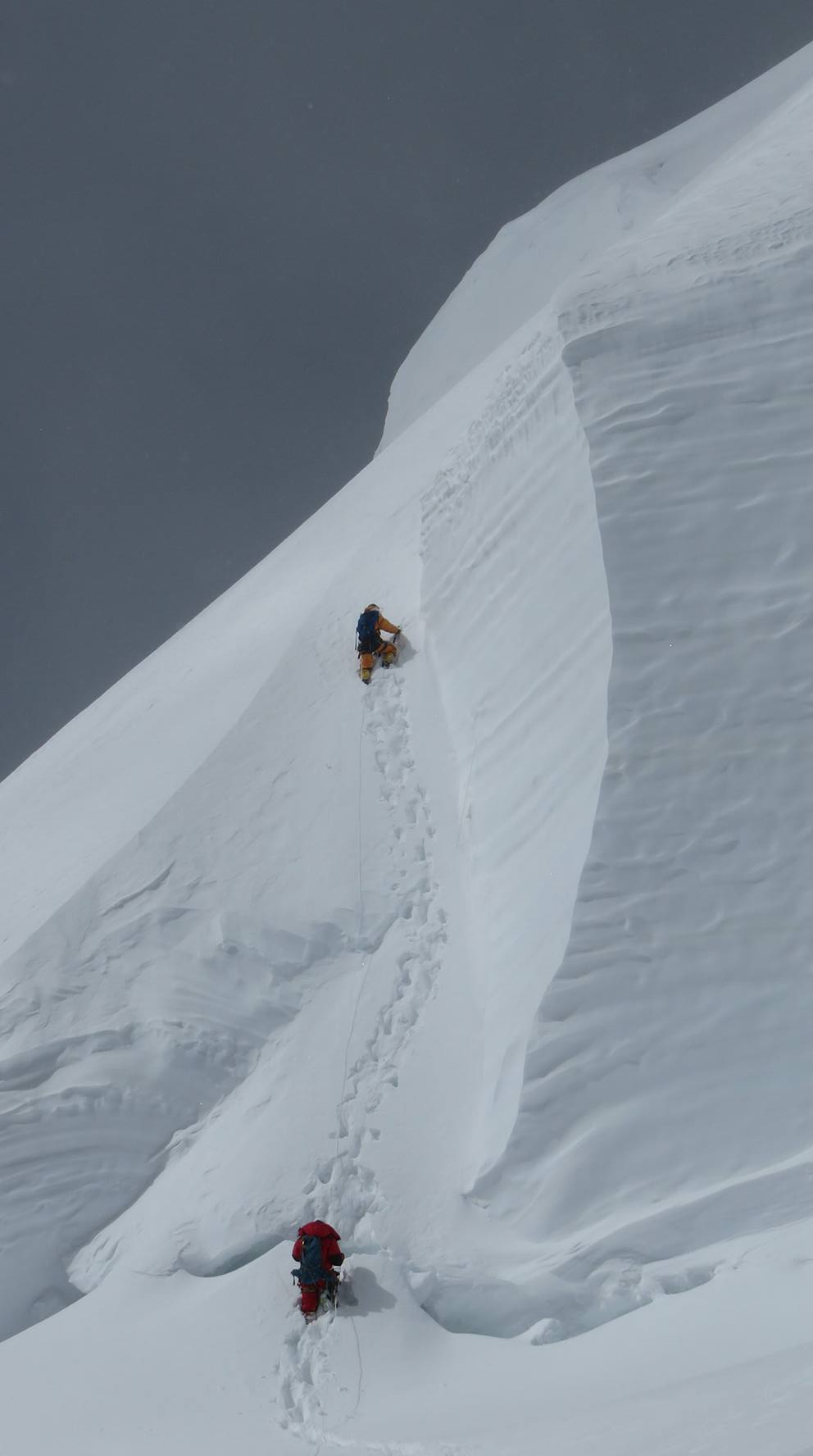
Days 45 to 48: reserve summit days for second attempt if first push is weather-limited. The reserve days provide a second opportunity if the first push is turned back above Camp II by weather. If physical condition, oxygen supply, and weather all support a second attempt within the reserve window, the team launches again from base camp. If any of these factors is inadequate, the expedition concludes with the high point achieved on the first push.
Days 1720: First Rotation to Camp I (6,100m)
Altitude: 6,100m | Acclimatization rotation
Days 49 to 52: trek out via the South Gasherbrum Glacier to Concordia, then Baltoro Glacier back to Askole. The Baltoro return follows the approach in reverse. Concordia to Goro II, Goro II to Urdukas, Urdukas to Paiju, Paiju to Askole. Four days of moraine walking at progressively lower altitudes. By Paiju the air is rich enough to feel like luxury. The porter team walks with the expedition on the exit and porter payments are made at Askole before the jeep departure.
Days 2125: Base Camp Rest
Altitude: 5,100m | Recovery and preparation
Day 53: drive Askole to Skardu, 4 to 5 hours by jeep through the Braldu Valley. Hotel in Skardu, hot shower, restaurant dinner, phone calls home.
Days 2632: Second Rotation to Camp II and Camp III
Altitude: 7,200m | High camp acclimatization
Day 54: rest day in Skardu before the Islamabad flight. Summit certificate application to Pakistan Alpine Club if applicable. Expedition debrief with the leader. Personal laundry and rest.
Days 3338: Base Camp Rest and Weather Monitoring
Altitude: 5,100m | Final preparation and weather window
Day 55: fly Skardu to Islamabad and depart. Morning flight, afternoon in Islamabad, international departure in the evening or following morning depending on connection timing.
Days 3944: Summit Push (Camps I, II, III, Summit)
Altitude: 8,034m | Summit attempt
Reserve days. These days cover flight delays between Skardu and Islamabad, any last-minute permit issues, or expedition overrun. If all went smoothly these days serve as extra rest in Skardu or Islamabad before your international departure.
Days 4548: Reserve Summit Days
Altitude: 5,1008,034m | Additional weather window if needed
Reserve days continued. The Karakoram weather and the Skardu flight schedule both create potential delays. Having these buffer days built in means you never miss your international connection because of a mountain weather disruption.
Days 4952: Trek Out via Baltoro Glacier
Altitude: 5,1003,015m | Return to Askole
Reserve summit days at base camp if needed. If the first weather window closed before the summit was reached, these days extend your stay at base camp for a second attempt. The guide coordinates with weather services daily during this period.
Day 53: Askole to Skardu
Altitude: 2,228m | Jeep drive and celebration
Reserve summit days continued. Patience at base camp is one of the hardest parts of any 8,000-metre expedition. The mountain dictates the schedule. Trust the guide's weather assessment and wait for a genuine window rather than rushing into unsafe conditions.
Day 54: Rest in Skardu
Altitude: 2,228m | Rest and debrief
Final reserve days. By this point in the schedule either the summit has been reached and you are walking out, or the expedition time has run out and you begin descent regardless. The guide makes the final call on when to begin the walk out based on all factors including team condition and remaining time.
Day 55: Skardu to Islamabad and Departure
Altitude: 507m | Flight and onward departures
Trek out day. Whether summit was successful or not, today the walk back to Askole begins. The Baltoro Glacier looks familiar on the return. The walk out typically takes four days from base camp to Askole. The jeep wait at Askole is a welcome sight after everything that came before.
Highlights
- Summit Gasherbrum II at 8,035 metres via the southwest face and southeast ridge, the 13th highest mountain on Earth and the most technically approachable of all 8,000-metre peaks on the normal route.
- Walk the full Baltoro Glacier from Askole to Concordia alongside international expeditions bound for K2 and Broad Peak before branching onto the South Gasherbrum Glacier.
- Establish base camp at 5,150 metres on the South Gasherbrum Glacier with both Gasherbrum I and Gasherbrum II visible above camp.
- Complete two systematic acclimatization rotations reaching Camp III before the summit push, a programme designed to maximise physiological readiness at 8,000 metres.
- View K2 and Broad Peak from Gasherbrum summit altitude, a perspective available only to climbers who have completed one of the Gasherbrum expeditions.
- Experience base camp life on the Gasherbrum glacier alongside teams from multiple nations during the K2-area summer climbing season.
Included/Excluded
Return flights Islamabad to Skardu
All jeep transport Skardu to Askole and return
All hotels in Islamabad and Skardu (pre and post expedition)
All meals throughout: hotel, trekking approach, and base camp
Certified 8,000m expedition guide and assistant guide
Full Balti porter team for Baltoro approach and base camp carry
Base camp cook, cook tent, and full camp kitchen
High-altitude tents for Camps I, II, and III (group equipment)
Fixed rope for the southeast ridge route
All trekking and climbing permits, royalty fees, and liaison officer
Daily advanced weather forecasting service
Satellite phone and base camp communications
First aid, emergency oxygen, and evacuation plan
Porter insurance and all regulated wages per Pakistani law
International flights to and from Pakistan
Pakistan visa fees and personal travel insurance
Personal high-altitude climbing gear: suits, boots, crampons, ice axe, harness, jumar
Personal oxygen supplementation equipment (can be arranged on request)
Personal snacks, supplements, and beverages beyond included meals
Tips for guides, cooks, and porters
Medical expenses and rescue or evacuation costs
Personal sleeping bag, sleeping mat, and down gear
Things To know
Climber Assessment and Selection
Gasherbrum II is a serious 8,000-metre peak and World of Mountain takes the responsibility of expedition member selection carefully. We assess every applicant's experience and fitness before confirmation to protect the safety of the full team.
- All applicants must submit a climbing CV listing previous summits, maximum altitudes, technical experience (fixed rope, crampon, ice axe), and any guided expedition history before a booking is confirmed.
- A video call with the lead guide is conducted for all applicants to assess technical knowledge, physical conditioning plan, and psychological readiness for an extended high-altitude expedition.
- Prior experience on a summit above 6,500 metres on a technical route is strongly recommended. Suitable reference peaks include Denali, Aconcagua, Island Peak, or similar technical routes at high altitude.
- Fitness benchmarks provided upon booking include target VO2max ranges, load-carrying capacity tests, and a recommended 12-week training programme developed specifically for Karakoram 8,000-metre preparation.
- Unsuitable applicants are advised before any financial commitment is made. We would rather decline a booking than have an unprepared climber on the mountain.
Essential Personal Equipment
Your personal equipment is the most critical investment you make for a Gasherbrum II summit attempt. Inadequate gear at 7,000 metres or above is a life-threatening deficiency. Do not cut corners on quality for an expedition of this nature.
- High-altitude down suit rated to minus 40 degrees Celsius for summit push conditions one-piece suits are preferred over two-piece systems for thermal efficiency above Camp III.
- Double plastic mountaineering boots or modern hybrid boots with full crampon compatibility, insulated to minus 40 degrees, and tested by you on prior cold-weather climbs.
- Jumar (mechanical rope ascender), locking carabiners, full body harness, personal anchor sling, and prussik cords all inspected and rated for the loads involved.
- Glacier goggles with 100 percent UV and side coverage rated for extreme altitude conditions. Bring a spare pair goggle failure at summit altitude is an emergency.
- Four-season personal sleeping bag rated to minus 30 degrees Celsius for high camp use, in addition to any liner bag used at base camp.
- Personal down jacket, down trousers, insulated gloves in two layers (liner and mitts), and balaclava for high camp life between rotation periods.
Acclimatization and Health Protocol
A safe Gasherbrum II summit attempt depends entirely on a thorough double-rotation acclimatization strategy. The fifty-five day expedition is structured specifically to allow the body to adapt progressively to extreme altitude without rushing the process.
- Daily oxygen saturation (SpO2) and heart rate monitoring is conducted with pulse oximeters throughout the expedition. Results are logged and used to make go/no-go decisions on each rotation.
- The expedition carries a full high-altitude medical kit including dexamethasone, nifedipine, Gamow bag, and supplementary oxygen for emergency use.
- Diamox (acetazolamide) use is discussed individually with each climber during the pre-expedition briefing. Dosage varies by individual and prior response.
- A clear and non-negotiable descent protocol is established before the expedition begins: any climber showing HACE or HAPE symptoms is immediately accompanied down by the assistant guide regardless of their position on the mountain.
- Rest days at base camp are mandatory after each rotation and are not optional regardless of how strong individual climbers feel. Recovery is physiologically essential and cannot be rushed.
Permits, Royalty, and Documentation
Gasherbrum II requires multiple layers of official documentation that must be arranged well in advance. World of Mountain manages the complete permit process on your behalf, but certain personal documents must be provided promptly after booking.
- The Gasherbrum II climbing royalty fee is included in your expedition cost. Permit processing takes a minimum of four to six weeks and requires a colour copy of your passport information page and a recent passport photograph.
- A government-appointed Pakistan Liaison Officer (LO) accompanies all international expeditions to G2. The LO is based at Gasherbrum Base Camp throughout the expedition and conducts periodic route inspections.
- An environmental deposit is collected by Pakistan's Ministry of Tourism and returned in full upon verified clean departure meaning all waste removed from the mountain and basecamp area confirmed by the LO.
- Trekking permits for the Baltoro Glacier approach are separate from the climbing royalty and are also included in the expedition cost.
- A valid Pakistan visa must be obtained before arrival. Most nationalities can apply online through Pakistan's e-visa portal. Processing typically takes five to seven working days.
Base Camp Life and Communications
Gasherbrum Base Camp at 5,100 metres is your home for the core weeks of the expedition. A well-equipped, comfortable base camp is critical for physical recovery between rotations and for maintaining the mental resilience required for a long high-altitude campaign.
- The World of Mountain base camp includes a separate cook tent, dining tent, sleeping tents, toilet tent, equipment storage, and a first aid station all set up by the advance team before your arrival from the Baltoro approach march.
- A dedicated Base Camp Manager coordinates logistics throughout the expedition, manages porter schedules, handles food resupply, and maintains communication with the Skardu office.
- A satellite phone at base camp allows emergency contact and scheduled family updates. Regular updates can be sent to nominated family members on a schedule agreed before departure.
- Weather forecasts from a professional Karakoram meteorological service are received daily at base camp and assessed by the lead guide. Summit window decisions are made based on this data combined with on-mountain observation.
- Gasherbrum Base Camp is a shared international camp. Multiple teams from various nations are typically present during the season, and the atmosphere is collaborative, with teams sharing weather information and route conditions openly.
Responsible Mountaineering
Gasherbrum II is located in the heart of one of the world's last great wilderness areas. Every expedition member carries a personal responsibility to leave the mountain and its environment in better condition than they found it.
- All fixed rope placed on the route is removed at the end of the expedition. World of Mountain does not leave permanent anchors or rope on the mountain as a matter of policy.
- All non-biodegradable waste from high camps is collected in designated bags and carried down to base camp on each descent. Leaving waste at high altitude is unacceptable and illegal under Pakistani expedition regulations.
- Human waste management at base camp uses a designated deep-pit latrine system. At high camps, waste bags are used and transported down for disposal at base camp.
- Porter wages, equipment, and food meet or exceed all requirements of Pakistan's Porter Welfare Law. Porters carry legal load limits, receive appropriate high-altitude clothing, and are covered by comprehensive insurance.
- Helicopter use for resupply or extraction is minimised to genuine emergency situations only, in line with Karakoram wilderness conservation principles.
FAQs
What prior climbing experience is required for Gasherbrum II?
Summit experience on at least one 7,000-metre peak and demonstrated technical climbing ability on ice and mixed terrain are required. Gasherbrum II is technically less demanding than K2 or Broad Peak on its normal route, but Death Zone altitude (8,035 m) demands the same physiological foundation regardless of technical grade. A climber with strong performance on a 7,000-metre peak in the Karakoram or Himalayas is well positioned for G2. First-time high-altitude objectives above 6,000 metres are more appropriate preparation before attempting G2.
Is Gasherbrum II a good first 8,000-metre peak?
Gasherbrum II is frequently described as the most approachable of all 8,000-metre peaks on its normal route. This assessment is broadly accurate. The southwest face route is less technically demanding than K2's Abruzzi Spur, less glaciated than the Khumbu approaches, and without the severe objective hazards of Annapurna's south face. That said, 8,035 metres is the same altitude reality regardless of route character. The Death Zone is the Death Zone. Weather on the upper Gasherbrum ridge is severe and unpredictable. The summit plateau is exposed and narrow.
G2 summit success rates across all commercial guided expeditions are approximately 20 to 35 percent depending on the season. Some years with good weather windows see significantly higher success rates. G2 is a good first 8,000-metre objective for a climber who has done the preparation work at lower altitudes and has realistic expectations about the objective risks.
Do I need to bring my own personal oxygen?
Most clients on our G2 expedition choose to use supplementary oxygen from Camp II at 7,000 metres upward. The decision is individual and should be based on rotation performance and the guide's assessment of your oxygen saturation at Camp II altitude. We carry oxygen equipment for all clients and it is available from Camp II. Supplementary oxygen is not mandatory on G2 on the normal route, but it significantly improves both the summit success probability and the safety margin above 7,500 metres.
What is the guided summit success rate on Gasherbrum II?
Our guided G2 expedition has achieved summit success in approximately 25 to 35 percent of summit push attempts across all years of operation. The primary limiting factor in all cases has been weather, not client fitness or guide performance. In years with multi-day summit windows in late July and early August, the success rate is substantially higher. In years where the window is short or never fully opens, even well-acclimatized teams do not reach the summit.
How many climbers are on the team?
Groups typically include 4 to 8 clients on our shared expedition departures. Each client works with a dedicated high-altitude support climber from Camp II upward. The guide to client ratio above Camp II is 1:1. The total expedition team including cook staff, base camp manager, and approach porters is 30 to 50 people depending on group size.
What are the weather windows like on Gasherbrum II?
The Gasherbrum weather window typically aligns with the broader K2-area window: stable high-pressure periods of 3 to 5 days occur several times between late June and mid-August. The most reliable summit weather historically occurs in late July and the first two weeks of August. Forecasts from commercial meteorological services (MetGram, Mountain Forecast) provide 72-hour and 5-day summit-level wind data that drives all go or no-go decisions above Camp II.
Is the Baltoro Glacier approach safe?
The Baltoro Glacier approach involves standard moraine walking rather than technical glacier travel. The route is established and well-marked by trekking traffic throughout the season. There are no technical hazards on the approach from Askole to Concordia. Between Concordia and Gasherbrum Base Camp the route crosses the South Gasherbrum Glacier which requires basic glacier travel (staying roped together with your guide on any crevassed sections). Above base camp on the southwest face and southeast ridge, all technical terrain is protected by fixed ropes.
What high-altitude tents are used on the mountain?
High-altitude tents from Camp I through Camp III are provided by the expedition. We use 4-season expedition tents (Mountain Hardwear Trango or equivalent) rated for severe wind and temperature. Personal sleeping bags at high camps are the climber's responsibility and should be rated to minus 30 Celsius or colder for Camp III conditions. Expedition tents at base camp include a mess tent with folding table and chairs, a cook tent with full kitchen equipment, a sleeping tent per client or pair of clients, and a toilet tent.
Are there other teams on the mountain during the expedition?
Other international teams are typically present on Gasherbrum II during the season. Teams from Italy, Korea, Pakistan, Spain, and other nations are common. The climbing community on the Gasherbrum peaks is smaller than on K2 but the collaboration on rope fixing and weather information sharing is similar. The G1 and G2 base camp areas share the same general glacier zone and teams from both peaks interact regularly.
What happens if I need medical evacuation from high altitude?
Helicopter evacuation from Gasherbrum Base Camp at 5,150 metres is possible in good weather conditions. Evacuation from high camps above 5,500 metres is extremely difficult or impossible with standard rescue helicopter capabilities in Pakistan. All clients are required to carry evacuation insurance covering helicopter rescue in Pakistan at a minimum coverage of 100,000 USD. The expedition carries a satellite emergency communicator for direct contact with rescue coordination in Skardu.
Can I extend the expedition if needed?
Extension up to 10 additional days beyond the 55-day standard programme is possible with advance agreement at the time of booking. Extensions are subject to liaison officer availability, cook team and porter contracts, and permit validity. Additional days at base camp are charged at the daily base camp rate. Extensions to high camps are subject to weather and high camp fixed rope conditions. The most common reason for an extension request is an extended weather wait during the summit push phase.
What food is provided at base camp?
Base camp meals are prepared by a professional Pakistani expedition cook with Karakoram expedition experience. Three meals daily plus unlimited tea, coffee, and hot chocolate are standard. Breakfast typically includes porridge, eggs cooked to order, toast, and fresh chapatti. Lunch is served on the trail on approach days and at the mess tent at base camp. Dinner at base camp typically includes soup, a rice or pasta main course, protein (chicken, mutton, or lentil daal on alternating days), vegetables, and a dessert. Fresh food is available until Askole. Above Askole all food is from expedition stores.
Tour Location
Gasherbrum, Karakoram, Pakistan
Reviews
0/5
Not Rated
Based on
0 review
Excellent
0
Very Good
0
Average
0
Poor
0
Terrible
0
No Review
10%
from
$9,500
$8,500
from
$9,500
$8,500