Concordia Trek
Karakoram, Gilgit-Baltistan, Pakistan
0/5
0% of guests recommend
Duration
14 Days
Group Size
12 persons
Overview
About the Concordia Trek
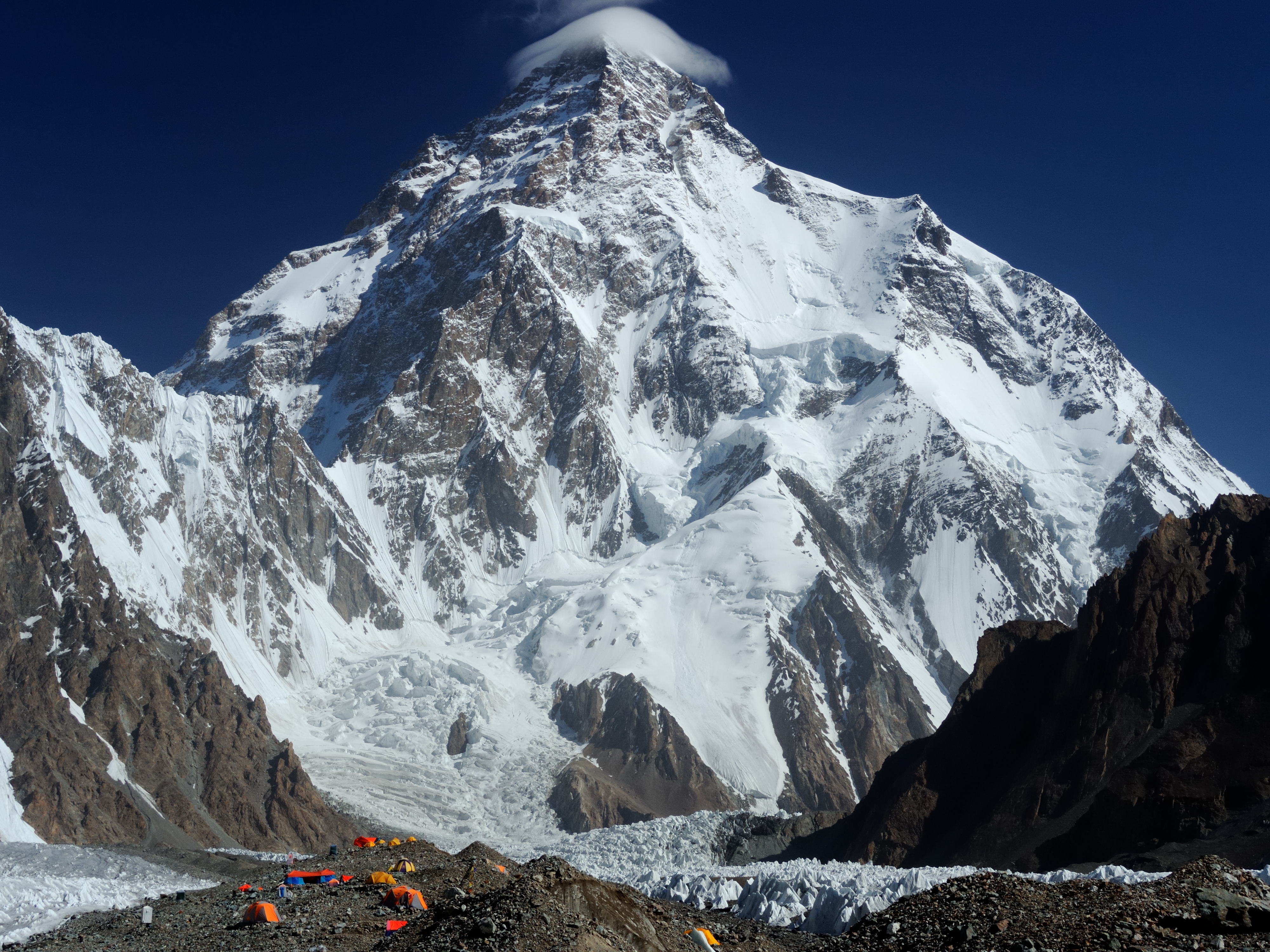
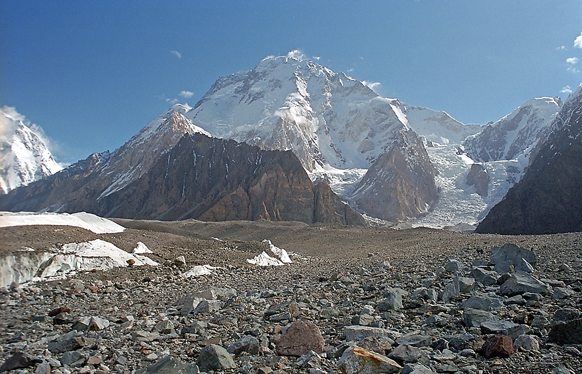
Concordia is the name given to the glacier junction at 4,691 metres where the Baltoro Glacier meets the Godwin-Austen Glacier in the Karakoram range of Pakistan. From this single point you can see K2 at 8,611 metres, Broad Peak at 8,047 metres, Gasherbrum I at 8,080 metres, and Gasherbrum II at 8,035 metres all at once. No other accessible location on Earth places a trekker simultaneously within view of four separate 8,000-metre peaks. That fact alone has driven adventurers to the Baltoro for over a century.
The 14-day Concordia Trek begins in Islamabad, takes a dramatic morning flight to Skardu at 2,228 metres, follows the Braldu Valley jeep road to Askole village at 3,050 metres, and then walks the Baltoro Glacier through camps at Jhola, Paiju, Urdukas, and Goro II before reaching Concordia. A side trip from Concordia walks the Godwin-Austen Glacier north to K2 Base Camp at 5,150 metres. The return retraces the same glacier route back to Askole and Skardu. Total glacier walking distance is approximately 140 kilometres.
Route Overview
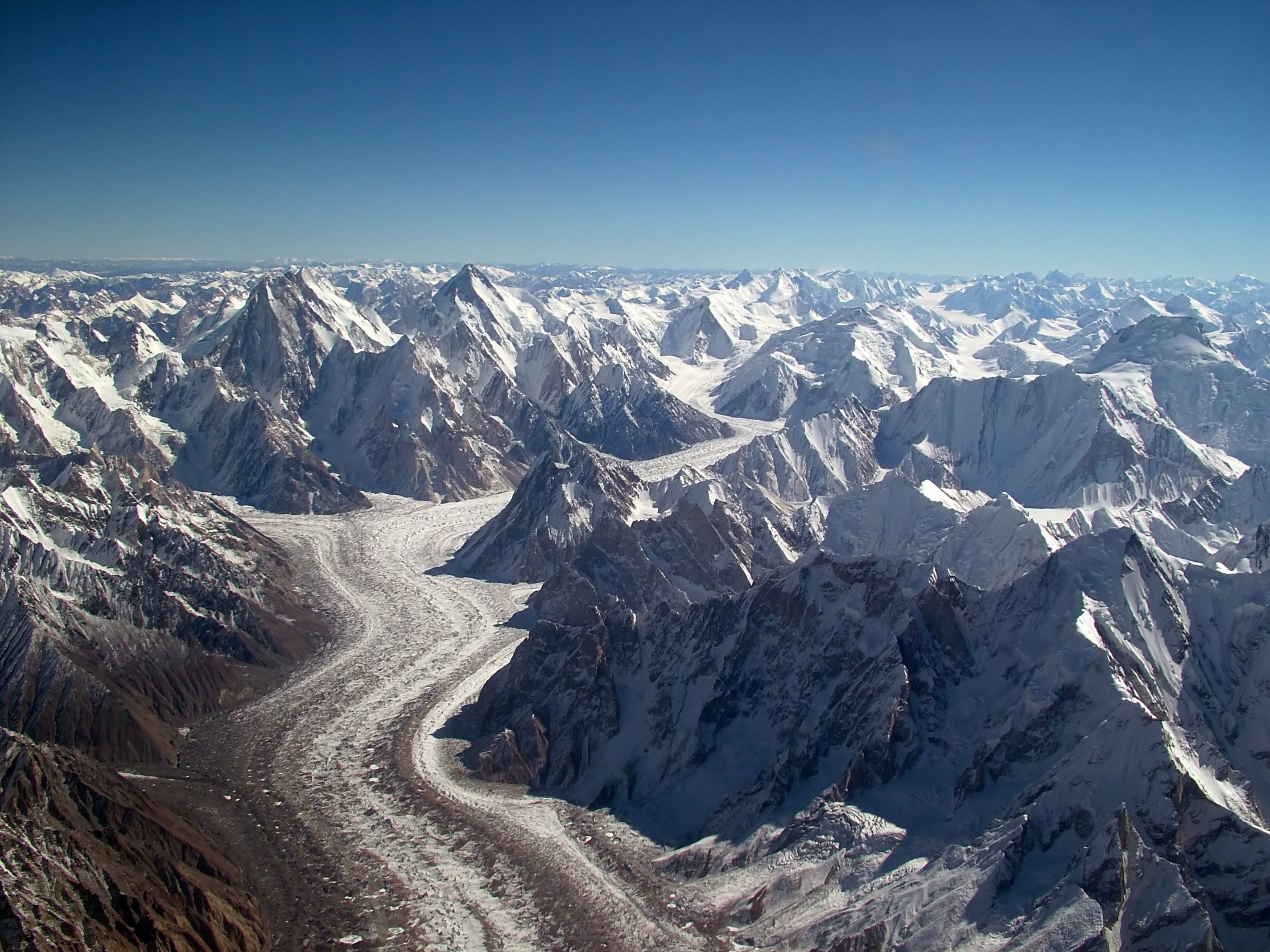
The approach from Askole to Concordia follows the left bank moraine of the Baltoro Glacier for seven walking days. The moraine is rough, rocky terrain that demands constant foot-placement attention and rewards it with some of the most dramatic scenery in the world. Each day's camp is higher than the last and each day's skyline is more dramatic. Paiju Peak at 6,610 metres dominates the lower Baltoro. The Trango Towers including Nameless Tower at 6,286 metres line the middle section. Masherbrum at 7,821 metres anchors the southern view on the upper glacier approach. Concordia opens all of these at once and adds K2.
The K2 Base Camp side trip from Concordia is 8 kilometres along the Godwin-Austen Glacier gaining 460 metres to 5,150 metres. This side trip is one of the defining experiences of the trek. At K2 Base Camp you stand directly below the world's most dangerous mountain and look up the Abruzzi Spur toward the summit. Memorial plaques for over 80 climbers who have died on K2 since 1902 put the mountain's character in human terms that statistics alone cannot.
Key Stages of the Baltoro Approach
The lower Baltoro from Askole to Paiju passes through the terminal moraine zone and reaches the first proper glacier camps. Paiju Camp at 3,400 metres is the last green vegetation before Concordia and includes a rest day that is both medically important and personally welcome. The middle Baltoro from Paiju to Goro II takes you directly below the Trango Towers and past Urdukas, one of the finest camp positions on the route, before reaching the upper glacier at 4,270 metres. The upper Baltoro from Goro II to Concordia is 9 kilometres of dramatic glacier approach where K2 grows from a horizon feature to a mountain that fills the sky.
Best Time to Visit
The Baltoro trekking season runs from mid-June through mid-August. July is the most reliable month for clear views and stable glacier conditions. The monsoon that closes most Nepal trekking routes in July arrives at the Karakoram much weakened, typically bringing only afternoon cloud and occasional light rain rather than sustained precipitation. Snow bridges over crevasses are firm in July and the moraine surface is at its driest. June is possible but the upper glacier can carry significant late-season snow that complicates route-finding. September brings the risk of early autumn snowfall on the high sections.
Difficulty and Physical Requirements
The Concordia Trek rates as strenuous. Daily walking runs 5 to 8 hours on rough moraine terrain for 8 consecutive glacier days. The highest point is 5,150 metres at K2 Base Camp where the available oxygen is roughly 53 percent of sea level. There is no technical climbing. No ropes, crampons, or mountaineering equipment are required. The difficulty is entirely physical endurance combined with altitude management. A person who can hike 20 kilometres on rough ground in a single day at low altitude and who has some tolerance for altitude discomfort is capable of this trek with appropriate preparation. Prior experience at altitude above 3,500 metres is recommended but not required.
Culture and the Balti People
The villages of Askole and the Braldu Valley are home to the Balti people, an ethnic group of Tibetan origin who have lived in the high valleys of Baltistan for centuries. The Balti are primarily Shia Muslim and their culture reflects centuries of trade connections with Tibet, Central Asia, and the Indian subcontinent. Askole village at 3,050 metres is the gateway community for Baltoro expeditions and has been since the first European explorers arrived in the late 19th century. The porters on the trek are from this community and their knowledge of the glacier route, built across generations of expedition work, makes the entire Baltoro trek possible.
Skardu, the base city for the trek, is the capital of Baltistan district and one of the most historically interesting towns in northern Pakistan. The 16th-century Kharpocho Fort above the town, the Indus River below, and the apricot orchards that line the valley terraces give Skardu a character unlike any other mountain town.
Why Choose the Concordia Trek
The Concordia Trek gives you one of the finest mountain experiences available anywhere on Earth without requiring any technical climbing skills. The combination of the Baltoro Glacier approach, the Trango Towers section, the Concordia viewpoint, and the K2 Base Camp side trip covers more extraordinary mountain ground per trekking day than almost any other non-technical route on the planet. Our expedition includes all permits, an experienced guide who has done this route dozens of times, a licensed porter team, four-season tents, sleeping mats, and three hot meals daily from Askole onward. Groups are capped at 12 people for a personal experience on one of the world's most iconic routes.
Customized/Private Groups PricingDiscount will be automatically applied during the booking process if the number of guests meets the criteria specified in table below.(currently discounts are applicable to private tours only)
| Solo Price | 2 to 4 Person | 5 to 8 Person | 9 to 20 Person |
|---|---|---|---|
| $3,500 | $2,300 | $1,900 | $1,800 |
Itinerary
Day 1: Arrive Islamabad
Islamabad
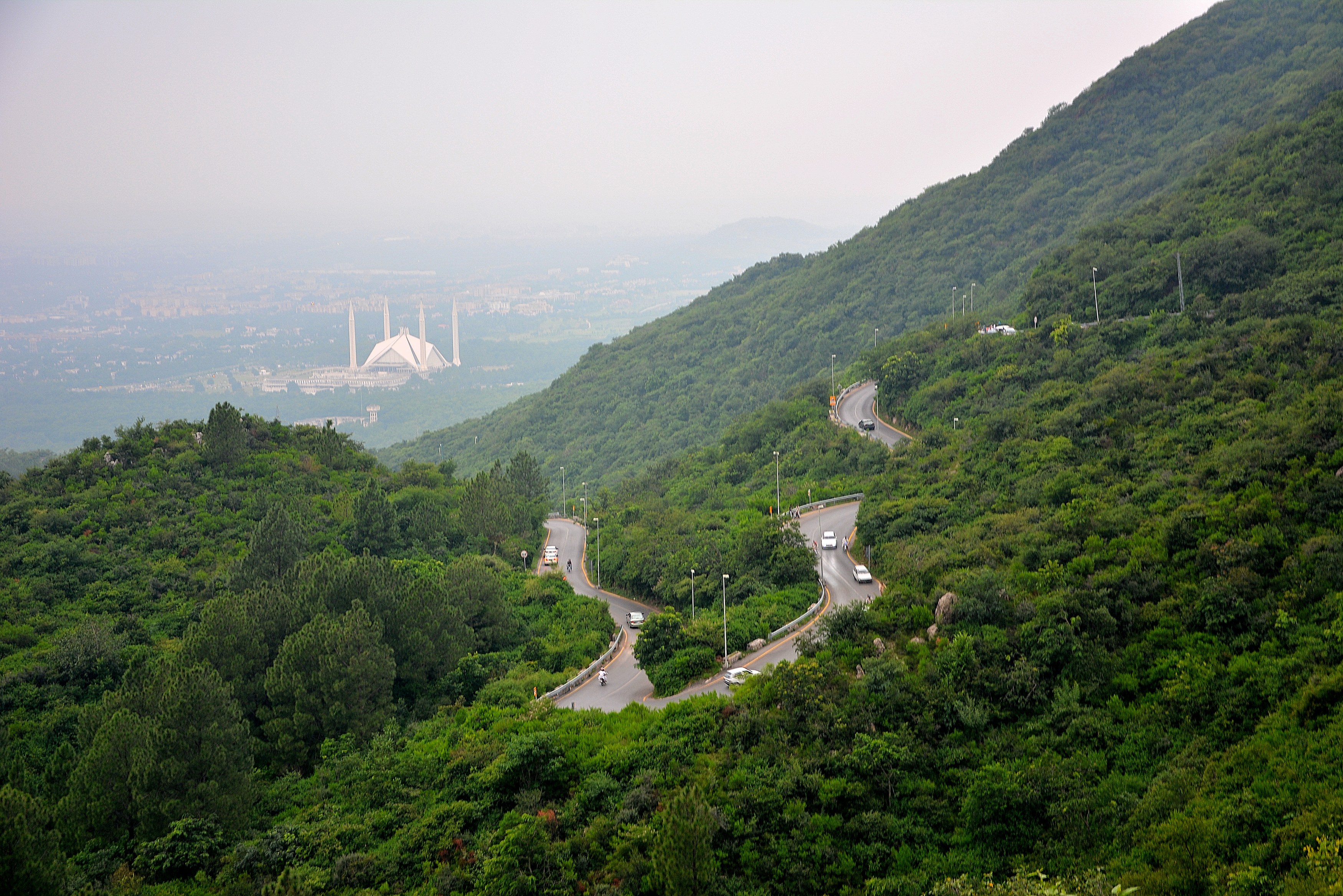
You arrive at Islamabad Benazir Bhutto International Airport and meet your World of Mountain guide in the arrivals hall. Transfer to your hotel in the F-6 or F-7 area takes 30 to 45 minutes. Islamabad is Pakistan's capital, built in the 1960s at 508 metres above sea level. The city is well planned with wide avenues, the Margalla Hills rising above the northern edge, and a noticeably calmer atmosphere than Pakistan's major commercial cities. Your hotel has reliable hot water, Wi-Fi, and in-room air conditioning. Use the afternoon to rest after your international flight.
The evening welcome dinner with your guide is where the trek becomes real. Your guide lays out the 14-day schedule day by day, explains the permit situation, introduces the cook team leader who will be preparing your meals for the next two weeks, and answers every question you have about what is coming. The guide checks your kit list and flags anything critical you might have forgotten. The Aabpara market near the hotel has gear shops open until 9 PM if you need to buy anything tonight. Important items to confirm you have: sleeping bag rated to minus 20 Celsius, glacier glasses with UV side protection, trekking poles, moleskin blister prevention patches, and a water purification method (iodine tablets or a filter).
Sleep as early as possible. The Skardu flight departs between 6 and 7 AM and the airport transfer requires a 4:00 AM hotel departure. Set two alarms. The flight is the only practical way into Skardu for this trek, and missing it due to oversleeping means a full day lost to waiting for the next available flight.
Day 2: Fly to Skardu
Skardu town and valley
Hotel departure at 4 AM for the 20-minute drive to Islamabad airport. The Skardu flight departs in the 6 to 7 AM window and operates only in the early morning because thermal winds off the Karakoram valleys make afternoon landings at Skardu Airport unreliable. The Pakistan International Airlines ATR-72 turboprop carries 68 passengers. Luggage is weighed strictly at check-in with a 20 kilogram limit. The security and boarding process is straightforward. Bring your passport because it is your primary ID at domestic Pakistani airports.
The one-hour flight northeast to Skardu is genuinely spectacular on a clear morning. Request a window seat on the left side of the aircraft. After takeoff from Islamabad you quickly leave the plains and begin crossing the foothills of the Himalayas. About 40 minutes into the flight watch for Nanga Parbat at 8,126 metres to appear on the horizon. It is clearly distinguishable as the largest summit visible, rising above the surrounding range in a way that makes every other peak look small. The Indus River is visible in its gorge thousands of metres below as the plane descends toward Skardu Airport. Landing on the runway above the Indus with the Karakoram walls rising on three sides is an arrival unlike any other.
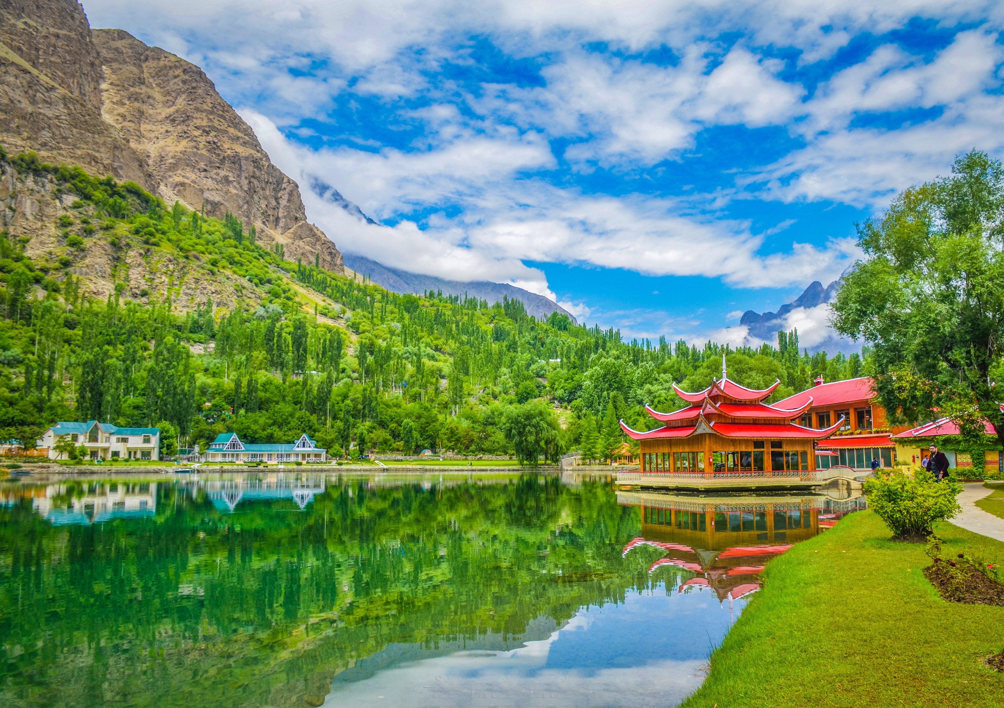
In Skardu you are transferred to your hotel in the town centre. Skardu at 2,228 metres is the capital of Baltistan district and the logistical hub for all Baltoro expeditions and treks. The town bazaar runs several hundred metres and is worth an afternoon walk: dried apricots, walnuts, and mulberries are piled in mounds at fruit sellers. Gear shops stock trekking equipment brought in from Islamabad. The Skardu Museum has a small but worthwhile collection of Balti artefacts and historical photographs of early mountaineering expeditions. An option for the afternoon is a visit to Kharpocho Fort above the town, a 30-minute uphill walk that gives a sweeping view over the Skardu Valley and the Indus River below. Tomorrow is a rest day before the Askole drive the following morning.
Day 3: Drive Skardu to Askole
Askole village via Braldu Valley
Today is your acclimatization day in Skardu and it matters more than it might seem. Your body adjusts to altitude across a curve of days, not hours. The adjustment at 2,228 metres is your first step up that curve and it will compound with each subsequent day at higher elevation. Do not skip this day by trying to push to Askole early. Walk slowly around Skardu town this morning. Climb to Kharpocho Fort if you did not go yesterday. The steady uphill walk of 30 to 40 minutes gains about 150 metres and is a gentle workout at this altitude that stimulates your cardiovascular system without stressing it.
Your guide uses this day to complete the permit paperwork at the Pakistan Alpine Club liaison office in Skardu. The Baltoro Glacier Trekking Permit requires your passport copies, photographs, and the group leader's signature on several forms. This process takes 2 to 3 hours including waiting time. While your guide handles this, you are free to explore at your own pace. Satpara Lake 8 kilometres south of town is a popular afternoon excursion reachable by taxi in 15 minutes. The lake sits at 2,636 metres with clear water and good mountain reflections. It also gets you 400 metres higher than Skardu, which is a useful acclimatization bonus. Shangrila Resort near the lake has a restaurant with good views where you can have lunch.
Tonight confirm all your equipment is packed correctly for the Askole drive tomorrow. Your main trekking bag goes onto the jeep roof and should be packed with everything you need for 14 nights camping. Keep a small daypack in the jeep cabin with snacks, water, a warm layer, your camera, and your documents. The drive to Askole is rough and long and the bags on the roof sometimes shift. Anything fragile or critical goes in the cabin bag. Wake-up tomorrow is at 5:30 AM for a 6 AM breakfast and 7 AM departure.
Day 4: Askole to Jhola Camp
Jhola Camp, Baltoro Glacier
Breakfast at 6 AM in the hotel, jeeps loaded by 6:30 AM, departure by 7 AM. The drive to Askole village takes 4 to 5 hours covering about 100 kilometres. The first section follows the Indus River south from Skardu before crossing at Shigar Bridge and turning east up the Braldu River Valley. The road quality is good until Shigar Bridge and then progressively deteriorates as you enter the Braldu Valley gorge. The road was constructed in the 1980s specifically to support Baltoro expedition traffic and is carved into the cliff face for significant sections. In places the outer wheels of the jeep are within a metre of a several-hundred-metre drop to the Braldu River below. Experienced Skardu drivers handle this road daily without concern. The view down to the river is dramatic.
The Braldu River runs a distinctive milky green from glacial flour, the fine rock powder ground by glaciers upstream. The colour is caused by suspended particles of silica too small to filter out and harmless but unmistakable. Stop at Dassu village roughly halfway to Askole for a tea break. Basic chai (tea with milk and sugar) is available at small roadside teahouses. The air at Dassu at around 2,500 metres is noticeably fresher than Skardu and the valley walls tower above you. From Dassu the road enters its most dramatic section with the gorge narrowing and the road cuts becoming more spectacular. Paiju Peak begins to appear at the eastern end of the gorge as you approach Askole.
Askole at 3,050 metres is the last permanent village before the Baltoro Glacier starts. Approximately 700 people live here year-round in stone houses surrounded by small irrigated fields of wheat and potato. The village has a basic medical post, a school, and several guesthouses that cater to expedition teams. Your cook and porter team assembles here. Tonight is the last time you sleep with a roof over your head for 12 nights. The cook team prepares a hot dinner: rice, lentil daal, vegetable curry, and chapatti baked in the camp kitchen. After dinner your guide briefs the full team on tomorrow's early start and the route to Jhola Camp. Sleep by 9 PM.
Day 5: Jhola to Paiju Camp
Paiju Camp, Baltoro Glacier
First trekking day: Askole to Jhola Camp, approximately 14 kilometres, 5 to 7 hours. Wake at 5 AM, breakfast at 5:30 AM, start walking by 6:30 AM. The trail leaves Askole heading east on a sandy path above the Braldu River. The first two hours are relatively easy, traversing above the river on a well-defined trail through boulder fields and gravel flats. After about 90 minutes you reach the terminal moraine of the Baltoro Glacier, the steep ridge of rock debris pushed down by the glacier over millennia. Cross a wire bridge over the Braldu River just below the terminal moraine and begin the transition onto the glacier's lateral moraine on the left bank.
Moraine walking is the defining terrain type of the Baltoro. It is rocky, uneven, and requires constant attention to foot placement. There is no single clear path. Your guide and the porters, who have walked this route dozens of times, pick the best line through the rocks. The glacier ice is visible on your right side beneath a layer of dark grey rock debris. The Baltoro carries an unusual amount of surface rock due to the very high erosion rates in the Karakoram, where the mountains are still rising tectonically and the rock is frequently fractured. Look for the subtle signs that you are on ice: the rocking of large flat boulders when you step on them, the sound of running water beneath your feet, the occasional blue or white ice visible in crevasse openings between rocks.
Jhola Camp at 3,170 metres is a flat sandy area at the edge of the lateral moraine with room for a dozen or more tents. You arrive in early afternoon. The porter team arrives over a 1 to 2 hour window as different individuals walk at different speeds. Camp is set up by 3 PM. Dinner is at 6 PM. The sky at Jhola on a clear night is extraordinary. The Milky Way is a solid band across the sky and individual nebulae are visible with the naked eye. This level of sky darkness is now very rare from inhabited places and the Baltoro preserves it simply through its remoteness.
Day 6: Rest Day at Paiju
Paiju Camp
Jhola to Paiju Camp: 11 kilometres, approximately 5 to 6 hours. Leave camp at 7 AM. The route continues along the left bank moraine heading northeast. For the first hour the terrain is familiar moraine walking at a gentle grade. Then Paiju Peak begins to appear in earnest ahead of you. Paiju Peak at 6,610 metres is a technical rock and ice peak that dominates the southern skyline of the lower Baltoro for much of this section. Its steep north face drops 3,000 metres in a near-continuous sweep to the glacier below. The mountain was first climbed in 1977 by a Japanese expedition via the northeast ridge after numerous earlier attempts. Watching it grow larger through the morning walk is one of the sustained visual pleasures of this trekking day.
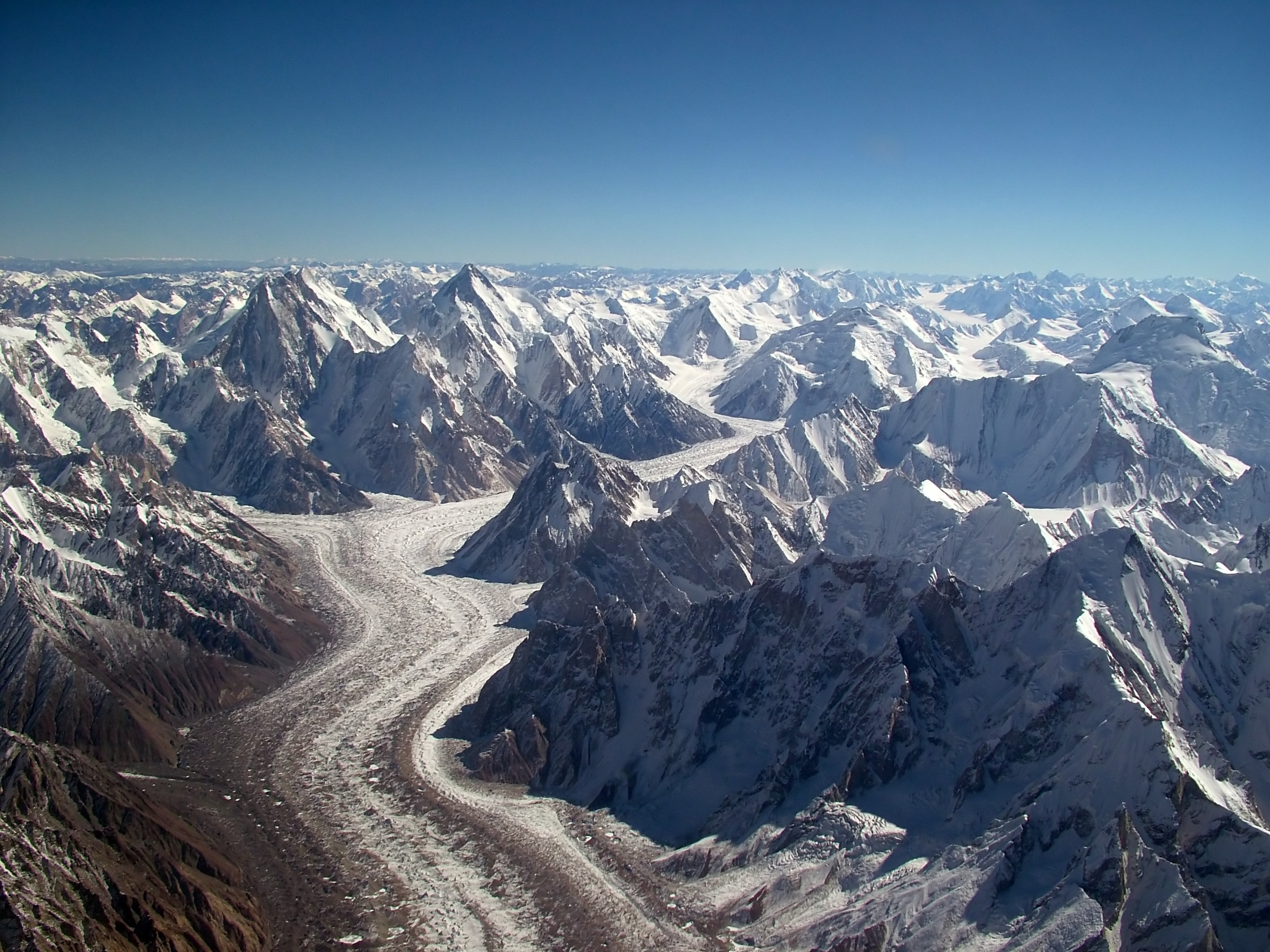
The Baltoro Glacier at this point is 2 to 3 kilometres wide and entirely fills the valley from bank to bank. The scale of the ice is difficult to comprehend. The glacier is 62 kilometres long and in its middle section over 300 metres thick. The rocky debris covering its surface makes it look more like a gravel plain than a glacier until a crevasse opens beside the trail and you can see the blue ice walls descending 30 or 40 metres below the surface. Crevasses on the Baltoro are generally covered by rock debris and not immediately obvious as hazards. Staying on the established lateral moraine route avoids the main crevasse zones on the central glacier surface.
Paiju Camp at 3,400 metres is the last green vegetation before Concordia. The camp occupies a strip of sandy and grassy ground beside a small clear stream. After two days of moraine grey, the presence of any vegetation feels significant. The stream runs off the southern valley wall rather than from the glacier, making it clear and cold rather than silty. Fill your water bottles here directly without treatment if you wish, this being one of the few points on the trek where the water source is clearly not glacial melt. The cook team makes the most of the Paiju location with a particularly good dinner tonight. Tomorrow is a rest day, which most people find they genuinely need by this point.
Day 7: Paiju to Urdukas
Urdukas Camp, Baltoro Glacier
Rest day at Paiju Camp. This day is medically necessary, not optional padding. The altitude gain from Skardu (2,228 m) to Paiju (3,400 m) over three days has taxed your cardiovascular system and your body needs a full day without additional climbing stress to consolidate the acclimatization gains. Use the morning to sleep late, wash clothes in the stream (bring biodegradable soap only), or sit in the sun outside your tent. The cook serves breakfast through to 10 AM for rest day sleepers. The afternoon meal schedule is also relaxed. Eat more than you think you need today: your appetite may have been suppressed slightly at altitude and rest days are when the body rebuilds energy reserves.
An excellent use of 2 to 3 rest day hours is the hillside walk above camp. From Paiju a rough goat trail climbs 200 to 300 metres up the rocky hillside above the camp within 45 to 60 minutes one way. The view from the top of this climb is the first genuinely wide panoramic view of the trek: down the Baltoro toward Askole to the west, up toward the Trango Towers to the northeast, and across the glacier to the southern walls. The scale of the glacier system becomes comprehensible from this height in a way it is not while walking on it. Paiju Peak fills the upper half of the view to the east. The descent back to camp takes 30 minutes. This short climb to a viewpoint is the only altitude gain you should attempt today.
Your guide checks in with each trekker individually on rest days. Any persistent headache, loss of appetite, disrupted sleep, or unusual fatigue should be reported to the guide today rather than tomorrow when you are heading to higher altitude. Rest days are the right time to discuss altitude concerns because there is time to monitor symptoms before committing to higher camps. The guide also confirms the route briefing for tomorrow's walk to Urdukas and shows the group photographs of the Trango Towers taken from closer range so you know what to look for on the approach tomorrow.
Day 8: Urdukas to Goro II
Goro II, upper Baltoro Glacier
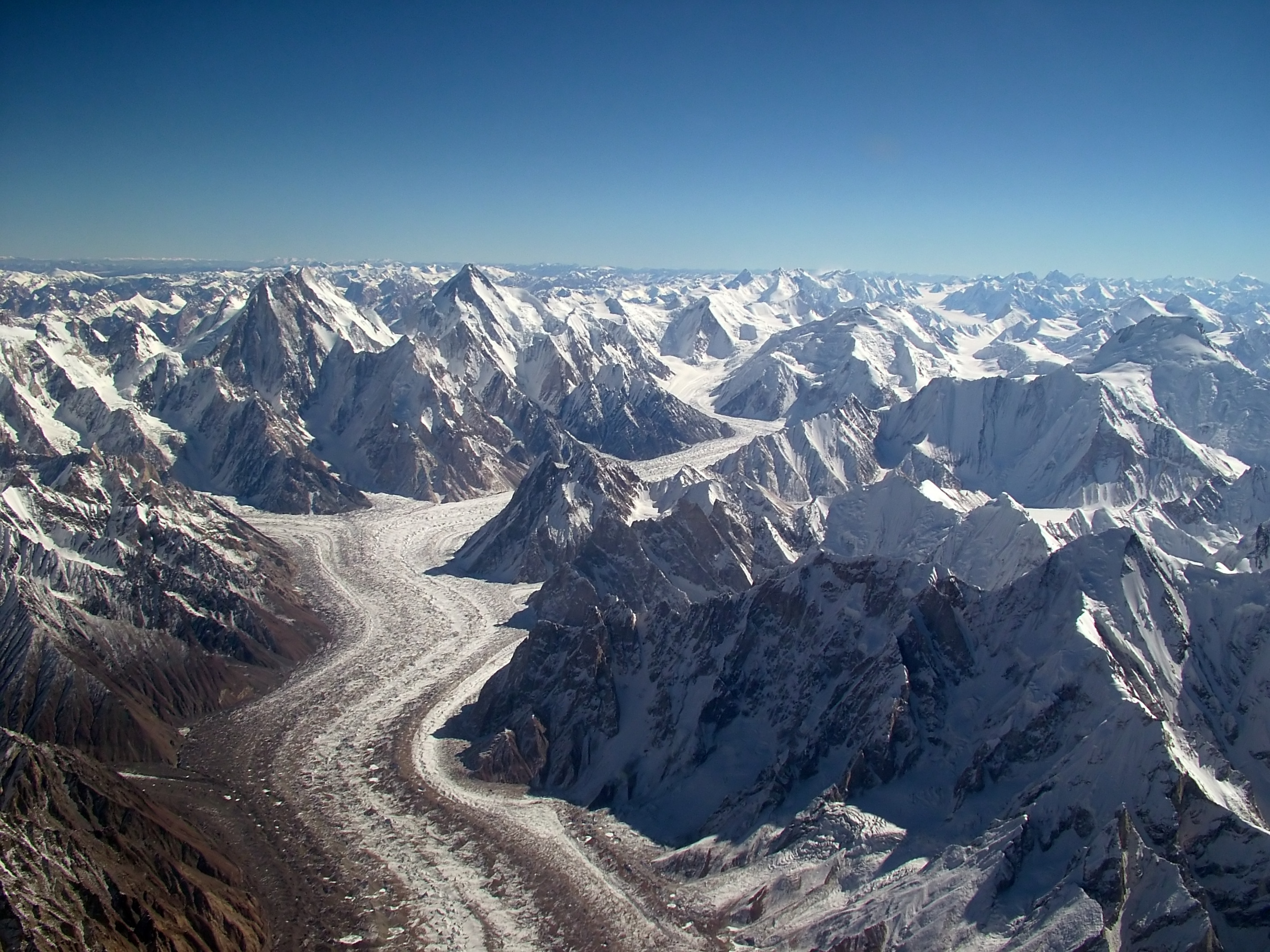
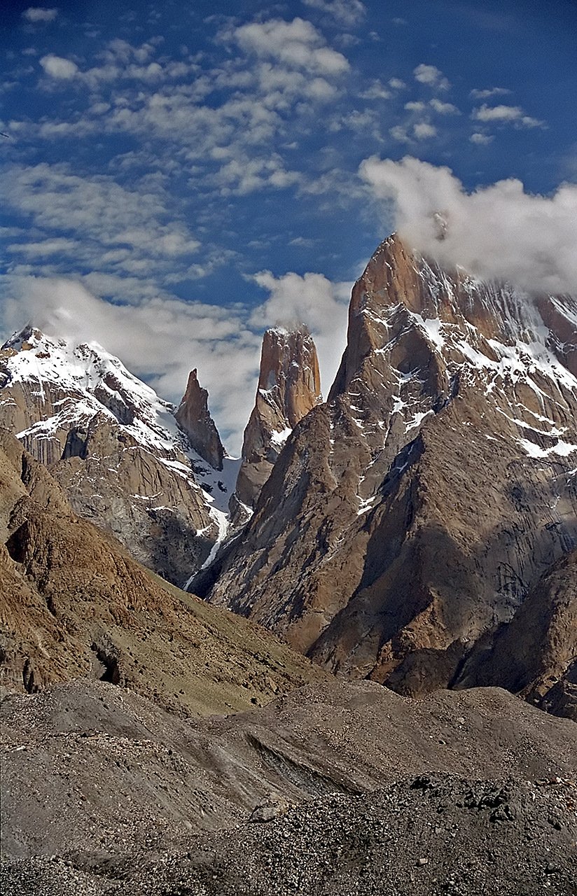
Paiju to Urdukas: 14 kilometres, approximately 6 to 7 hours, with Urdukas sitting at 4,050 metres. Leave camp at 7 AM. The first major attraction of today's walk appears within 2 hours: the Trango Towers. The tower group consists of four main rock pillars on the northern bank of the Baltoro. Trango Nameless Tower at 6,286 metres is the tallest and most famous. Its east face is a vertical granite wall 1,200 metres high, one of the largest rock faces in the world. Climbers from across the world travel specifically to climb it. The difficulty rating of the standard routes (around 5.12 technical climbing) is amongst the hardest sustained rock climbing on any major peak.
The walk from Paiju toward Khoburtse and then Urdukas involves the best sustained views of the Trango Towers available from the trekking route. Over the course of 2 to 3 hours you see the towers from different angles as you move northeast. From directly below they look like perfectly vertical stone columns. From a more oblique angle the rock strata become visible, tilted geological layers that explain how such extreme vertical relief is possible. The sun on the east faces in the morning hours creates dramatic lighting contrasts between the sunlit rock and the shadow behind. This is the best photography opportunity of the first half of the trek.
Urdukas at 4,050 metres is one of the most scenically positioned camps on the Baltoro. The camp sits on a rocky ledge raised about 30 metres above the glacier surface, which gives a panoramic view looking both up and down the glacier. To the southwest you can see back past the Trango Towers toward the lower Baltoro. To the northeast the upper glacier stretches toward Concordia. From Urdukas the first distant glimpse of K2 is sometimes possible on very clear late afternoons, the dark pyramid shape at the far end of the glacier. Confirm with your guide whether K2 is visible from Urdukas today. If it is, this is the moment to see it for the first time from a distance, before the close-up views at Concordia and base camp make it overwhelming.
Day 9: Goro II to Concordia
Concordia, glacier confluence

Urdukas to Goro II: 8 kilometres, approximately 5 to 6 hours, reaching Goro II at 4,270 metres. Leave at 7 AM. Today crosses from the mid-Baltoro section into the upper Baltoro and the landscape changes perceptibly. The rock debris covering the glacier decreases as you move into the higher parts of the system where the glacier surface has less time to accumulate fallen rock from the valley walls. White and pale blue ice appears more frequently underfoot. The glacier surface is wetter from summer melt. Watch for sudden crevasse openings between rocks even on the lateral moraine. Your guide identifies the safe walking line.
Masherbrum at 7,821 metres becomes clearly visible to the southeast today. Masherbrum is the 24th highest mountain in the world and one of the most recognised profiles in the Karakoram for its near-perfect four-sided pyramid shape. The mountain sits 15 kilometres south of the Baltoro Glacier and was first climbed by an American-Pakistani expedition in 1960 via the northwest ridge. From Goro II and the surrounding moraine it appears as an enormous clean-cut pyramid with steep ice couloirs running between its rock ridges. Its summit ridge is narrow and exposed at 7,821 metres. Further to the east, K6 at 7,282 metres and Chogolisa at 7,665 metres are both visible on clear days.
Goro II at 4,270 metres is the last camp before Concordia and the first where altitude sickness becomes a meaningful possibility for susceptible individuals. The camp sits directly on the glacier surface on a flat area of consolidated moraine. There is no shelter from wind and the nights at Goro II are cold even in July, typically dropping below minus 5 Celsius after midnight. Your sleeping bag rated to minus 20 keeps you comfortable at these temperatures with significant margin. Eat a full dinner, drink a full litre of water before sleeping, and report any unusual symptoms to your guide before bed. Tomorrow you reach Concordia.
Day 10: Concordia and K2 Base Camp
K2 Base Camp
Goro II to Concordia: 9 kilometres, approximately 4 to 5 hours, reaching Concordia at 4,691 metres. This is the walk that defines the Concordia Trek. Leave camp at 7 AM. The route crosses the upper Baltoro Glacier northeast from Goro II. The terrain here is a mix of consolidated moraine, gravel flats, and occasional open ice. K2 is directly visible ahead from Goro II when you leave camp, though at this distance it appears as one peak among several on the eastern skyline. As you walk northeast it grows larger. For 4 hours it grows larger. By the time you are 2 kilometres from Concordia it fills the upper quarter of the northeastern sky.
The final approach to Concordia has a specific geography. The Baltoro Glacier makes a slight left turn (northwest) around a rocky moraine promontory about 500 metres before Concordia. As you round this bend the view opens simultaneously to the north, northeast, and east. K2 is directly ahead in the north. Broad Peak appears to its right. The Gasherbrums emerge further east and right. Mitre Peak at 6,025 metres stands as a sharp pyramid to the south. You are standing at the confluence of the two largest glaciers in the Karakoram and looking at four of the six highest mountains on Earth from a single point. Almost every trekker who reaches this view stops walking involuntarily.
Camp at Concordia on the glacier moraine. The afternoon at Concordia is one of the finest in the trekking world for doing nothing: sitting outside your tent, drinking hot tea, and watching the light change on K2. The mountain is lit differently at every hour of the afternoon. The black rock of the Abruzzi Spur catches direct sunlight from midday through to late afternoon. The snow on the upper slopes reflects light even after the sun has dropped below the southern rim. In calm evening conditions with no wind, the glacier below the peaks is absolutely silent and the scene is completely still. This is what people who have been here try and fail to describe adequately to those who have not.
Day 11: Concordia to Goro II
Goro II, Baltoro Glacier
Rest day at Concordia at 4,691 metres before the K2 Base Camp walk. This day is the standard rest and acclimatization stop before the additional 460 metres to K2 Base Camp. Use the morning at camp. Walk the moraine area around camp slowly. Eat a full breakfast. Drink water consistently throughout the day regardless of thirst. At 4,691 metres the kidneys excrete water more rapidly and dehydration builds fast without the sensation of thirst that normally drives drinking behaviour. A practical guide: produce light-coloured or clear urine, not dark yellow. Dark yellow urine at altitude means drink more immediately.
The K2 summit visible from Concordia is 3,920 metres above you. From Concordia you can see approximately the lower third of the Abruzzi Spur, the standard route on the Pakistani side. The route goes up the lower rock buttresses of the southeast ridge, gains the shoulder called the Shoulder at about 7,900 metres, traverses across to the Bottleneck couloir at 8,300 metres, and then follows the final snow and rock to the summit at 8,611 metres. This is visible as a logical line from Concordia on a clear day with binoculars. Above the shoulder the mountain disappears into its own weather most afternoons. The summit itself is visible from Concordia about 30 percent of the time due to cloud formation around the summit pyramid.
Your guide briefs the group after dinner on the K2 Base Camp walk tomorrow. Key points: leave Concordia by 7 AM with only a daypack (main sleeping tent stays at Concordia), bring at least 2 litres of water, snacks for the full day, sunscreen rated SPF 50 or above, glacier glasses not sunglasses, warm layers for the base camp wind, and your camera. The walk is straightforward and well-established. Walking time to K2 Base Camp is 2 to 3 hours. Time at base camp is typically 2 to 3 hours. Return to Concordia takes 2 hours. Total day is 6 to 8 hours of light to moderate effort.
Day 12: Goro II to Urdukas
Urdukas, Baltoro Glacier
Concordia to K2 Base Camp: 8 kilometres gaining 460 metres, approximately 2.5 to 3 hours one way. Leave Concordia at 7 AM with daypacks only. The route heads north-northeast from Concordia camp onto the Godwin-Austen Glacier. The Godwin-Austen Glacier is narrower than the Baltoro and its surface is more ice-dominant with less covering rock debris. You walk on the right bank moraine where established. The glacier ice on your left is increasingly blue-white as you gain altitude and leave the main debris zones behind. K2 grows with every step in a way that is both measurable and overwhelming.
At approximately 5 kilometres from Concordia you cross onto the main glacier surface for a short section before regaining the moraine on the right bank. Your guide identifies the safest crossing point. The ice is firm underfoot and not slippery in the morning temperatures. By 2 kilometres from K2 Base Camp the mountain is directly above you and the sky is only mountain and not horizon on three sides. The Abruzzi Spur is visible in detail now: the lower snow slopes, the fixed rope sections on the steeper rock, and the high snow shoulder far above. If a current expedition has fixed lines in place on the lower route you can see them with binoculars.
K2 Base Camp at 5,150 metres is a flat moraine area at the very foot of the Abruzzi Spur. It is marked by decades of accumulated expedition debris: tent platforms built into the moraine by successive teams, fixed rope anchor points driven into the rock at the glacier edge, rusting oxygen cylinder fragments, and memorial plaques for climbers who died on the mountain since the first expedition in 1902. The plaques include names from the 1986 season when 13 climbers died in one storm event, from the 2008 collapse that killed 11 in two days, and from dozens of individual accidents across a century of attempts. Stand here, read the plaques, and take the time the place deserves.
Day 13: Urdukas to Paiju
Paiju Camp
Concordia to Goro II: 9 kilometres, approximately 4 to 5 hours. The return journey begins today. You retrace the Godwin-Austen Glacier connection from Concordia east, then turn southwest down the Baltoro toward Goro II. For much of the morning K2 is visible over your right shoulder. The mountain looks different from the southwest than from the northeast. The full Abruzzi Spur is in shadow in the morning light from this direction. The summit pyramid catches early sun on the southwest face and appears almost incandescent in the right conditions. Take a final long look at K2 from the Goro II approach because after today the peak will drop below the horizon behind you and not return until you are back in Skardu.
The return to Goro II is a familiar route walked in reverse. The landmarks appear in reverse order and the downhill gradient that was uphill on the approach feels easier on the lungs but demands more knee control. Your trekking poles, set 10 centimetres longer than for uphill, absorb the downhill impact on the knee joints. Pace yourself steadily. The temptation to walk fast on the familiar terrain of the return is real and the risk is a turned ankle or knee strain on the moraine. Many Baltoro injuries happen on the return journey when fatigue and overconfidence combine on the same rough terrain.
Goro II at 4,270 metres feels lower and warmer on the return than it did on the approach because your acclimatization has progressed and you have descended 420 metres from K2 Base Camp. Your appetite on the return is generally stronger than the approach because you are coming down from altitude rather than going up. The cook team makes a good dinner tonight. Tomorrow is the walk to Urdukas and the Trango Towers reappear ahead of you on the westward descent.
Day 14: Paiju to Askole, Drive to Skardu
Skardu
Goro II to Urdukas: 8 kilometres, approximately 4 to 5 hours. Return day two. Leave at 7 AM and head southwest on the moraine toward Urdukas. The Trango Towers appear on the horizon ahead of you within the first hour. Seeing them from the east on the return is different from seeing them from the west on the approach. The light and angle change the character of the rock faces. The Nameless Tower's east face, which was brilliant in morning light on the approach, is now in afternoon shadow on the return giving the rock a darker, more textured appearance. Some photographers prefer this evening/return light on the towers. Arrive at Urdukas in early afternoon.
At Urdukas on the return you have time to explore the camp area more thoroughly than on the approach when you arrived tired from the long Paiju-Urdukas day. Climb the rocky slope above camp for 15 to 20 minutes in the late afternoon. From this higher position, looking back northeast up the glacier, you can trace your route all the way to Concordia and in clear conditions see the turn in the glacier where K2 Base Camp lies beyond. The view of what you have walked and what lies behind you has a particular quality on the return: the knowledge that you have done it, compounded by the view of the distance involved.
Tonight at Urdukas is one of the last full camp nights before Askole. The dinners on the return tend to be more relaxed and celebratory than the approach nights. The cook team knows the trek is winding down and the morale of the group on the return is typically high. After dinner your guide leads an informal review of the trek highlights. Everyone shares their personal moments from the past 10 days on the glacier. This conversation is worth participating in actively. The stories you tell tonight are the ones you will tell at home for the rest of your life.
Highlights
- Reach Concordia at 4,691 metres and see K2, Broad Peak, Gasherbrum I, and Gasherbrum II simultaneously from one glacier junction, the most dramatic mountain panorama accessible to non-technical trekkers anywhere on Earth.
- Walk to K2 Base Camp at 5,150 metres on a side trip from Concordia and stand at the foot of the world's second highest and most dangerous mountain.
- See the Trango Towers at close range during the Paiju to Urdukas section, including Nameless Tower at 6,286 metres, one of the hardest rock climbs in the world.
- Trek the full Baltoro Glacier from Askole to Concordia, a route that passes more 7,000 and 8,000-metre peaks per kilometre than almost any trekking route on Earth.
- Camp at Urdukas on a rocky ledge above the glacier with panoramic views in both directions, one of the finest camp positions in the Karakoram.
- Pass Masherbrum at 7,821 metres to the south as you walk the Goro II section, its perfect pyramid profile visible for hours of the upper glacier approach.
- Drive the Braldu Valley jeep road from Skardu to Askole, 4 hours of spectacular gorge driving on a track carved into cliff faces above the emerald green Braldu River.
Included/Excluded
Airport transfers in Skardu are included to get you from the airport to your hotel
Government trekking permit is paid for by Concordia Trek so you don't worry about it
Baltoro glacier zone fee is covered in the price to enter the protected area
Professional English-speaking guide travels with you the whole trek to help and explain things
High-altitude porter team carries most of the heavy gear so you walk with less weight
All camping meals including breakfast, lunch, and dinner are provided every single day
Quality dome tents and sleeping mats are set up at each camp for your comfort
First-aid kit with basic medicines is available if you get minor cuts or feel unwell
Your flights from your home country to Pakistan are not included
You need to get your own Pakistan visa before the trek
Personal climbing gear like ice axes and crampons are your responsibility
Your sleeping bag is not provided and you must bring your own
Travel insurance that covers helicopter rescue is not part of the price
Hiring a private porter just to carry your personal bag costs extra
Money to tip the guides and porters at the end is separate
Things To know
Best Time to Trek to Concordia
The best time to trek to Concordia is from June to early September. These four months offer the most safe conditions for hiking this high mountain route. Outside these months, snow and ice make the trails too hard to cross. Winter brings extreme cold and blocked passes that stop most trekkers. Spring melts create dangerous streams and unstable ground. So plan your trip between June and the start of September for the best experience.
June is a good choice if you like fewer people on the trail. The snow from winter is still there in many places. This makes the walking harder and slower than later months. However, June has much fewer trekkers than July and August. The weather in June starts to warm up as spring ends. If you want a quiet trek without big crowds, June is your month. July and August are the warmest months of the year. These two months bring the most trekkers to Concordia. The weather is more stable, and the trails are mostly clear of snow. Days are long with good light for walking and camping. Most people choose these months because the conditions are easiest. By early September, nights get quite cold at higher heights. The days are still warm, but you need warm sleeping bags at night. September has fewer people than July and August but more than June.
Do not worry about monsoon rain when you trek to Karakoram. The monsoon affects other parts of Pakistan heavily from June to August. But the Karakoram mountains stay quite dry during these months. The high peaks block most rain from reaching this area. This is good news for your trek because you will not face heavy rain. However, remember that nights at Concordia are always very cold. Even in the warmest months of July and August, temperatures drop below zero at night. You must bring warm sleeping bags and good winter clothes. Cold nights are normal here
How Fit Do You Need to Be
The Concordia Trek in Pakistan is a moderate to challenging walk. It is not an easy trek, but it is not extreme either. Most people who are reasonably fit can complete it. You will need to prepare your body before you arrive. This trek is harder than a casual walk around town. It pushes your body but does not require you to be a professional athlete. The trek works well for people aged 18 to 60 years old. Many people in this age range finish the trek every year. Your fitness level matters more than your age or experience.
Each day on the trek, you will walk between 6 to 8 hours. The ground beneath your feet is rough and rocky. You will also walk on glaciers, which are sheets of ice and snow. The paths are not smooth or easy to walk on. Your legs will feel tired by the end of each day. You need to be ready for this kind of work. The terrain changes from day to day, but it stays difficult throughout. Walking downhill can be just as hard as walking uphill. Your knees and ankles need to be strong and ready.
Before you start the trek, you should train for 3 months. Walk or run 4 days every week during these 3 months. This regular training will make your body strong and ready. You also need to practice walking uphill without stopping. Try to walk uphill for 3 hours without taking a break. This shows you can handle the demands of the trek. You do not need any climbing experience or special equipment skills. Just a good fitness level and a willing heart are enough. Start your training now and you will be ready for this adventure.
Altitude and How Your Body Adjusts
Concordia sits at 4691 meters above sea level. K2 Base Camp is even higher at 5150 meters. These heights are much higher than most people live. Your body needs time to get used to thin air. The air has less oxygen the higher you go. This means your body has to work harder to breathe. We know this can feel strange and hard at first. That is why we plan the trek carefully for you. We do not rush you up the mountain too fast.
Our trek plan helps your body adjust to the altitude. We have a rest day at Paiju so you can recover. We walk slowly toward Concordia over several days. Walking slowly helps your body make more red blood cells. These cells carry oxygen around your body. More time at lower heights makes the higher heights easier. This slow climbing method is the best way to stay healthy. Many trekkers feel much better when we take our time.
Some people feel sick when they go too high too fast. You might get a headache, feel very tired, or lose your appetite. You might also feel sick to your stomach. These are signs of altitude sickness. They are normal and usually go away when you rest. Tell your guide right away if you feel any of these things. Our guides carry a pulse oximeter to check your oxygen levels. We also carry basic medicine to help you feel better. If your symptoms are bad, your guide will walk back down with you right away. Your health and safety come first on this trek.
What to Pack for the Concordia Trek
When you go on the Concordia Trek, you need the right clothes to stay warm and dry. Start with warm base layers that fit close to your skin. Wear a fleece jacket on top of your base layers. Bring a waterproof jacket to keep rain and wind off your body. Pack trekking trousers that let you move freely while hiking. A warm hat and gloves are very important because it gets cold up high. Your clothes should be easy to wash because you will wear them many times.
For your feet, you need good hiking boots that you have already worn in. New boots can hurt your feet during a long trek. Camp sandals are nice to wear when you are resting at your tent. They let your feet breathe after a long day of walking. Your sleeping bag must be rated to minus ten degrees Celsius. The nights are very cold on this trek, so your bag must keep you warm. A warm sleeping bag will help you sleep well and rest properly.
You should also bring other items to stay safe and healthy. Sunscreen with factor fifty will protect your skin from the strong sun. Bring sunglasses to protect your eyes from bright light and snow glare. Lip balm stops your lips from getting dry and cracked. Trekking poles help your knees and make walking easier. A headlamp lets you see when it gets dark. Carry a water bottle to drink water all day long. Bring any medicines you need for your health. A camera lets you remember this trek for the rest of your life.
Permits and Paperwork
To trek in Pakistan, you need several official documents. The Pakistani government requires a trekking permit for the Concordia Trek. You also need to pay a conservation fee for the Baltoro Glacier. Finally, you must pay an entry fee to enter the national park. These three requirements might seem like a lot. But do not worry. World of Mountain takes care of all of this for you. We handle every permit and every fee before you arrive. You do not need to arrange anything on your own. This makes your trip much simpler and less stressful.
When you arrive in Pakistan, you only need to bring two things. First, bring your original passport. Second, bring two passport photos with you. That is all. We will have all your permits ready when you land. You can pick them up at the airport or at your hotel. We make sure everything is done correctly and on time. You will not have any paperwork to do when you arrive. Everything will be waiting for you.
If you are not from Pakistan, you will also need a tourist visa. Most visitors can get this visa when they land at the airport. Some people can also get it online before they travel. Check with the Pakistani embassy in your country to be sure. The visa is easy to get and does not take long. Once you have your visa, your passport, and your photos, you are ready. We will handle the rest. Your trek will start on time with no delays.
Food and Water on the Trek
Our cook team works hard to give you three hot meals every day at camp. Breakfast is ready when you wake up. You will eat porridge, eggs, and toast. Hot tea is always available. This gives you energy before you start walking. Lunch is different because you eat it on the trail while you hike. You will get a packed lunch with sandwiches, nuts, and dried fruit. This food is easy to carry and eat while you walk. Dinner is the best meal of the day. Our cooks make hot rice, lentils, vegetables, and sometimes chicken. The food is simple, tasty, and fills you up after a long day.
Water is very important on this trek. We get our drinking water from glacier streams near our camp. But the water is not safe to drink right away. Our team always boils the water and filters it first. This removes anything that could make you sick. You should always drink this treated water and never drink water straight from a stream.
You must carry a water bottle that holds at least two liters. Refill your bottle at camp before you start hiking each day. Drink water often during the day, even if you do not feel thirsty. We also give you water purification tablets as a backup. Use these tablets if you are not sure about your water. They work well and are easy to use. Always stay hydrated because you will walk at high altitude and need lots of water.
FAQs
How do I book the Concordia Trek Pakistan?
Concordia scores as a strenuous trek. Daily walking of 5 to 8 hours on rough moraine terrain for 8 consecutive glacier days demands good fitness. The altitude peaks at 5,150 metres at K2 Base Camp and spends multiple nights above 4,000 metres. The terrain is uniquely demanding in that there is no smooth path anywhere on the glacier section. Every step on the Baltoro Glacier moraine requires foot placement attention that you do not need on a proper mountain trail. After 8 hours this attentional demand creates a specific fatigue beyond the aerobic effort.
However, there is nothing technically difficult about this trek. No ropes, no crampons, no climbing skills required. Difficulty is purely physical and altitude-related. A person who can hike 20 kilometres in a day on rough terrain at sea level, and who is willing to accept some altitude discomfort, is physically capable of this trek with appropriate preparation.
What is the group size for the trek?
Previous experience at altitude above 3,500 metres is recommended but not required. The difference between a trekker with prior altitude experience and one without is primarily the knowledge of how they personally respond to altitude. Some people acclimatize easily and feel almost no effect at Concordia. Others feel significant discomfort. Without prior experience you cannot predict which you are. If this is your first high-altitude trek, that is fine, but go in with honest expectations and a willingness to adjust pace or plans if your body demands it.
What can I do in Islamabad on my arrival day?
Acute Mountain Sickness (AMS) affects a meaningful percentage of Concordia trekkers. Typical AMS symptoms, headache, fatigue, reduced appetite, and disturbed sleep, are common above 4,000 metres and usually manageable with rest and hydration. We do not push trekkers who are showing worsening AMS symptoms to continue. The protocol is simple: if symptoms worsen after rest, you descend until they improve. Concordia is not worth dying for. If someone in the group needs to turn back, we provide a guide escort for the descent and reorganise the group schedule.
The more serious altitude illnesses (HAPE and HACE) are rare at Concordia because the rate of altitude gain on this trek is slow. However, we carry a full altitude emergency kit including a Gamow bag (portable altitude chamber), dexamethasone, nifedipine, and a satellite communicator. Our guides are trained in wilderness first aid and altitude sickness management. Emergency helicopter evacuation from the Baltoro is possible in good weather from several points on the route.
What happens if there is bad weather during the trek?
July is the best month. The weather is most stable, the Baltoro permits are available, and the mountain views are clearest. The window runs roughly from 20 June to 20 August. Mid-June can have late-season snow on the moraine above Urdukas. September is possible but early autumn weather is unpredictable and snowfall on the upper Baltoro can close the route. Avoid anything outside June through August unless you have a specific reason and accept the increased risk.
Can solo travelers join the Concordia Trek?
The minimum test: walk 20 kilometres on rough mountain terrain with a 12-kilogram pack in a single day without injury. If you cannot do this currently, you are not ready for the Baltoro and should begin a training programme 3 to 4 months before departure. Key training elements: long hikes on uneven ground, progressive distance build-up, quadriceps and hip strengthening for moraine descent sections, and any opportunity for altitude exposure above 2,500 metres.
Cardiovascular fitness is more important than strength. Your aerobic system is the limiting factor on the altitude sections, not your muscles. Running, cycling, and stair training build the cardiovascular capacity needed. If you can run 10 kilometres continuously and hike a full day on rough ground, you have the aerobic base required. Do not neglect the strength component, however. Weak quadriceps and hip stabilisers are the main reason people get knee injuries on Baltoro moraine descents.
How far in advance should I book the trek?
Non-negotiable items: sleeping bag rated to minus 20 Celsius (not minus 5, not minus 10, genuinely minus 20 or below), trekking poles (the Baltoro moraine is significantly harder and more dangerous without them), glacier glasses with side UV protection not standard sunglasses, and hiking boots broken in for at least 100 kilometres before the trek starts.
Important items: down jacket or heavy synthetic insulation layer, waterproof shell jacket and trousers, thin thermal base layers, wool or synthetic trekking socks (multiple pairs), a warm hat that covers the ears, liner gloves and heavier mittens, high-factor sunscreen (SPF 50 minimum) and lip balm with UV protection, a wide-brim hat for glacier sun, and personal water purification. We supply all camp equipment. You carry only personal clothing and gear in your daypack.
What kind of accommodation will we have on the trek?
You need a Baltoro Glacier Trekking Permit issued by the Pakistan Alpine Club in Islamabad and a No Objection Certificate (NOC) from the Gilgit-Baltistan Tourism Department. We obtain both permits on your behalf as part of the tour cost. Provide your passport copy and two passport-size photographs when you book. Permits must be applied for at least 45 to 60 days before departure. Quota limits apply to Baltoro permits in July, which is another reason to book well in advance.
Can vegetarians eat well on this trek?
In Islamabad and Skardu you stay in hotels with private rooms and en-suite bathrooms. From Askole to the return you sleep in four-season dome tents supplied by us. Tent sizes are single or double occupancy. You provide your own sleeping bag. The foam sleeping mats we supply are 3 centimetres thick and provide adequate insulation from the cold glacier ground in summer conditions.
Toilet facilities on the glacier are pit toilets at established camps and cat-hole burial on the moraine between camps. This is universal on the Baltoro and there is no alternative. Carry a small trowel, toilet paper, and a ziplock bag in your daypack. Sanitation standards on the Baltoro are formally regulated by the Pakistan Alpine Club and we comply fully with all waste management requirements.
What should I do if I feel sick from the altitude?
There is no mobile phone coverage on the Baltoro Glacier. Signal disappears near Askole and does not return until the jeep drive back. You will be out of mobile contact for approximately 14 days. We carry a satellite communicator for emergencies. Family and friends can track the expedition via GPS share links provided before departure. Let people at home know before you leave that communication will be zero for this extended period.
How can I stay in touch with my family back home?
Permits for the Baltoro Glacier are issued by the Pakistan Alpine Club with annual quotas. Trekking permits, NOC documentation, and guide registration are all included in our tour price. You do not pay any additional permit fees in Pakistan. Provide passport copies and photographs to us when you book and we handle the full permit application process.
What are the toilet facilities like at the camps?
Groups are capped at 12 trekkers per permit. We typically run groups of 4 to 10 people for a more personal experience. Solo travellers join existing group departures. Private tours for individuals or small groups are available at a higher per-person cost. Contact us with your preferred dates for a private tour quote.
Can children go on the Concordia Trek Pakistan?
Skardu flight cancellations are common and should be treated as a normal part of logistics rather than an emergency. Typical cancellation rate on the Islamabad-Skardu route is 20 to 30 percent of flights in a given summer season. Multiple consecutive day cancellations due to sustained cloud happen several times per season. We build 2 buffer days into every Concordia Trek departure schedule specifically for this scenario.
If both buffer days are consumed before a flight becomes available, we take the Karakoram Highway overland route from Skardu to Islamabad via Gilgit. This road journey takes 14 to 18 hours and connects through some of the finest mountain scenery in the world including the Hunza Valley. It is long but reliable and always gets you to Islamabad in time for international connections when booked with the standard buffer days in the itinerary.
Tour Location
Karakoram, Gilgit-Baltistan, Pakistan
Reviews
0/5
Not Rated
Based on
0 review
Excellent
0
Very Good
0
Average
0
Poor
0
Terrible
0
No Review
10%
from
$1,850
$1,650
from
$1,850
$1,650